 Write to the booksellers
-
Type
Book (1008)
Drawings (1)
Magazine (13)
Maps (57)
-
Latest
Last 3 days (1)
Last month (16)
Last week (1)
-
Language
English (1)
French (1074)
German (3)
Portuguese (1)
-
Century
16th (3)
17th (28)
18th (55)
19th (131)
20th (226)
21st (51)
-
Countries
Belgium (266)
Brazil (1)
Canada (5)
China (1)
Côte d'Ivoire (12)
France (572)
Netherlands (1)
Switzerland (221)
-
Syndicate
ALAC (5)
ILAB (349)
NVVA (129)
SLACES (129)
SLAM (157)
SNCAO (2)
loss of a minute is just so much loss of life': Edward Robinson and Eli Smith in the Holy Land
, Brepols, 2020 Paperback, xx + 339 pages, Size:156 x 234 mm, Illustrations:25 b/w, 8 col., 1 tables b/w., 2 maps color, Language: English. ISBN 9782503589138.
Summary Perhaps no other Palestine / Holy Land explorer has received as much attention as Edward Robinson, the American philologist, theologian, and historical geographer responsible for laying the foundations for the modern historic-geographical study of the Holy Land. Surprisingly, to date, almost no one has delved into Robinson's archive to illuminate his Holy Land expeditions, the writing of his monumental Biblical Researches, and the compilation of his fine maps. Similarly, no one has conducted a detailed study of the archive of Eli Smith, American Board of Commissioners of Foreign Missions Beirut missionary and Robinson's travel companion, for the same purposes. Fluent in Arabic and highly familiar with the region and its inhabitants, Smith's contribution to the expedition and to the Biblical Researches was considerable as his archive reveals. Investigating documents in both Robinson's and Smith's archives, the author of the present book became quickly convinced that much of the accepted narrative concerning Robinson's Holy Land studies should be re-evaluated and, consequently, rewritten. Several issues, for lack of relevant sources, have not yet been addressed by scholars. The story of Robinson and Smith's expedition and writing of the Biblical Researches that emerges from their extensive correspondence underscores the difficulties they overcame, and the accuracy and magnitude of their scholarship in an age bereft of modern technology. TABLE OF CONTENTS List of Illustrations Preface Acknowledgements Edward Robinson 1794-1863: A Short Biography 1. Introduction: The Archives of Edward Robinson and Eli Smith The introduction reviews the vast and different collections of archival materials consulted for this study. 2. The 1838 Expedition to the Holy Land: Origins and Preparations 2.1 Documenting the decision to embark and expedition preparations Robinson's decision-making process, beginning with his pivotal 1832 meeting with Smith in Andover, MA, until embarking on the expedition in Spring 1838. 2.2 Robinson's German period: Seeds of the Holy Land expedition Robinson's desire to embark on a scholarly expedition to the Holy Land was influenced by the example of leading German scholars he met while studying in Halle and Berlin from 1826 to 1830. 2.3 Developing a historical-geographic approach to the Scriptures. 'The father of Holy Land studies' developed a unique and innovative method for scholarly investigation of the land of the Scriptures. 2.4 Organizational and technical matters 3. The 1838 Expedition: Itinerary and Development 3.1 Financing the expedition 3.2 Robinson and Smith's descriptions and comments of events en route Based upon archival material, the story of their everyday life, contact with locals and dignitaries. 4. In Berlin and Halle: Writing the Biblical Researches 4.1 The post-expedition journey: Robinson and Smith to Germany Robinson's and Smith's travel decisions and their impact upon their subsequent research and the dramatic tale of Robinson's recovery and his wife Talvj's involvement. 4.2 Return to NY or stay in Berlin? Robinson and his UTS superiors Robinson initially planned to return to New York and begin teaching at UTS in Autumn 1838, but he actually returned only two years later. 4.3 The Biblical Researches: Planning, writing, and distribution 4.3.1 The preface: Explaining the underlying scientific approach 4.3.2 Origin of the manuscript: From inception to format 4.3.3 The writing begins in earnest 4.3.4 Attention to detail: Arabic place names and orthography 4.3.5 Publishing the manuscript The Biblical Researches, three volumes comprising more than 600 pages each, was published almost simultaneously in London and in Boston in English, and in Halle in German. 4.3.6 Biblical Researches 1841 - distribution 4.4 Robinson's secondary sources Robinson's amazing use of diverse sources to construct his arguments and the historical-geographic picture of the land and its sites. 5. Co-travelers and Companions 5.1 Eli Smith, the underacknowledged partner ABCFM missionary Eli Smith, responsible for construction of the Beirut Arabic printing press and the Arabic translation of the Bible, was Robinson's student and companion on the expedition. 5.1.1 Eli Smith and the German Orientalists Smith's contacts with some of the leading German Orientalists developed and strengthened during his nine months in Leipzig after the expedition. 5.2 Therese Albertine Luise von Jakob-Robinson, 'Mediator of the Balkan Slavs', and Holy Land Studies Talvj, Robinson's second wife whom he married in Halle in 1828, had, until his death, a crucial role not only in his personal and social, but in his academic life as well. 5.3 James Adger, the anonymous fellow traveler Although he accompanied Robinson and Smith for almost the entire expedition, James Adger of Charleston, SC, is barely mentioned in publications. 6. Epilogue: Whose Arch is It? Robinson and Smith's epoch-making publication, the Biblical Researches, has been the source of many scientific debates. Perhaps the most vigorous debate concerns attributing the discovery of 'Robinson's Arch' to its namesake. This chapter explores traveler Reverend Stephan Olin's contention that it should not have been named for Robinson since others discovered it earlier, Robinson claimed that he was the first to connect the arch to the bridge reported by Flavius. 7. Concluding Remarks Bibliography Archives Abbreviations for periodicals Short titles bibliography Indexes Names Places, Organizations and Events
Atlas of European Values
, Brill Academic Pub, 2005 Hardcover, 139 pages, ENG, 315 x 235 mm, in New condition!, with illustrations in colour. ISBN 9789004144606.
The Atlas presents European ideas and beliefs in the form graphs, charts and maps. Values such as democracy, freedom, equality, human dignity and solidarity are held by almost all Europeans, but the survey points to differing views about marriage, religion, work and such topics as euthanasia, happiness, sexuality and death. This unique Atlas covers all European nations from Iceland to Turkey, from Portugal to the Ukraine. It graphically illustrates the rich diversity that is Europe.
Jean Roze Hydrographe Dieppois du milieu du XVIe siècle.
Paris, Ernest Leroux, 1890 ; brochure grand in-8°, couverture vert d'eau imprimée en noir;10pp.Extrait du Bulletin de Géographie historique et descriptive , tome IV, n°2.
Le Dr Hamy ethnologue et anthropologue était originaire de Boulogne-sur-mer. ( CO2CL)
Note sur la Mappemonde de Diego Ribero ( 1529) Conservée au Musée de la Propagande de Rome.
Paris, Ernest Leroux, 1887 ; brochure grand in-8°, couverture grise imprimée en noir;10pp. Tiré à part du Bulletin de Géographie historique et descriptive, 1887, n°1.
Le Dr Hamy ethnologue et anthropologue était originaire de Boulogne-sur-mer.(CO2CL)
Note sur une Carte Marine inédite de Giacomo Russo de Messine ( 1557).
Paris, Ernest Leroux, 1888 ;brochure grand in-8°, couverture vert d'eau imprimée en noir;16pp. ;1 figure dans le texte et 1 planche hors texte volante.Bon exemplaire.
Le Dr Hamy ethnologue et anthropologue était originaire de Boulogne-sur-mer.(CO2CL)
Les Origines de la Cartographie de l' Europe Septentrionale.
Paris, Ernest Leroux, 1889 ; grand in-8°, couverture vert d'eau imprimée en noir; 104pp., et 5 cartes hors texte ( numérotées V à IX).Petits accrocs en bordure de la couverture, dos cassé, bon état intérieur.
Rare titré à part du Bulletin de Géographie Historique et Scientifique, 1888, n°6. (CO2CL)
La carte d'Arenberg de la terre et prévoté de Neufchateau en 1609, avec le ban de Mellier et la seigneurie de Bertrix. Edition commentée et enrichie d'un dossier cartographique
Bruxelles, Crédit Communal 1996 173pp. richement illustré en couleurs et en n/bl, 35cm., reliure toile d'éditeur, jaquette illustrée, très bon état, B92710
Notes pour servir à l'histoire, à la bibliographie et à la cartographie de la Nouvelle-France et les pays adjacents 1545-1700. (Réimpression).
Amsterdam, Meridian, 1976, gr. in-8°, XXXVI + 367 p., reliure de l'éditeur en toile verte, dos avec titre doré, très bel exemplaire à l'état de neuf. (Barbier III/430c).
Réimpression de l'édition de Paris 1872. Le Canada et la Louisiane surtout.
(SLACES, NVVA)
Phone number : 41 (0)26 3223808
Karten in Bildern. Zur Ikonographie der Wandkarte in holländischen Interieurgemälden des 17. Jahrhunderts
Hildesheim, Olms 1986 349pp.with 147 bl/w ills., 21cm., softcover, very good, S85370
Simon Stevin, 1548-1620 L'emergence de la nouvelle science,
Turnhout, Brepols, 2004 Paperback, 184 p., 60 b/w ill. + 24 colour ill., 23 x 28 mm. ISBN 9782503517049.
Durant l'annee 2004, de multiples manifestations culturelles se deroulent en Belgique pour celebrer la presidence neerlandaise de l'Union europeenne. La Bibliotheque royale de Belgique s'y associe en organisant une exposition consacree a Simon Stevin, qui incarnait deja l'idee europeenne : ne a Bruges en 1548, il emigra aux Pays-Bas pour y poursuivre sa carriere scientifique et pour assurer a ses idees la plus large diffusion possible. En l'absence de toute justification formelle de sa part, plusieurs hypotheses tentent d'expliquer ce depart -emigration forcee ou exil volontaire?- sans etre en mesure d'apporter une quelconque reponse qui puisse emporter la conviction. Aux Pays-Bas, Simon Stevin acquit la protection, la confiance et meme l'amitie du Prince Maurice de Nassau. Simon Stevin fut un theoricien, de tres haut niveau comme en temoignent notamment ses ecrits mathematiques, linguistiques ou cosmographiques. En outre, il fut un praticien hors pair dont les realisations dans des domaines aussi divers que l'hydraulique, la mecanique, la physique et l'art des fortifications prouvent le genie. Comme bien d'autres hommes de science de la Renaissance et des debuts de l'epoque moderne, Simon Stevin consacra beaucoup de son temps et de son energie a realiser des experiences scientifiques : il mettait en ?uvre la methode inductive dont il elargissait constamment le champ d'application. Cette nouvelle approche methodologique donna naissance a une science nouvelle. Languages : French,
Infographie. Carnets de recherches des plus grands designers.
Editions de la Martinière - 2014 - In-4, broché, couverture à rabats illustrée en couleurs - 351 p. - Riche iconographie en couleurs in-texte
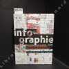
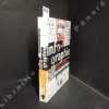
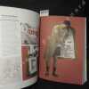
Bon état
STEVENSWEERT. MUNTEN EN KAARTEN.
, Leeuwarden, Hugo Suringar, 1983., softcover, originele geillustreerde uitgeversomslag, 21x15cm, 264pp, geillustreerd.
De Munten en pattegronden, kaarten van Stevensweert
STEVENSWEERT. MUNTEN EN KAARTEN.
, Leeuwarden, Hugo Suringar, 1983. ( dub.), GEBONDEN, kunstleder, 21x15cm, 264pp, geillustreerd z/w.
STEVENSWEERT. MUNTEN EN KAARTEN.
Nieuwe geographische en historische atlas van de zeven Vereenigde Nederlandsche provinti n : bestaande inde vijftig nieuwe accurate kaarten, waar onder veele particuliere gemeeten heemraadschappen, plans van de voornaamste steden, met eene korte beschrijving van de provintien, de steden en het merkwaardigste in dezelve; nevens de staat der regeering zoo politicq als kerkelijk &., [1740-1766]
Amsterdam, H. de Leth, 1766 Gebonden in originele lederen band destijds, 156 pagina's. Tekst en 53 uitvouwbare kaarten en plattegronden met zorgvuldig handgekleurde grenzen. 21x13cm. **Een mooi en compleet/intact exemplaar; *Zie; Koeman, Le H 2.
Topografisch-historische Atlas - Nieuwe geographische en historische atlas van de zeven Vereenigde Nederlandsche provinti n : bestaande inde vijftig nieuwe accurate kaarten, waar onder veele particuliere gemeeten heemraadschappen, plans van de voornaamste steden, met eene korte beschrijving van de provintien, de steden en het merkwaardigste in dezelve; nevens de staat der regeering zoo politicq als kerkelijk &., [1740-1766] - Met beknopte beschryving der Vereenigde Nederlanden.
La Topographie mise à la portée de tous. Syllabaire ou méthode pratique pour apprendre à lire rapidement la carte de l'Etat Major
P., Dumaine, 1873, in-8, 33pp. illustrées d'une grande carte dépliante broché
"Vocabulaire Franco-Anglo-Allemand de Géomorphologie"
"1956. Paris Société d'Edition Les Belles Lettres 1956 - Broché 16 5 cm x 24 cm XIV+ 230 pages - Texte de Henri Baulig - Bon état"
Mémoire sur la projection des cartes géographiques adoptée au dépôt général de la guerre par M. Henry, Colonel au Corps impérial des Ingénieurs-géographes publié par ordre de S.E. Mr Le Duc De Feltre pour faire suite au mémorial topographique et militaire -- EDITION ORIGINALE -- ENVOI DE L'AUTEUR -- BEL EXEMPLAIRE
P., Imprimerie Impériale, 1810, un volume in 4 relié en demi-basane, dos orné de filets dorés (reliure de l'époque), 4pp., 220pp., (1), 4 planches dépliantes
---- EDITION ORIGINALE ---- ENVOI DE HENRY à MONSIEUR DELCROS ainsi libellé : "A Monsieur le Capitaine DELCROS de la part de l'auteur - signé M. HENRY" ---- Recherches des formules nécessaires à l'emploi de la projection et des principales propriétés qui la caractérisent - Application de la projection à un cas de pratique et en particulier au tracé d'une carte d'Europe - Tables relatives à cette application**2641/L1
Carta Geologica delle Alpi Nord-Occidentali.
Milano, 1937. 90 x 125 cm. Farbige Karte, auf Leinen aufgezogen und gefaltet.
Geologische Karte von Nord-östlichen Alpen (Wallis, Italien)
Résultats des observations magnétiques effectuées de 1934 à 1938 pour l'établissement de la carte magnétique du Congo Belge [5 fascicules]
Bruxelles, Librairie Falk fils / Hayez / Institut Royal Colonial Belge 1939-1951 5 fascicules: 88 + 105 + 138 + 71 + 67pp.avec figures dans le texte + 12 + 21 + 15 + [10] planches hors-texte, 31cm., dans la série "Institut Royal Colonial Belge, section des sciences techniques, mémoires, collection in-4o" tome 3 [=FASC.préliminair-Fasc.II] & tome 5 fascicule 3 [=Fasc.IV] & "Univeristé de Liège. Institut d'astronomie et de géodésie. Physique du globe" vol.7.II [=Fasc.I] & vol.7.IV [=Fasc.III], br.orig., bon état [contenu: Fascicule préliminaire: aperçu des méthodes et nomenclature des stations. Fasc.I: Elisabethville et le Katanga (15 avril 1934 -17 janvier 1935 et 1er octobre 1937 - 15 janvier 1938). Fasc.II: Kivu, Ruanda, région des parcs nationaux (20 janvier 1935 - 26 avril 1936). Fasc. III: Région des mines d'or de Kilo-Moto, Ituri, Haut-Uele (27 avril - 16 octobre 1936). Fasc.IV: Haut-Uele, Bas-Uele, Aruwimi, le fleuve de Ponthierville à Bumba (27 novembre 1936 - 20 juin 1937)]
Evocation du vieux Paris - Vieux quartiers, vieilles rues, vieilles demeures historique, vestiges, annales et anecdotes (Tome 1, deuxième édition)
1957 Ed. de Minuit - 1957 - Fort In-8 cartonné - 677 p. - Illustrations et cartes en N&B
Bon état - Pli de lecture au dos
Sammlung von 14 Blättern mit geographischen Karten, teilweise koloriert, 19. Jahrhundert, alle in Passepartout von gleichem Format, in Halbleinen-Mappe.
Die folgenden 13 Karten, ca.15 x 20 cm: Schlacht bei Giornico, den 28 Christmonath 1478, Müllhaupt sc. / Schlacht bey Grandson, 2. März 1476. koloriert / Schlacht bei Nancy. 5 Januar 1477. Müllhaupt sc. koloriert / Belagerung der Stadt Zürich im Jahr 1444. koloriert / Die Schlacht bey St Jacob an der Birs, 26 August 1444, koloriert / Kriegs-Schauplatz von Ende Juni 1476 bis zum 4 Jenner 1477. Müllhaupt sc. / Kriegs-Schauplatz vom 1 bis 21 Juni 1476. Müllhaupt sc. koloriert / Kriegs-Schauplatz im Schwaben-Krieg bis 20. April 1499. Müllhaupt sc. koloriert / Das Schlachtfeld bey Näfels A° 1388 / Das Schlachtfeld "Am Stols" A° 1405 / Das Schlachtfeld "Bey Arbedo" A° 1422 / Carte des Rhein-Tales bey Sargans und Ragatz. koloriert / Die Schlacht bey St. Jacob an der Sihl d. 22 July 1443. J.J. Goll, del et sc. / und 1 Karte: Schlacht bey Murten 22 Jni 1476. Müllhauser sc. koloriert, 12 x 34 cm. English:Collection of 14 leaves with geographical maps, partly coloured, 19th century, all matted, and of the same size, in half clothportfoliothe following 13 maps, about 15 x 20 cm: Battle at Giornico, ... 1478, Müllhaupt sc. / Battle at Grandson, ... 1476. koloriert / Battle at Nancy. ... 1477. Müllhaupt sc. colored / Siege of the town of Zürich ... 1444. colored / Battle at St Jacob an der Birs, ... 1444, colored / Battle fields of the end of June 1476 to the 4th of Jan. 1477. Müllhaupt sc. / Battle fields of 1 to 21 Juni 1476. Müllhaupt sc. colored/ Battle field Schwaben-War until 20. April 1499. Müllhaupt sc. colored / The battle field at Näfels A° 1388 / Das Schlachtfeld "Am Stols" A° 1405 / Battlefield "Bey Arbedo" A° 1422 / Map of the Rhein-Tales at Sargans and Ragatz. colored / Battle at St. Jacob an der Sihl d. 22 July 1443. J.J. Goll, del et sc. / and 1 Map: Battle at Murten 22 Jni 1476. Müllhauser sc. colored, 12 x 34 cm.
(SLACES, NVVA)
Phone number : 41 (0)26 3223808
Gemalte Spielkarten. Deutsches Spielkarten-Museum Leinfelden-Echterdingen,
, _Deutsches Spielkarten-Museum, 1985, softcover 50 pag Illustrated.
Zweigmuseum des W rttembergischen Landesmuseums, Ausstellung ab 1.12.1985. Verzeichnis der ausgestellten Spiele und Grafiken. [Von Detlef Hoffmann und Margot Dietrich].
Nouvelle contribution à la carte magnétique de la Belgique
Bruxelles, Palais des Académies 1934 50pp.avec figures dans le texte + grande carte dépliante en couleur, 29cm., dans la série "Académie royale de Belgique, classe des sciences, mémoires, collection in-4o, deuxième série" tome 11 fascicule 1, br.orig., non coupé, bon état
"Topographie générale (2 volumes); tome 1 : généralités, mesures des angles et distances; tome 2 : Les procédés topographiques en planimétrie et nivellement. Collection scientifique de l'Institut géographique national."
Paris, Editions Eyrolles, 1970-1971. 16 x 25, 2 volumes, 363 + 432 pages, nombreuses figures, 1 planche dépliante, reliure d'édition pleine toile, très bon état (sauf cachet d'ex-propriétaire).
Tome 1 : sans rhodoïd.
Catalogue des cartes, plans et cartes marines conservés au dépôt des cartes des Archives canadiennes
Imprimerie nationale Fort in-8 Couverture souple Ottawa 1912
Moyen 685 pages. Dos absent, quelques taches à l'intérieur. Publications des Archives canadiennes no. 8. Exemplaire de travail de cet inventaire de plus de 4000 entrées.