Write to the booksellers
-
Type
Book (1268)
Drawings (1)
Magazine (13)
Maps (61)
-
Latest
Last 24h (2)
Last month (70)
Last week (2)
-
Language
Dutch (7)
English (3)
French (1327)
German (4)
Latin (1)
Portuguese (1)
-
Century
16th (4)
17th (31)
18th (62)
19th (148)
20th (270)
21st (63)
-
Countries
Belgium (284)
Brazil (1)
Canada (5)
China (1)
Côte d'Ivoire (12)
France (821)
Netherlands (1)
Switzerland (218)
-
Syndicate
ALAC (5)
CLAM (9)
ILAB (349)
NVVA (130)
SLACES (130)
SLAM (152)
SNCAO (2)
Niederlande - Belgien und Luxembourg. Carte N° 40, extraite de Stielers Hand-Atlas.
- Carte 40 x 50 cm, pliée en 2.
Carte géographique. Justus Perthes à Gotha, 1905.
Ostalpen. (Alpenländer : Westlisches Blatt.) Carte N° 15, extraite de Stielers Hand-Atlas.
- Carte 40 x 50 cm, pliée en 2.
Carte géographique. Justus Perthes à Gotha, 1905.
Schweiz. (Alpenländer : Westlisches Blatt) Carte N° 14, extraite de Stielers Hand-Atlas.
- Carte 40 x 50 cm, pliée en 2.
Carte géographique. Justus Perthes à Gotha, 1905.
Thüringishe Staaten. Carte N° 13, extraite de Stielers Hand-Atlas.
- Carte 40 x 50 cm, pliée en 2.
Carte géographique. Justus Perthes à Gotha, 1905.
Département des Basses-Alpes
Planche de l'Atlas National Illustré. Dressé par Levasseur. Pas de couverture Très bon Paris Pelissier Vers 1850 35 x 50 cm
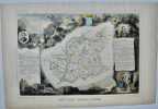
édition originale
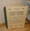
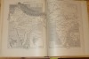
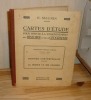
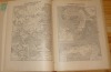
Cartes D'Étude pour servir à l'enseignement de l'histoire et de la géographie. Enseignement primaire supérieur deuxième année (programmes de 1920). Époque Contemporaine (1774-1851). Les grandes puissances européennes et leurs colonies. Paris, Masson et Cie. 1923.
1 volume in-4° relié toile verte, 36 cartes. Très bon état infime état d'usage.
Phone number : 06.31.29.75.65
Cartes D'Étude pour servir à l'enseignement de l'histoire et de la géographie. Enseignement primaire supérieur troisième année (programmes de 1920). Histoire Contemporaine (1852-1920). La France et ses colonies. Paris, Masson et Cie. 1923.
1 vol. in-4° rel. toile verte, 32 cartes. Couverture un peu salie avec léger état d'usage sinon bel état.
Phone number : 06.31.29.75.65
"Inventaire raisonné des collections cartographiques Vandermaelen, conservées à la Bibliothèque Royale de Belgique (4 volumes); tome 1 : Cartes de Belgique; tome 2 : Carte topographique de la Belgique au 1 : 20 000; tome 3 : Villes et communes de Belgique (hors Bruxelles); tome 4 : Bruxelles."
Bruxelles, Bibliothèque Royale Albert 1er, 1994-2000. 21 x 28, 4 volumes, xxviii-563 + 335 + xxx-466 + xxx-546 pages, très nombreux figures, plans et cartes en N/B et en couleurs, reliure d'édition pleine toile bleue, très bon état (1 cachet d'ex-propriétaire au bas de la page de garde dans chaque volume).
"Avec la collaboration scientifique de Claire Chantrenne et Bart op de Beeck; sous la direction de Hossam Elkadem."
L'image du monde, des Babyloniens à Newton.
Paris, ADAPT Editions, 1999. 16 x 24, 235 pp., quelques illustrations en N/B, broché, très bon état (cachet d'ex-propriétaire).
Préface de Jean Rosmorduc.
OP DE KAART hoe de wereld in kaart werd gebracht.
, Luster uitgeverij, 2014 Ingenaaid boek, 494 pp met illustraties, nieuw staat !!. ISBN 9789460581120.
Simon Garfields belangstelling voor kaarten wordt gewekt wanneer hij als kind dagelijks de metrokaart in de Londense subway bestudeert. Zijn fascinatie is sindsdien alleen maar toegenomen. In Op de kaart onderzoekt hij hoe kaarten, vanaf de eerste schetsen van de oude Grieken tot aan Google Maps, onze geschiedenis hebben gemaakt en beinvloed. Garfield verhaalt over de onmogelijke opdracht om Afrika in kaart te brengen, over het maken van de perfecte globe, over Ptolemeus en Johannes Blaeu, over de ontdekkers van de Zuidpool en de Star Maps in Hollywood. En waarom heet Amerika eigenlijk niet Columbus? Op de kaart is een onweerstaanbare zoektocht, rijk geillustreerd en vol vermakelijke anekdotes, naar waar we waren, waar we zijn en waar we naartoe gaan. Een verrukkelijk boek over letterliefde, schreef De Morgen over het veelgeprezen Precies mijn type, waarin Simon Garfield de geschiedenis van de typografie belicht. Op dezelfde enthousiasmerende, onnavolgbare wijze schrijft hij in Op de kaart over landkaarten en atlassen. Simon Garfield (1960) is journalist en schrijft voor The Independent en The Observer. Hij heeft vele non-fictieboeken op zijn naam staan. Recent verscheen van hem het reeds herdrukte Precies mijn type, een boek over letters.
Manuel élémentaire pour la construction et le dessin des cartes géographiques
Paris, Roret, 1837. In-18° broché de 346 + 90 pages. 3 planches dépliantes en fin de volume. Le haut du dos est absent sinon trés bel état pour ces livres si fragiles.
"Collection de manuels formant une encyclopédie des sciences et des arts".
"Les cartes topographiques belges; lecture et emploi pratique en campagne, croquis, reconnaissances, levée à vue, etc."
Paris, Librairie Chapelot, 1922. 14 x 23, 148 pp., 118 figures, broché, bon état (papier légèrement jauni).
Les origines du Koweit.
Koweït: Centre de recherches et d'études koweitiennes, 2005 in-4, 193 pages, 82 planches en couleurs. Bibliographie. Reliure d'éd., jaquette, très bon état. Histoire de la cartographie du Koweith.
Les origines du Koweit. (Koweït: Centre de recherches et d'études koweitiennes, 2005). [M.C.: Koweit, cartographie, histoire]
SOCIETE D'HISTOIRE MODERNE ET CONTEMPORAINE
Reference : 13762
(2007)
ISBN : 978-2-7011-4572-3
Revue d'histoire moderne et contemporaine - tome 54 -n°4, octobre-décembre 2007.
Paris, Belin, 2007 1 volume 16 x 24cm Broché 191p. Très bon état.
Au sommaire, "Ecole et société en France": article de Jean-Michel CHAPOULIE sur l'école sous la IVè République; "Politiques et pratiques coloniales (XVIIIe-XXe siècles)": articles de Laurent DUBOIS et de Bernard CAMIER sur le théâttre des Lumières à Saint-Domingue, de Hélène BLAIS sur la cartographie en Algérie dans les années 1830-1840, de Romain BERTRAND sur la politique coloniale des Pays-Bas en 1880-1930, d'Eric JENNINGS sur l'émigration depuis Saint-Pierre et Miquelon en 1903-1939; comptes rendus d'ouvrages.
SOLDATS de PLOMB de la GRANDE ARMEE de NAPOLEON - N° 85 - 2001
Une revue de 12 pages, format 220 x 285 mm, illustrée, brochée couverture couleurs, Editions Atlas, bon état
Au sommaire : Général Junot en grand uniforme de colonel-général des hussards ; La bataille de Moesskirch ; Napoléon et la cartographie ; Bruno, comte Daru
Phone number : 04 74 33 45 19
Neue Karte des alpinen und verbündeten Rätien und seiner Untertanen / Georges Grosjean: Die Rätia-Karte von Fortunat Sprecher von Bernegg und Philipp Klüwer aus dem Jahre 1618.
Dietikon-Zürich, Verlag Bibliophile Drucke Josef Stocker, 1976, 52x65 cm. 4 S. Text, 1 faksim. Karte. Eines von 490 numm. Exemplaren (GA 530 Ex.). Ex. Nummer 90. Pappband-Mappe mit Leinen Rückenstreifen. (OHLn.-Mappe - Titelschild auf Umschlag vorne).
Image disp.

(SLACES, NVVA)
Phone number : 41 (0)26 3223808
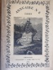
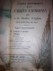
SOCIETE DES TOURISTES DU DAUPHINE. Annuaire N° 6. 1880 . 6 ème année.
1881 1881 Edité à Grenoble chez Allier. 1881. Un volume in 8. broché; non coupé. 216 pages. Une très belle carte hors texte en couleurs plusieurs fois repliée, représentant la carte historique des Vallées Vaudoises par A. de Rochas d'Aiglun. éditée par le Spectateur Militaire. intérieur très frais. dos bruni comme souvent.
DESTOCKAGE 30% de remise immédiate sur le prix marqué .
Changements de noms de rues de la ville de Lyon, proposés par la commission municipale. Texte officiel publié avec des notes critiques et huit plans en couleurs.
1884 A Lyon, Chez l'auteur - M DCCC LXXXIV (1884) - In-8 broché, couverture rempliée - 156 pages


Fentes sur 4 cm aux mors de la première de couverture - Plis de lecture au dos - Début de fente sur la partie supérieure du dos sans désolidarisation Bon
Schul-Atlas über alle Theile der Erde nach dem neuesten zustande, und ûber das Weltgebäude. Nach Stieler’s Hand-Atlas verkleinert. Dreissigste verbesserte und vermehrte Auflage [Trentième édition améliorée et augmentée]
Gotha, Justus Perthes 1850 In-4à l’italienne 23,5 x 31 cm. Reliure demi-basane havane, dos lisse muet, 24 planches, table. Reliure défraîchie avec manque angulaire, coupes usées, intérieur correct. En l’état.
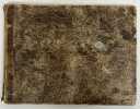
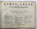
Texte en allemand. Géographe et cartographe allemand réputé, Adolf Stieler (1775-1836) laisse œuvre cartographique considérable par les progrès qu'il réalisa dans l’établissement de cartes géographiques. Etat correct d’occasion
Plan du Port de Saint-Nazaire 1886.-
Tiré de l'Atlas des Ports étrangers. Paris. Imprimerie Nationale. 1886. Plan de 24,4 x 33 cm plié, gravé par A. Simon, publié par le Ministère des Travaux Publics. Impression en noir et bleu. Bord droit lgt insolée sinon bon état.
Carte (52 x 61 cm) gravée en couleurs, encadrée (61 x 70 cm): Comitatus Stolbergensis delineatio geographia praefecturas Hohnstein, Stolberg, Hayn, Berenroda, Ebersburg, Ufftrungen, Rosla et Questen: cum limitibus et vicinia accurate exhibens caelo ; Matthaei Seutteri...; Tob. Conr. Lotter Sculpsit.
Cartouche du titre en bas à gauche avec figures allégoriques, scènes de forge et de chasse à courre. Légende en haut à gauche.
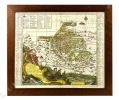
Carte circa 1740-1760, dressée par Matthäus Seutten et gravée par Tobias Conrad Lotter. Encadrement vitré en placage de loupe de frêne. Petite fente en pied, sinon bon état général avec des couleurs encore bien vives.

Carte générale de la Suisse. Dressée en 1787 d'après les observations les plus récentes et les plus exactes, pour servir à la nouvelle édition, très augmentée du Dictionnaire de la Suisse, ( Ca. 1:670000) A Genève: faite chez B.M.C. (Barde Manget et Comp.) 1788.
1788, 42.2 x 57.5 cm, Dans : Dictionnaire géogr., hist. et politique de la Suisse. / Vinzenz Bernhard von TSCHARNER, Gottlieb Emanuel Haller. Nouvelle édition. gravure sur cuivre, coloriée, Passepartout. Bon état.
Carte au frontières des cantons coloriées ainsi que la route, marquée en rouge, que suivent le plus communément les voyageurs en Suisse et sur laquelle se trouvent les meilleurs gites. Ryhiner Sammlung 6104; Blumer, Gesamtkarten 298; Weisz, Schweiz auf alten Karten, 188; Graf BSL II/40. Image disp.
(SLACES, NVVA)
Phone number : 41 (0)26 3223808
Carte générale de la Suisse. Dressée en 1787 d'après les observations les plus récentes et les plus exactes, pour servir à la nouvelle édition, très augmentée du Dictionnaire de la Suisse. ( Ca. 1:670000).
A Genève: faite chez B.M.C. (Barde Manget et Comp.) 1788, pliée pt. in-8vo (42.2 x 57.5 cm), carte coloriée.16 éléments montées sur toile au XVIIIè siècle, ex frais, carte pliée in-8°, étui d’époque, pièce de titre en maroquin rouge.
Carte au frontières des cantons coloriées ainsi que la route, marquée en rouge, que suivent le plus communément les voyageurs en Suisse et sur laquelle se trouvent les meilleurs gites. Ryhiner Sammlung 6104; Blumer, Gesamtkarten 298; Weisz, Schweiz auf alten Karten, 188; Graf BSL II/40. Image disp.
(SLACES, NVVA)
Phone number : 41 (0)26 3223808
Voyage de Siam des pères jésuites, envoyez par le Roy aux Indes et à la Chine avec leurs observations astronomiques, et leurs remarques de physique, de géographie, d'hydrographie, & d'histoire
Paris, Arnould Seneuze, Daniel Horthemels, 1686, in-4 (24,5x19cm): 16ff.-424pp. 8ff., illustré de 20 planches dont certaines à double pages, gravées par Cornelis Vermeulen, d'après les dessins de P. Sevin, relié plein veau chiné, dos à nerfs orné avec titre, frottements, manques en tête et coiffe arasée, 1 coin usé, mouillure en coin sur une quinzaine de feuillets, une planche détachée, quelques brunissures et rousseurs.
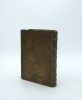
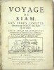
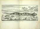
Édition originale du premier voyage au Siam, complet de ses 20 gravures de personnages, plantes, animaux et cartes et vignettes. Relation célèbre du voyage entrepris en 1685-1686 par le père Guy Tachard et plusieurs jésuites français envoyés par Louis XIV au Siam, dans le cadre de l’ambassade conduite par le chevalier de Chaumont. Le récit expose les buts religieux et scientifiques de la mission : établir des relations diplomatiques et missionnaires avec le roi Narai, et recueillir des observations astronomiques destinées à améliorer les calculs de longitude et les connaissances géographiques. Tachard y décrit le voyage maritime depuis Brest jusqu’à Ayutthaya, les étapes au Cap-Vert, au Cap de Bonne-Espérance, à Madagascar et à Surate, ainsi que la cour du roi de Siam et les coutumes du pays. M6-C
Analyse et cartographie des paysages : Etude d'un milieu de contact forêt-savane, région de Touba (nord-ouest ivoirien)
Université Nationale de Côte d'Ivoire Dos carré collé 1984 In-4 (21 x 29 cm), dos carré collé, 458 pages, thèse de doctorat 3e cycle ; pliures au dos, quelques traces et rousseurs aux plats et tranches, déchirure sans manque et éraflures au premier plat, par ailleurs intérieur bien conservé, état moyen. Livraison a domicile (La Poste) ou en Mondial Relay sur simple demande.