 Write to the booksellers
-
Type
Book (1131)
Drawings (1)
Magazine (13)
Maps (59)
-
Latest
Last 3 days (2)
Last month (21)
Last week (11)
-
Language
English (1)
French (1199)
German (3)
Portuguese (1)
-
Century
16th (4)
17th (30)
18th (57)
19th (135)
20th (238)
21st (56)
-
Countries
Belgium (270)
Brazil (1)
Canada (4)
China (1)
Côte d'Ivoire (12)
France (692)
Netherlands (1)
Switzerland (223)
-
Syndicate
ALAC (4)
ILAB (352)
NVVA (131)
SLACES (131)
SLAM (159)
SNCAO (2)
MERCATOR, GERARDUS MERCATOR RUPELMUNDANUS.
Antwerpen, Mercatorfonds, 1994 linnen band met goudstempeling, geplastificeerde stofomslag, 340 x 260 mm., 448 pp., 450 illustraties waarvan 350 in kleur. Cassette. ISBN 9061533139.
Belicht belangrijkste aspecten van Mercators oeuvre, zijn rijke persoonlijkheid en zijn historische betekenis met zijn kaarten als rode draad.
CARTOGRAFIE EN POLITIEK IN HET BELGIE VAN DE 19de EEUW.
Brussel, Gemeentekrediet, 1987 Gebonden, beige linnen hardcover met bruine opdruk, originele uitgeversomslag met flappen in kleur, 34.2x24.8 cm., 271 pp. + 5, geillustreerd in kleur en in z/w. ISBN 9789050660303.
De beginjaren van het ministerie van Openbare Werken. Bronnen voor de nationale en lokale geschiedschrijving.
"Cartographie et politique dans la Belgique du XIXe siècle; matériaux pour l'histoire nationale et locale. Aux origines du Ministère des Travaux Publics."
Bruxelles, Crédit Communal de Belgique, 1987. 25 x 34, 273 pp., très nombreuses cartes en couleurs, quelques illustrations en couleurs et en N/B, reliure d'édition pleine toile, très bon état (1 cachet d'ex-propriétaire).
Edité en 1987 à l'occasion du 150e anniversaire du Ministère des Travaux Publics.
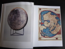
GERARDI MERCATORIS ATLAS EUROPAE.
, Antwerpen, Bibliotheek van de Vrienden van het Mercatorfonds, 1994., Suite, niet gebonden, met foudraal, vergulde bandstempel op de voorplaat, rug versierd met vergulde titel, zonder omslagwikkel, 27,5x40cm, 92pp + 17 uitvouwbare kaarten in kleur. ISBN 9789061533177.
Een facsimili-uitgave van kaarten van Gerard Mercator uit de Atlas van Europa, ca. 1570 - 1572.
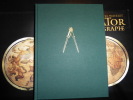
GERARD MERCATOR COSMOGRAPHE, le temps et l'espace.
, Antwerpen, Mercatorfonds, 1994., grand In-4 toile, sous etui, illustrates et sous jaquette, 445pp. BON ETAT ! ISBN 9061533147.
Avec nombre illustrations en couleur. TEXT IN FRENCE
"Gérard Mercator, cosmographe; le temps et l'espace. "
Belgique, Fonds Mercator Paribas, 1994 25 x 33, 445 pp., très nombreuses illustrations en couleurs pour la plupart, reliure d'édition pleine toile + jaquette rempliée, sous étui carton noir illustré, très bon état.
Très bel exemplaire en parfait état.
Gérard Mercator cosmographe. Le temps et l’espace.
[Anvers], Fonds Mercator et la Banque BNP Paribas Belgique, 1994. Grand in-4, 445[dont faux-titre et titre]-(1) pp. – (1) f.[Colophon/registre- ancien- de caractères], bradel toile verte, titre doré au dos, compas doré sur le plat supérieur, jaquette rempliée et étui illustrés en couleurs (reliure de l’Éditeur ; infimes défauts sur l’étui, sinon exemplaire quasi-parfait).
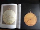
Imprimé sur papier couché ; l’illustration est exceptionnelle : environ cinq cents figures dans le texte (vignettes, pleines et doubles pages, deux sur quatre pages) la plupart en couleurs ; quant aux textes, sous la direction de Marcel WATELET, une vingtaine d’auteurs ont contribué à la rédaction de la plus importante « somme » consacrée à Gérard De Kremer, plus connu sous son nom latinisé : Gerardus MERCATOR (Rupelmonde, 1512 – Duisbourg, 1594). L’ouvrage est divisé en cinq parties, (historique), (géographie), « l’outillage, les sciences et les techniques » (citons, -presque- au hasard : « la bibliothèque de Mercator », avec le « catalogus » en fin de volume et « le monde de l’édition et du livre »), « la représentation de l’espace » (globes, cartes - dont Palestine, Flandre, « Gallia », etc.-) et enfin, « la famille, l’héritage ». In fine, bibliographie et deux index (noms, lieux). Splendide ouvrage, dans la continuité des productions du Fonds Marcator. GAR (V3 G)
Gérard Mercator cosmographe. Le temps et l’espace
Anvers, Fond Mercator, Paribas 1994 Grand in-4 25 x 34 cm. Reliure de l’éditeur pleine toile verte sous jaquette rempliée illustrée en couleurs et étui, 445 pp. Très nombreuses illustrations en noir et en couleurs dans le texte et à pleine page. Exemplaire en excellent état. Très bel ouvrage publié à l’occasion du 400e anniversaire de la mort de Gérard Mercator 1512-1594 humaniste, mathématicien, géographe des Pays-Bas espagnols, inventeur de la projection qui porte son nom.
Très bon état d’occasion
Histoire de L'Ecole Cartographique Belge et Anversoise du XVIe siecle. Amsterdam, Meridian Publishing Co, 1964. 2 vols.
Amst., 1964, ,
2 vols. 402,470 pp. 15 plts. Soft cover.*Reprint of the 1895 edition, fine condition.
duche de Brabant en cartes et gravures anciennes.
, Duculot / Mappamundi,1983 Gembloux / Knokke, Belgique, 1983., Couverture reliee sous jaquette, 160 pages, 39 x31 cm, ** tres bon etat ( neuf !!! ). ISBN 9782801104767.
reproductions de cartes et gravures en couleurs et en noir et blanc, legendes en francais, anglais et allemand, captions in French, English and German, Beschriftung im Franzosisch, Englisch und Deutsch
duche de Brabant en cartes et gravures anciennes.
Gembloux / Knokke, Duculot / Mappamundi, 1983 Hardcover, 160 pages, Texte en Francais, 385 x 305 x 25 mm, Tres belle exemplaire !!. ISBN 9782801104767.
reproductions de cartes et gravures en couleurs et en noir et blanc, legendes en francais, anglais et allemand, captions in French, English and German, Beschriftung im Franzosisch, Englisch und Deutsch
Die Schweiz auf alten Karten. Mit Geleitwort und einem kartographisch-technischen Anhang von Prof. Ed. Imhof.
2. Auflage. Zürich, NZZ, 1969. 4°. 247 S. Mit zahlr. (dv. viele gef.) Karten u. Textillustr. nach alten Vorlagen. Orig.-Halblederband.

Ohne Cellophan-Schutzumschlag.
Die Schweiz auf alten Karten. Mit Geleitwort und einem kartographisch - technischen Anhang von Ed. Imhof.
Zürich, Verlag der Neue Zürcher Zeitung, 1945, in-4to, 227 S. + 4 n.numm. S., mit Textabb. u. 244 z.T. gefalt. Kartenabb., Widmung vom Vorbesitzer auf Vorsatz, Original H.-Leinenband, (erste Ausgabe).
Image disp.
(SLACES, NVVA)
Phone number : 41 (0)26 3223808
Die Schweiz auf alten Karten. Mit Geleitwort und einem kartographisch - technischen Anhang von Ed. Imhof.
Zürich, Verlag der Neue Zürcher Zeitung, 1945, in-4to, 227 S. + 4 n.numm. S., mit Textabb. u. 244 z.T. gefalt. Kartenabb., Original H.-Leinenband, Orig. ill. Umschlag. (Erste Ausgabe).
Image disp.
(SLACES, NVVA)
Phone number : 41 (0)26 3223808
Mapping the World. A History of exploration.
Folio Society, Londres, 2000. Un volume in-4 reliure de l'éditeur sous étui cartonné illustré, 263 pages, texte en anglais, riche iconographie en couleurs. Parfait état.
La librairie est ouverte du mardi au samedi de 9h30 à 12h30 et de 13h30 à 19h00. Commandes par courriel ou téléphone. Envoi rapide, emballage soigné. La librairie est ouverte du mardi au samedi de 9h30 à 12h30 et de 13h30 à 19h00. Commandes par courriel ou téléphone. Envoi rapide, emballage soigné.
Handful of History
, Alan Sutton, 1978 softcover, 201 pages, illustr. b/w. ISBN 0904387216.
A Handful of History is the result of his careful analysis of each card, and the result is a scholarly work on the subjects of each pack.
Das militärische Planzeichnen und die Militär-Kartographie. Ein Handbuch für Officiere. (ERSTAUSGABE).
Berlin, Ernst Siegfried Mittler, 1872, in-8vo, 2 Bl. + 86 S. + 2 lith. Figurentafeln, Bibl.-Stempel und hs. Bibl.-Nr. auf Titelbl., Leinenband, vergold. Titel und Bibl.-Nr. auf dem Rücken.
Jordan, Bibliographie zur Geschichte des Festungsbaues -.
(SLACES, NVVA)
Phone number : 41 (0)26 3223808
Speelkaarten Holland Casino
, Holland Casino, Ringband; COMPLEET; Inclusief kaartspel en losse bijlage met vertaling in Engels en Duits.
Speelkaarten. Dit boek bevat een exlusief kaartspel. en een los boekje
Around the world in 200 globes, stories of the twentieth century
Antwerpen , Uitgeverij Luster, 2024 Hardcover, 264 pages, 30.5 x 25 cm, richly illustrated, English text. *new ISBN 9789460583674.
Take a unique journey through the turbulent 20th century with 200 vintage globes as your guide. In a time of socio-political upheaval and technological revolutions, globe makers had to constantly revise their creations. Globes captured the spirit of the era, from art nouveau to modernism, keeping in step with technological advancements, from plastics to smartphones. The 200 globes in this book tell a tale of innovation and evolution, in times of war and peace, from the exhilaration of the Space Race to scientific breakthroughs. Some were made possible thanks to new production methods, while others are exemplary of the trends and styles of their time. Discover how these exquisite and intriguing artefacts, fashioned from folded metal or paper, illuminated glass or molded plastic, are a testament to history and a reflection of our ever-changing society. Willem Jan Neutelings (1959) is the co-founder of Neutelings Riedijk Architects, known among others for the MAS Museum in Antwerp and the Netherlands Institute of Sound and Vision in Hilversum. He is also an expert globe collector who has conducted extensive research into the design and production of globes during the 20th century. In this book he shares his remarkable collection and fascinating stories of historical events and colorful personalities, documenting the inextricable link between societal transformations and globe design throughout the 20th century.
Le petit Atlas des pays du monde
France Loisirs 1995 415 pages in8. 1995. cartonné. 415 pages.

french édition - Quelques marques plis de lecture et/ou de stockage mais du reste en bon état. Envoi rapide et soigné dans enveloppe à bulles depuis France
Le petit Atlas des pays du monde
France Loisirs 1995 415 pages in8. 1995. cartonné. 415 pages.

French édition - Livre présentant des marques de stockage et/ou de lecture sur la couverture et/ou les pourtours mais demeurant en très bon état d'ensemble. Expédition sous blister dans une enveloppe matelassée depuis la France
Le petit Atlas des pays du monde
France Loisirs 1995 415 pages in8. 1995. cartonné. 415 pages.
French édition :quelques marques de lecture et/ou de stockage sur couverture et coins mais du reste en bon état de lecture - Expédition sous blister dans une enveloppe matelassée depuis la France
Carte routière de la division de CONSTANTINE
Imprimerie du Service Géographique de l'Armée, 1938. In-8 broché allongé. Carte dépliante en couleurs. Très bon état.
Les erreurs de la carte de France.
1906 Paris, Imprimerie du service géographique de l'armée, 1906. In-8, broché, couverture imprimée, 49 pp. 26 planches ht,Cartes et photographie.
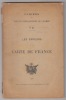
manques au dos,texte bon Remise de 20% pour toutes commandes supérieures à 200 €
Carte du Département.-
De l'Atlas La France, Histoire Nationale des Départements. Lithographie Rigo et Cie. s.d. (milieu XIX°). Grande carte de 58x76cm, plusieurs fois repliée. Limites des arrondissements colorées, Armes et vue d'Auxerre en bordure. Rare.