 Write to the booksellers
-
Type
Book (239)
Magazine (22)
Maps (2)
-
Language
English (1)
French (262)
-
Century
18th (2)
19th (7)
20th (141)
21st (17)
-
Countries
Belgium (40)
France (200)
Greece (2)
Switzerland (21)
-
Syndicate
ILAB (113)
NVVA (1)
SLACES (1)
SLAM (105)
LES OUTILS DANS LES BALKANS DU MOYEN AGE A NOS JOURS . T 1: Nomenclature et formes. T2 : Planches .
1986 Editions de l' Ecole des hautes études en sciences sociales et Maisonneuve et Larose, 1986, 2 volumes petit in4 toile rouge éditeur sous emboitage ,379-1032pp Constituent les tomes 14 et 15 de: Documents et recherches sur le monde byzantin ,néohellenique et balkanique, sous la direction de A Guillou. Titre sur le dos légèrement effacé.
The Land Of Macedonia
Topio Publications. 1992. In-4. Relié. Bon état, Couv. convenable, Dos satisfaisant, Intérieur frais. Environ 250 pages. Nombreuses photographies en couleurs hors texte.Texte en langue Anglaise. Jaquette en bon état.. Avec Jaquette. . . Classification Dewey : 949.6-Balkans
Photographs by Dimitris Talianis- Classification Dewey : 949.6-Balkans
DIE BULGARISCHE IKONE
Staatliche Druckerei BALKAN, Sofia-press, 1981 bound with dusjacket, 270pp. ill.
1300 jahre Bulgarien und ikone
Kosovo assiegé - Une Bombe à Retardement
Lausanne L'age D'homme 2000 In8 61 pages - broché - très bon état
Très bon
Carte de la presqu'île des Balkhans.
- 1 carte 30 x 23 cm, pliée en deux.
Carte géographique. Carte N° 24 tirée de l'"Atlas-général composé de trente cinq cartes coloriées et gravées sur cuivre". Justus Perthes à Gotha, 1884.
Les grottes de Grèce- Guide complète des grottes de Grèce
Ekdotike Athenon S.A.. 1984. In-8. Broché. Bon état, Couv. convenable, Dos satisfaisant, Intérieur frais. 160 pages. Nombreuses illustrations, cartes, photos en couleurs, dans et hors texte. Couverture contrepliée.. . . . Classification Dewey : 949.6-Balkans
Classification Dewey : 949.6-Balkans
LES CATHEDRALES DE SERBIE
Paris, 1917, in-8, 97 pp., 1 carte dépliante, planches de photos hors texte. Broché, dos doublé , couverture salie, tampon René PELLETIER, premier cahier dérelié.
Au lendemain des Guerres Balkaniques.
PAYOT & Cie. 1915. In-12. Broché. Etat d'usage, Couv. légèrement passée, Dos satisfaisant, Quelques rousseurs. 127 pages. Ouvrage de bibliothèque : dos renforcé par une bande papier, code sur la coiffe en-tête et tampons sur la page de titre et dans quelques marges.. . . . Classification Dewey : 949.6-Balkans
Préface de M. R.G. Lévy. Situation Economique, Financière et Politique comparée de l'Albanie, la Bulgarie, la Grèce et la Serbie. Classification Dewey : 949.6-Balkans
EN DALMATIE. Cent quarante quatre photographies par Emmanuel Boudot Lamotte . .Introduction historique par André Pierre.
1938 P, Hartmann , 1938, petit in4 broché.
Notitia de locis sanctis. Texte arabe et traduction fran aise
, Brepols, 2021 Paperback, 88 pages, Size:180 x 265 mm, Illustrations:1 tables b/w., Language(s):Arabic, French. ISBN 9782503598086.
Summary Le fascicule propose l' tude, l' dition et la traduction d'un texte anonyme contenant une description des Lieux Saints de Syrie et de Palestine, transmis par le Par. ar. 300 (XIVe si cle). l'analyse de la structure, du contenu et de la langue du texte fait suite l' dition critique, accompagn e de la traduction fran aise et d?un riche apparat de notes et de r f rences d'autres sources anciennes et modernes. TABLE OF CONTENTS Introduction Bibliographie Texte et traduction Les listes des lieux saints - Tableau comparatif Index scripturaire Index des noms propres Table des mati res
La vie économique des provinces illyriennes (1809-1813).
Paris, Ed. Bossard, 1930. In-8 broché, 359 pp., qq. tableaux, 3 cartes, tableau chronologique des décrets et arrêtés, tableau comparatif des monnaies, poids et mesures, index des noms de personnes, des noms géographiques. Ex. non coupé, [joint] : une coupure de presse de 1931 relatif à l'ouvrage.
Thèse principale pour le Doctorat ès Lettres présentée à la Faculté des Lettres de l'Université de Paris. Couv. un peu jaunie, bon ex. au demeurant. - Frais de port : -France 6,9 € -U.E. 9 € -Monde (z B : 15 €) (z C : 25 €)
Christian Maps of the Holy Land. Images and Meanings
, Brepols, 2020 Paperback, xxv + 176 pages, Size:216 x 280 mm, Illustrations:62 b/w, 11 col., Language: English. ISBN 9782503585260.
Summary This book offers a way of reading maps of the Holy Land as visual imagery with religious connotations. Through a corpus of representative examples created between the sixth and the nineteenth centuries, it studies the maps as iconic imagery of an iconic landscape and analyses their strategies to manifest the spiritual quality of the biblical topography, to support religious tenets, and to construct and preserve cultural memory. Maps of the Holy Land have thus far been studied with methodologies such as cartography and historical geography, while the main question addressed was the reliability of the maps as cartographic documents. Through another perspective and using the methodology of visual studies, this book reveals that maps of the Holy Land constructed religious messages and were significant instruments through which different Christian cultures (Byzantine, Catholic, Protestant, and Greek Orthodox) shaped their religious identities. It does not seek to ascertain how the maps delivered geographical information, but rather how they utilized the geographical information in formulating religious and cultural values. Through its examination of maps of the Holy Land, this book thus explores both Christian visual culture and Christian spirituality throughout the centuries. TABLE OF CONTENTS List of Illustrations Abbreviations Timeline Introduction Part I. Iconic Landscape, Iconic Map Chapter 1. Formation of a Holy Land Chapter 2. Madaba Map: A Visual Portrait of the Holy Land from the Byzantine Period Composition and Content Religious Message Generator of Cultural Memory Map and Pilgrimage The Holy Land Map and Early Christian Art Part II. The Map of the Holy Land in the Latin West Chapter 3. Innovative Western Spiritual Iconographies Twelfth-Century Maps Matthew Paris's Map in his Chronica majora (mid thirteenth century) Grid Maps from the Fourteenth Century Chapter 4. Fifteenth-Century Pilgrims' Maps: Late Medieval Instruments of Devotion Gabriel Capodilista's Map William Wey's Map Bernhard von Breydenbach's Map A Map by an Anonymous Author Part III. Between Pilgrimage and Scripture, Catholicism and Protestantism Chapter 5. Friedrich III's Cartographical Pilgrimage Imagery Lucas Cranach the Elder's Map: A Transitional Image Gotha Panel Chapter 6. Map and Scripture Gerard Mercator's Map of the Holy Land John Speed's Map, Associated with the King James Bible Maps of the Holy Land in the Dutch States-General Bible Justus and Cornelis Danckerts' Map of the Holy Land: A Pictorial Epitome Part IV. Map as Icon: Greek Orthodox proskynetaria from the Ottoman period Chapter 7. Icon of a Land Conclusion Appendices I. Inscriptions on the Madaba Map II. Sites Mentioned in the Pilgrimage Guide of Gesta Francorum Ihrusalem expugnantium (dated to 1101-1104) in Order of Appearance) III. Inscriptions on Three Twelfth-Century Maps of the Holy Land IV. Inscriptions on London, British Library, Add. MS 27376, fols. 188v-189r V. A List of Places in William Wey's Pilgrimage Account (Oxford, Bodleian Library,MS Bodley 565), said to be synchronized with his map of the Holy Land VI. Sites in and around Jerusalem in Bernhard von Breydenbach's Map of the Holy Land Bibliography Index
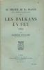
Au service de la France, neuf années de souvenirs. Tome II : les Balkans en feu (1912)
PLon et Nourrit. 1929. In-8. Broché. Etat d'usage, Couv. convenable, Dos fané, Intérieur bon état. 429 pages. Manque en coiffe de pied. Quelques rousseurs sur certianes pages. Ouvrage illustré de deux gravures hors-texte. Intérieur non coupé.. . . . Classification Dewey : 949.6-Balkans
Classification Dewey : 949.6-Balkans
Au service de la France. Neuf années de souvenirs. Les Balkans en feu. 1912
Plon Paris, Librairie Plon, 1930. In-8 broché de 429 pages. N° 2 de la collection. Bon état
Toutes les expéditions sont faites en suivi au-dessus de 25 euros. Expédition quotidienne pour les envois simples, suivis, recommandés ou Colissimo.
Au service de la France. Neuf années de souvenirs. Les Balkans en feu. 1912
Plon Paris, Librairie Plon, 1926. In-8 broché de 429 pages. N° 2 de la collection. Bon état
Toutes les expéditions sont faites en suivi au-dessus de 25 euros. Expédition quotidienne pour les envois simples, suivis, recommandés ou Colissimo.
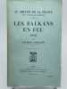
LES BALKANS EN FEU 1912. Au service de la France - Neuf années de souvenirs, II
Paris Librairie Plon 1929 in 8 (23x14,5) 1 volume broché, couverture imprimée, 429 pages [1] avec 2 gravures hors-texte. Raymond Poincaré, Bar-le-Duc 1860 - Paris 1934, avocat et homme d'Etat français, président de la République française du 18 février 1913 au 18 février 1920. Très bel exemplaire ( Photographies sur demande / We can send pictures of this book on simple request )
Très bon Broché
REVISION DU MARXISME-LENINISME AU SUJET DE LA GUERRE DE LIBERATION EN YOUGOSLAVIE
LE LIVRE YOUGOSLAVE. 1949. In-12. Broché. Bon état, Couv. convenable, Dos frotté, Intérieur frais. 79 pages.. . . . Classification Dewey : 949.6-Balkans
Classification Dewey : 949.6-Balkans
Balkan n°3 : Grèce, incertitudes après les élections - Les dessous du scandale Koskotas - Les Pomaks musulmans : entre Bulgarie et Turquie - La vendetta au Montenegro - Economie, sociétés mixtes et zones franches
SDPII. Juil - Aout 1989. In-8. Broché. Très bon état, Couv. fraîche, Dos satisfaisant, Intérieur frais. Revue de 124 pages.. . . . Classification Dewey : 949.6-Balkans
Revue de l'actualité politique, économique et culturelle de l'Europe du Sud-Est. Classification Dewey : 949.6-Balkans
Balkan n°4 : Kosovo, déclarations de Slobodan Milosevic et de Milovan Djilas - Religion, les chrétiens à l'Est - Le précieux parfum de la rose de Bulgarie - Mitsotakis, une vieille complicité avec ses adversaires communistes - Emigr. les passe-murailles
SDPII. Oct - Déc 1989. In-8. Broché. Très bon état, Couv. fraîche, Dos satisfaisant, Intérieur frais. Revue de 131 pages. Quelques cartes en noir et blanc, dans le texte.. . . . Classification Dewey : 949.6-Balkans
Revue de l'actualité politique, économique et culturelle de l'Europe du Sud-Est. Classification Dewey : 949.6-Balkans
Balkan n°5 : Bulgarie, la perestroïka à pas feutrés - Le sort des Minorités turques en Bulgarie et Grèce - Le tabac de Bulgarie - Sauvegarde de la Nation Serbe ...
SDPII. Janv - Mars 1989. In-8. Broché. Très bon état, Couv. fraîche, Dos satisfaisant, Intérieur frais. Revue de 76 pages. Quelques cartes en noir et blanc, dans le texte.. . . . Classification Dewey : 949.6-Balkans
Revue de l'actualité politique, économique et culturelle de l'Europe du Sud-Est. Classification Dewey : 949.6-Balkans
Phone number : 33 (0)6 77 77 12 33
Ils ont voulu tuer Dieu Albanie La persécution contre l'église catholique (1944-1991) Collection témoins
AED. non daté. In-16. Broché. Bon état, Couv. convenable, Dos satisfaisant, Intérieur frais. 471 pages augmentées de nombreuses photos en noir et blanc dans texte.. . . . Classification Dewey : 949.6-Balkans
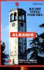
Collection témoins. Classification Dewey : 949.6-Balkans
AU SERVICE de la FRANCE, NEUF ANNEES de SOUVENIRS : II - Les BALKANS en FEU - 1912
Un ouvrage de 430 pages, format 140 x 225 mm, relié cartonnage dos toilé, publié en 1926, Librairie Plon, bon état
Souvenirs
Phone number : 04 74 33 45 19
Comment les Austro-Hongrois ont fait la guerre en Serbie. Observations directes d'un neutre.
COLIN Armand. 1915. In-8. Broché. Bon état, Couv. convenable, Dos satisfaisant, Intérieur frais. Plaquette de 48 pages. Quelques photos en noir et blanc, dans le texte. Ouvrage de bibliothèque : étiquette de code sur la coiffe en-tête et tampons sur la page de titre.. . . . Classification Dewey : 949.6-Balkans
Etudes et Documents sur la Guerre. Classification Dewey : 949.6-Balkans
Budapest. La ville en instantanés.
CORVINA. 1964. In-4. Relié toilé. Bon état, Couv. convenable, Dos satisfaisant, Intérieur frais. Environ 70 / 80 pages. Nombreuses planches de photos en noir et blanc et en héliogravure. Petits accrocs sur les bords de la jaquette.. Avec Jaquette. . . Classification Dewey : 949.6-Balkans
Classification Dewey : 949.6-Balkans