 Write to the booksellers
DUPERREY (Louis-Isidore).
[ÎLES CAROLINES] Plan de l'île Bigali (archipel des Îles Carolines) - Plan de l'île Satahoual (archipel des Îles Carolines) - Plan des îles Tamatam, Fanadik et Ollap (archipel des Îles Carolines).
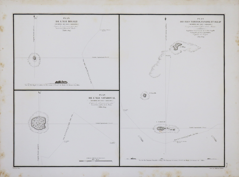
[1827]. 360 x 499 mm.
Reference : LBW-4449
Plans de l'île Bigali, renommée Pikelot, de l'île Satahoual, renommée Satawal, et des îles Tamatam, Fanadik et Ollap, aujourd'hui regroupées dans l'atoll de Pulap. Les plans ont été dressés en juin et juillet 1824 par Lottin, officier de marine sur la corvette la Coquille lors de l'expédition dirigée par le commandant Duperrey. Avec deux profils côtiers. Petites rousseurs marginales.
Bookseller's contact details
Librairie Le Bail
Didier Le Bail
13 rue Frédéric Sauton
75005 Paris
France
33 01 43 29 72 59
Payment mode
Sale conditions
Conditions de vente conformes aux usages et aux règlements du Syndicat de la Librairie Ancienne et Moderne (SLAM) et de la Ligue Internationale de la Librairie Ancienne (LILA). Paiements acceptés : cartes bancaires, via un lien de paiement, chèques, virements Conditions of sale in accordance with the practices and regulations of the Syndicat de la Librairie Ancienne et Moderne (SLAM) and the International League of Antiquarian Booksellers (ILAB). Payments accepted: credit cards, via payment link, checks, and bank transfers.