 Write to the booksellers
BRITISH ADMIRALTY HYDROGRAPHIC OFFICE.
[GALICE] Spain North West Coast. San Ciprian Bay to Cape Finisterre.
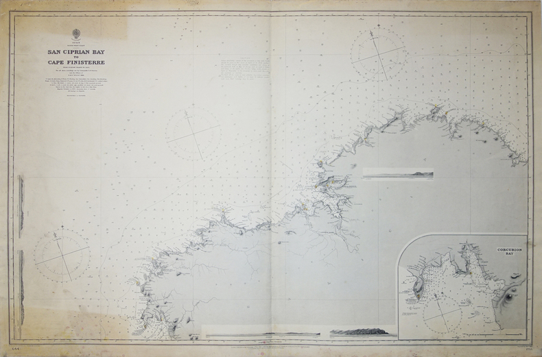
London, 1887. 650 x 982 mm.
Reference : LBW-3223
Belle et grande carte marine figurant les côtes galiciennes entre Foz et la baie de Corcubión jusqu'à Fisterra. Elle a été dressée d'après les cartes marines espagnoles par le commandant Dawson et les officiers à bord du HMS Sylvia, sous la direction de l'amiral Wharton, hydrographe de la Marine Royale Anglaise. Les phares sont aquarellés en jaune avec un point rouge : San Cibrao (San Ciprian), Ferrol, La Corogne, Corcubión, Fisterra, etc. En bas à droite, carte détaillée de la baie de Corcubión. Avec cinq profils côtiers. Parties haute et basse à gauche de la carte jaunies, petites taches dans les marges.
Bookseller's contact details
Librairie Le Bail
Didier Le Bail
13 rue Frédéric Sauton
75005 Paris
France
33 01 43 29 72 59
Payment mode
Sale conditions
Conditions de vente conformes aux usages et aux règlements du Syndicat de la Librairie Ancienne et Moderne (SLAM) et de la Ligue Internationale de la Librairie Ancienne (LILA). Paiements acceptés : cartes bancaires, via un lien de paiement, chèques, virements Conditions of sale in accordance with the practices and regulations of the Syndicat de la Librairie Ancienne et Moderne (SLAM) and the International League of Antiquarian Booksellers (ILAB). Payments accepted: credit cards, via payment link, checks, and bank transfers.