 Write to the booksellers
FER (Nicolas de).
Le Roussillon, subdivisé en Cerdagne, Cap Sir, Conflans, Vals de Carol et de Spir, où se trouve encore le Lampourdan, faisant partie de la Catalogne.
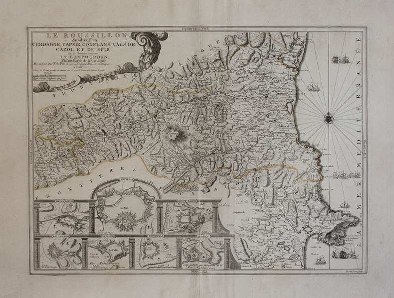
Paris, G. Danet, [circa 1725]. 398 x 544 mm.
Reference : LBW-3045
Jolie carte du Roussillon avec partie de la Catalogne jusqu'à Montiro, ornée de sept plans de villes fortifiées, d'une rose des vents et de navires, publiée par Guillaume Danet, gendre de Nicolas de Fer. Pliure centrale restaurée avec petit décalage au bas de la pliure. Contours aquarellés à l'époque. Pastoureau, FER II C, 31 ; Institut Càrtografic de Catalunya, p. 126.
Bookseller's contact details
Librairie Le Bail
Didier Le Bail
13 rue Frédéric Sauton
75005 Paris
France
33 01 43 29 72 59
Payment mode
Sale conditions
Conditions de vente conformes aux usages et aux règlements du Syndicat de la Librairie Ancienne et Moderne (SLAM) et de la Ligue Internationale de la Librairie Ancienne (LILA). Paiements acceptés : cartes bancaires, via un lien de paiement, chèques, virements Conditions of sale in accordance with the practices and regulations of the Syndicat de la Librairie Ancienne et Moderne (SLAM) and the International League of Antiquarian Booksellers (ILAB). Payments accepted: credit cards, via payment link, checks, and bank transfers.