 Write to the booksellers
COOK (James).
[NOUVELLE-ZELANDE] Carte du détroit de Cook dans la N.le Zélande.
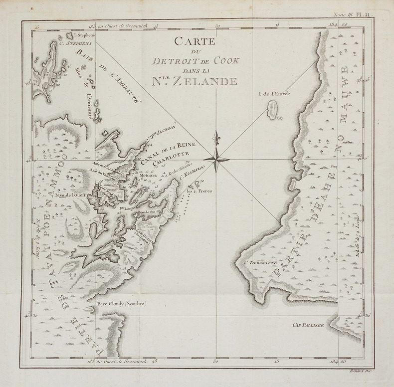
[1774]. 270 x 272 mm.
Reference : LBW-2757
Carte détaillée du détroit de Cook situé entre les îles du Nord et du Sud de la Nouvelle-Zélande, publiée dans le premier voyage de James Cook entre 1768 et 1771. Au cours de ce voyage, Cook explora la Polynésie, puis la Nouvelle-Zélande et les côtes orientales de l'Australie. Bel exemplaire, replié. Tooley, MCC 64, Printed maps of Australia, 341, p. 47.
Bookseller's contact details
Librairie Le Bail
Didier Le Bail
13 rue Frédéric Sauton
75005 Paris
France
33 01 43 29 72 59
Payment mode
Sale conditions
Conditions de vente conformes aux usages et aux règlements du Syndicat de la Librairie Ancienne et Moderne (SLAM) et de la Ligue Internationale de la Librairie Ancienne (LILA). Paiements acceptés : cartes bancaires, via un lien de paiement, chèques, virements Conditions of sale in accordance with the practices and regulations of the Syndicat de la Librairie Ancienne et Moderne (SLAM) and the International League of Antiquarian Booksellers (ILAB). Payments accepted: credit cards, via payment link, checks, and bank transfers.