 Write to the booksellers
DEPOT des CARTES et PLANS de la MARINE.
[HAUTE-NORMANDIE] Côtes de France : Département de la Seine Inférieure, depuis Fécamp jusqu'à Dives.
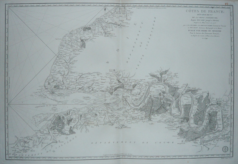
Paris, 1792. 585 x 862 mm.
Reference : LBW-1732
Grande carte figurant les côtes de la Seine-Maritime, appelée Seine-Inférieure jusqu'en 1955. Elle a été dressée d'après les plans levés en 1776 par Louis de La Couldre de La Bretonnière, lieutenant de vaisseau, et Pierre Méchain, astronome hydrographe de la Marine. Tous deux furent chargés en 1776 d'inspecter les côtes entre Dunkerque et Granville. A l'ouest, la carte va jusqu'à Rouen. Très bel exemplaire.
Bookseller's contact details
Librairie Le Bail
Didier Le Bail
13 rue Frédéric Sauton
75005 Paris
France
33 01 43 29 72 59
Payment mode
Sale conditions
Conditions de vente conformes aux usages et aux règlements du Syndicat de la Librairie Ancienne et Moderne (SLAM) et de la Ligue Internationale de la Librairie Ancienne (LILA). Paiements acceptés : cartes bancaires, via un lien de paiement, chèques, virements Conditions of sale in accordance with the practices and regulations of the Syndicat de la Librairie Ancienne et Moderne (SLAM) and the International League of Antiquarian Booksellers (ILAB). Payments accepted: credit cards, via payment link, checks, and bank transfers.