 Write to the booksellers
DUPERREY (Louis-Isidore).
[POLYNESIE FRANCAISE] Carte des îles situées au sud et à l'ouest des îles de la Société.
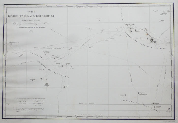
[1826]. 351 x 520 mm.
Reference : LBW-1141
Carte gravée par Ambroise Tardieu, figurant les archipels des îles de la Société, des îles Cook et des îles Australes ou Tubuai. Elle a été dressée en 1823 par le commandant Duperrey lors de l'expédition de la corvette la Coquille. Sur la carte sont tracées les routes des navigateurs ayant exploré ces archipels (Carteret, Cook, Wallis...). Bon exemplaire.
Bookseller's contact details
Librairie Le Bail
Didier Le Bail
13 rue Frédéric Sauton
75005 Paris
France
33 01 43 29 72 59
Payment mode
Sale conditions
Conditions de vente conformes aux usages et aux règlements du Syndicat de la Librairie Ancienne et Moderne (SLAM) et de la Ligue Internationale de la Librairie Ancienne (LILA). Paiements acceptés : cartes bancaires, via un lien de paiement, chèques, virements Conditions of sale in accordance with the practices and regulations of the Syndicat de la Librairie Ancienne et Moderne (SLAM) and the International League of Antiquarian Booksellers (ILAB). Payments accepted: credit cards, via payment link, checks, and bank transfers.