 Write to the booksellers
[G. F. Cruchley] -
CRUCHLEY, G. F. ; [ CRUCHLEY, George Frederick ]
Cruchley's Reduction of his Large Map of England and Wales with Part of Scotland ; Showing all the Railways & Turnpike Roads with the Great Rivers and the course of the different Navigable Canals : The Market and Borough Towns and principal places adjoining the Road
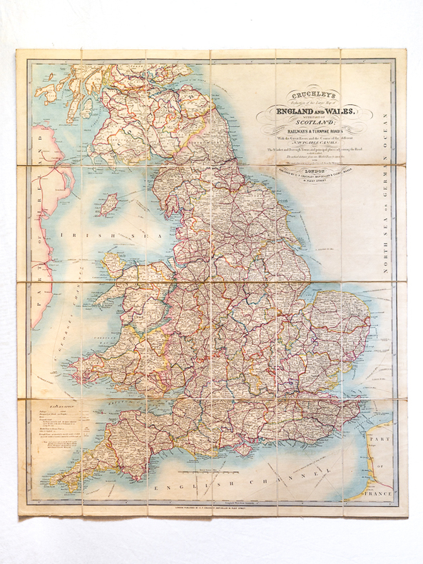

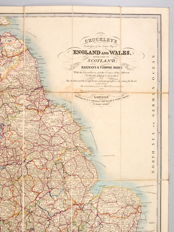
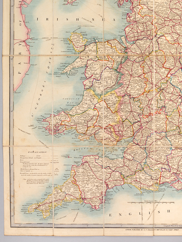
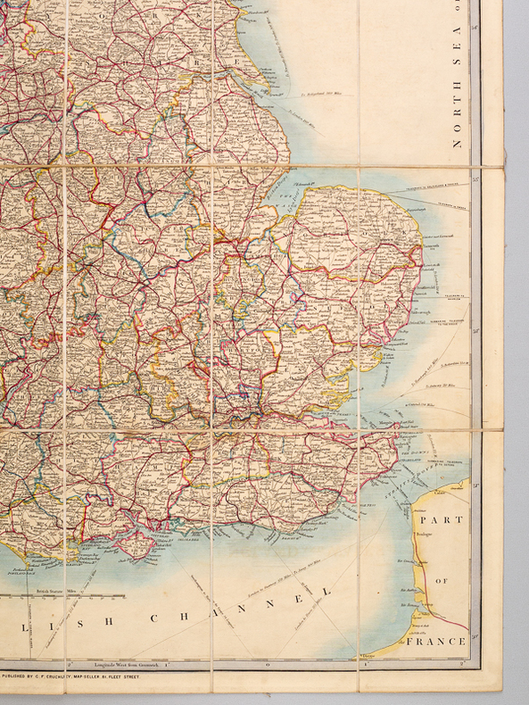

Colored folding map, mounted on linen, G. F. Cruchley, 81 Fleet Street, London, s.d. [ circa 1850-1860 ], 79 x 66,5 cm. Full title : Cruchley's Reduction of his Large Map of England and Wales with Part of Scotland ; Showing all the Railways & Turnpike Roads with the Great Rivers and the course of the different Navigable Canals : The Market and Borough Towns and principal places adjoining the Road ; to which is added the distance from one market town to another, with the exact admeasurement prefixed to each from the metropolis.
Reference : 59975
Nice map in its original colors (slight browning on foldings, otherwise a charming map).
Bookseller's contact details
SARL Librairie du Cardinal
M. Vincent Guérin
contact@librairie-du-cardinal.com
09 82 20 86 11
Payment mode
Sale conditions
Conformes aux usages de la librairie ancienne. Après avoir noté la référence de l'ouvrage (au moins le titre et l'auteur), contactez-nous par téléphone ou e-mail pour réserver l'ouvrage. Nous vous communiquerons le montant total, frais d'envoi compris (en colissimo suivi ou recommandé). Les frais d'envoi sont à la charge de l'acheteur, l'emballage est gratuit, le paiement se fait au choix soit directement par carte bancaire (nous contacter, nous vous enverrons un lien de paiement sécurisé), soit par chèque ou virement bancaire. L'ouvrage est envoyé dès l'encaissement.