 Write to the booksellers
JANE HAMILTON
A MAP OF THE WORLD
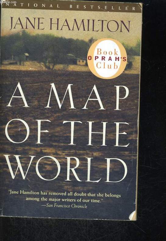
ANCHOR BOOKS. 1995. In-8. Broché. Etat d'usage, Couv. légèrement passée, Dos satisfaisant, Intérieur frais. 389 pages. Premier plat illustré en couleurs.. . . . Classification Dewey : 820-Littératures anglaise et anglo-saxonne
Reference : RO60063898
ISBN : 0385720106
Classification Dewey : 820-Littératures anglaise et anglo-saxonne
Bookseller's contact details
Le-livre.fr / Le Village du Livre
ZI de Laubardemont
33910 Sablons
France
05 57 411 411
Payment mode


Sale conditions
Les ouvrages sont expédiés à réception du règlement, les cartes bleues, chèques , virements bancaires et mandats cash sont acceptés. Les frais de port pour la France métropolitaine sont forfaitaire : 6 euros pour le premier livre , 2 euros par livre supplémentaire , à partir de 49.50 euros les frais d'envoi sont de 8€ pour le premier livre et 2€ par livre supplémentaire . Pour le reste du monde, un forfait, selon le nombre d'ouvrages commandés sera appliqué. Tous nos envois sont effectués en courrier ou Colissimo suivi quotidiennement.
5 book(s) with the same title
Reference : albacaedd9b650df23f
Map of the World. Union of Soviet Socialist Republics. World map. Union Of Sovi
Map of the World. Union of Soviet Socialist Republics. World map. Union Of Soviet Socialist Republics. In Russian /Karta mira. Soyuz Sovetskikh Sotsialisticheskikh Respublik.World map. Union Of Soviet Socialist Republics. General Directorate of Geodesy and Cartography. 1982. 83 p. We have thousands of titles and often several copies of each title may be available. Please feel free to contact us for a detailed description of the copies available. SKUalbacaedd9b650df23f.
Reference : albbbf78a283dfaeb47
The map of the world is a story for the elderly and middle-aged. In Russian /Vl
The map of the world is a story for the elderly and middle-aged. In Russian /Vl.Ivanov Kartamirapovest: dlya starshego i srednego vozrasta. Sketches by A. Davydovoy. M.: L.: Detizdat of the Central Committee of the All-Union Communist League of 1937. 112 p. We have thousands of titles and often several copies of each title may be available. Please feel free to contact us for a detailed description of the copies available. SKUalbbbf78a283dfaeb47.
Reference : alb03e896b37389bb9c
Macrae Chris I. Astrology on the globe. Geodetic map of the world In Russian /M
Macrae Chris I. Astrology on the globe. Geodetic map of the world In Russian /Makrey Kris I.I. Astrologiya na zemnom share. Geodeticheskaya karta mira M Polygran 1993 96 p.We have thousands of titles and often several copies of each title may be available. Please feel free to contact us for a detailed description of the copies available.SKUalb03e896b37389bb9c.
Map of the Roman empire, based on the international 1:1,000,000 map of the world, sheet H.I. 34: Cyrene. (Maps of Roman Lybia-East sheet (Cyrenaica). Compiled by R.G. Goodchild.
Oxford, The Society of Antiquaries of London, 1954.
17 p.; 1 big folding map. Stiff wrappers. 25.5 cm (Cover worn and spotted)
Map of the World, The World According to Illustrators and Storytellers
, Gestalten, 2013 Hardcover, 24,5 x 33 cm, 224, full color, hardcover, English, Fine copy. Including an index. ISBN 9783899554694.
Maps help us understand and navigate the world. For centuries, maps have become better, more refined, and more precise?there are no blind spots anymore. While Google Maps and GPS systems have become our tools of choice for navigation, contemporary maps have evolved into platforms for cutting-edge illustration, experimental data visualization, and personal visual storytelling.