 Write to the booksellers
-
Type
Artists book (1)
Book (8424)
Engraving (3)
Magazine (10)
Maps (356)
-
Latest
Last 24h (8)
Last 3 days (4)
Last month (110)
Last week (12)
-
Language
Bulgarian (1)
English (1)
French (8774)
German (10)
Italian (1)
Polish (1)
Portuguese (1)
Russian (1)
Spanish (4)
-
Century
16th (8)
17th (21)
18th (195)
19th (1469)
20th (2891)
21st (434)
-
Countries
Belgium (136)
Brazil (1)
Canada (3)
China (26)
Côte d'Ivoire (1)
Denmark (39)
France (8364)
Greece (1)
Netherlands (2)
Switzerland (220)
United States of America (1)
-
Syndicate
ALAC (3)
CLAQ (2)
CNE (1)
ILAB (6988)
NVVA (127)
SLACES (127)
SLAM (6804)
SNCAO (2)
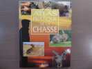
Atlas pratique de la chasse.
Atlas Paris 1995 In-4 ( 285 X 215 mn ) de 240 pages, cartonnage illustrée. Illustrations dans et hors-texte en couleurs. Très bel exemplaire.
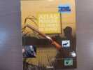
Atlas pratique, les armes de chasse.
Editions Atlas Paris 2000 In-4 ( 285 X 220 mn ) de 236 pages, cartonnage illustrée. Illustrations dans et hors-texte. Très bel exemplaire.
The Rhodesian Book of the Road.
Salisbury, M. O. Collins, 1974, in-4°, 72 pp, 28 cartes en couleurs dans le texte et à pleine page, illustrations de Jill Meikle et Celia Wakefield et très nombreuses photos, cart. illustré de l'éditeur, bon état. Texte en anglais. Peu courant
![The Rhodesian Book of the Road.. |Atlas] – PRATT (Susan)(Edited by).](https://static.livre-rare-book.com/pictures/CLI/78336_1_thumb.jpg)
Intéressant atlas routier de la Rhodésie du Sud (actuel Zimbabwe) en 1974, avec de belles cartes et de nombreuses photos de l'époque, la plupart en couleurs. Après l'indépendance de la Zambie, le nom de Rhodésie servit à désigner la Rhodésie du Sud, notamment après sa déclaration d'indépendance en 1965. L'ouvrage a été publié à Salisbury, capitale de la Fédération de Rhodésie et du Nyassaland, puis capitale du nouvel État indépendant du Zimbabwe (en 1980), rebaptisée Harare lors du deuxième anniversaire de l'indépendance en avril 1982. Désormais les frais d'envoi sont de 6 € seulement pour les livres jusqu'à 1 kg (colissimo suivi), pour la France métropolitaine.
Collection of 5 steel-engraved maps of ""Charte von der Königlichen Preussichen Provin(zen)...Entworfen von C.F. Weiland.
Weimar, in Verlage des Geographischen Instituts, 1825-28. Folio. Each 49x60 cm. 5 steel-engraved maps depicting the 5 parts of Prussia. All Handcoloured in outline. Cont. blank wrappers, wrappers partly lost. All maps with broad margins with use and tears, one tear reaching engraved surface. Some soiling. The last 2 maps dampstained in right corners.
Contents. 1. Charte v. d. Königl. Preuss. Provinz Schlesien. - 2....Pommern. 3....Brandenburg. - 4....Sachsen. - 5... Westphalen und die Rhein-provinz.
Atlas des Cartes de l’Histoire générale des Voyages.
Paris, 1738-1760. In 4° plein veau écaillé, dos lisse orné, triple filet doré sur les plats (dos passé, coiffes usagées, coins émoussés) comprenant 74 cartes simples, doubles ou dépliantes.
Atlas seul comprenant une grande mappemonde et des cartes particulières de l’Afrique et de l’Arabie, l’Extrême-Orient et l’Asie du Sud-Est, l’Amérique, l’Arctique, Tahiti, la Nouvelle-Calédonie, la Guadeloupe, etc… gravées par la plupart d’après les tracés de Jacque-Nicolas Bellin, de Maurepas ou de Cook.
Géopolitique transparente.
Baume-les-Dames, 1987 ; in-4, 255 pp., cartonnage de l'éditeur .
.
Feuille de Nyons
Bien complet de la carte Broché sans couverture illustrée Très bon Paris CNRS 1978 1 volume in-4°
La Geografia di Claudio Tolomeo Alessandrino, Già tradotte di greco in italiano da M. Giero. Ruscelli: & hora in questo nuoua editione da M. Gio. Malomba ricoretta, & purgata d'infiniti errori: come facilmente nella Prefatione a Lettori può ciascuno... - [DEPICTING THE WORLD]
Venetia (Venice), Giordano Ziletti, 1574-(73). 4to. Hcalf from ab 1820. Gilt back. Slight rubbing to spine. (78),350 pp. and 65 double-page engraved maps with text on verso of plates (130) pp,56,65 pp. 6 textlvs. at end with brownspots in right margin, sometimes a little browning to pages, few brownspots and a few textlvs. with minor wormtracts. Complete with all 65 maps called for, each measuring ab. 19 x 26 cm. A great part of the maps have some background shadowing from the printers ink, mainly due to the fact, that this is the third Ruscelli-edition, where the plates have been used before. 3 printer's wood-cut devices and 20 smaller and larger woodcuts in the text. 2 woodcuts with Ptolemy shown observing.
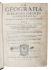
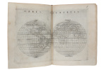
Third edition of Ruscelli's translation from Venice, 1561. The maps are printed from the same plates, with the exception of Ptolemy's map of the world, for which Malomba had returned to the original conical projection of Ptolemy. Moreover, one map is added: the map of ""Territorio di Roma"". In general the maps are enlarged copies of Gastaldi's maps from the edition of 1548 which came out in 8vo. The Ruscelli translation contains an important innovation, namely the division of the world map into two parts, one for the Old World and one for the New, as seen on the plate ""Tavola Universal"", depicting the 2 hemispheres. The atlas contains 27 ptolemaic maps and 38 new. 1 World, 1 Hemisphere, 10 Europe, 4 Africa, 12 Asia and 38 others. 10 of the maps relate to America.Philipps I:380. Sabin 66505. Nordenskiöld Nr. 34 (p.27).
Atlas pittoresque de la france.
Paris, Société des atlas pittoresques editions attinger , s.d. ; in-4, cartonnage de l'éditeur. Les 4 volumes. En 4 volumes très bel état.
En 4 volumes très bel état.
Atlas pittoresque de la france.
Paris, Société des atlas pittoresques editions attinger , s.d. ; in-4, cartonnage de l'éditeur. Les 4 volumes. En 4 volumes très bel état.
En 4 volumes très bel état.
Atlas pittoresque de la france.
Paris, Societe des atlas pittoresques , s.d. ; in-4, cartonnage de l'éditeur. Les 3 volumes. En 3 volumes.
En 3 volumes.
Étrennes Géographiques 1760.-
Paris. Ballard. 1760. In-16 (80 x 120 mm) plein maroquin rouge, dos à 5 nerfs entièrement orné, triple filet encadrant les plats et fleurs en écoinçons, gardes de papier dominoté à motifs en damier vert et or, 4ff. (titre, avertissement et catalogue des cartes) et 26 cartes doubles en couleurs, montées sur onglet. Les cartes contenues dans ce recueil ont été réduites par Rizzi-Zannoni qui a suivi principalement les cartes de M. D'Anville (d'après l'avertissement). Reliure un peu fatiguée, page de titre piquée, cartes en bel état. Bon exemplaire.
Atlas Routier et Touristique De La France
Le Grand Livre Du Mois Reliure Rigide Illustrée 1984 71 pages de cartes en couleurs sur un format 25 - 33 cm - adresse des syndicats d' initiative 2-04-011-980-9
Très Bon État
Atlas de la Chine. Un monde sous tension.
Autrement, 2012, gr. in-8°, 96 pp, nouvelle édition augmentée, nombreuses cartes en couleurs (cartographie : Madeleine Benoît-Guyod), repères, chronologies, biblio, index, reliure souple illustrée de l'éditeur, bon état
Plus de 120 cartes et infographies pour découvrir le nouveau visage social, économique et politique de la Chine. – Les formidables mutations de la société s'accélèrent : consommation, tourisme, aspirations et revendications nouvelles... – Un géant qui rivalise avec les grandes puissances mondiales. – Les grands enjeux d'avenir en cartes : crises environnementales, transport, santé et vieillissement. – Dans cette nouvelle édition entièrement mise à jour, Thierry Sanjuan souligne à quel point la Chine, à l'écart de la classique suprématie occidentale, invente son propre modèle de puissance développée. Désormais les frais d'envoi sont de 6 € seulement pour les livres jusqu'à 1 kg (colissimo suivi), pour la France métropolitaine.
Atlas de géographie moderne.
Paris, Librairie hachette et cie , 1894 ; in folio , cartonnage de l'éditeur. Reliure demi cuir frotté intérieur bel état.
Reliure demi cuir frotté intérieur bel état.
Atlas géographique.
Paris, Le grand livre du mois, 1983 ; in-4, 48 pp., cartonnage de l'éditeur. Ouvrage en bon état.
Ouvrage en bon état.
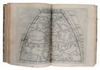
(Atlas Minor) - Atlantis Minoris...
Augsburg, Augustæ Vind, (1744). 4to-oblong. Cont. hcalf. Back and covers somewhat worn. Platesizes ca. 20,5 x 27 cm. (32) pp. and 60 full-page engraved maps (of 64 listed). Lacking the engraved title and 5 other maps (Africa, America septentrionalis, Regum Portugalliæ, Regnum Hispaniæ, Italia totur and Palæstina), but having 2 more not listed and some in the German section does not corresponds with the maps listed in the index. All maps in original handcolouring, occasionally a little brownspotted and traces of use in lower right corners. One map have a little loss of image in lower middle (Austria Saliburgensis).
Phillips No 3494. 2 maps relating to America (Globus Terrestris (World Map) and America Meridionalis). Having maps of Europe, Asia, Russia, Turkey, Scandinavia etc. The World Map engraved by Andr. Silbereisen and most of the other maps engraved by A.C. Seutter and Tobias C. Lotter (married to Seutters daughter and his successor).
Atlas Élémentaire de Geographie ancienne et moderne. Approuvé par le Conseil Royal de l'Université de France. 1.-3. Serie (all).
Paris, J. Andriveau-Goujon, 1841. Folio. Bound in full leather with a closing flap just like a briefcase. Slightly scratched and a few tears to binding. Titlepage with a tear, no loss. Complete with 30 double-page (ca 41x53 cm) full handcoloured engraved maps. A few tears in centerfoldings, very ligh brownspottings, otherwise good.
Philipps No 324 listing an edition from 1838, but not this (second edition ?). This fine engraved atlas comprises 10 historical maps and 20 recent (1841), among these Mappemonde, North-and South America, Asia, Africa, Europe etc.
Chiffres du monde 1989.
Paris, Encyclopaedia Universalis, 1989 ; grand in-8, 542 pp., cartonnage de l'éditeur. Bon état avec sa jaquette - atlas statistique.
Bon état avec sa jaquette - atlas statistique.
Auswahl von 31 Karten aus Stieler's Hand-Atlas über alle Theile der Erde, nach dem neuesten Zustande, und üiber das Weltgebäude. Schul-Ausgabe.
Gotha, Justus Perthes, 1866. Folio. (38x24,5 cm.). Orig. full cloth, blindstamped and with title on front board in gilt lettering. Spine ends worn and a tear to upper part of first hinge. The printed title pasted on inside of front cover from the publisher. (2) pp. and 31 steel-engraved double-page coloured maps. The first, Planeten-System lightly brownspotted, otherwise fine with a few marginal brownspots to margins.
With maps of all the Continents, Europe, The Hemispheres etc.
Handatlas. Auswahl von 31 Karten.
Gotha, Justus Perthes, (Maps dated 1876). Folio.. Orig. full cloth, blindstamped and gilt frontboard. Corners bumped, edges worn, covers with scratches. (2) pp. and 31 steel-engraved double-page coloured maps. Light browning to lower margins of some maps, otherwise clean.
With maps of all the Continents, Europe, The Hemispheres etc.
Stieler's Hand-Atlas. Auswahl von 31 Karten.
Gotha, Justus Perthes, n.d. (1877-78) Folio. Orig. full blindstamped cloth. Frontcover with gilt title. Lower part of spine (ca. 8 cm.) lacks, and top of spine with some wear, otherwise fine. With 31 double-page (37x43,5) steel-engraved maps with outline colouring. All maps clean and fine. Maps dated 1877 a. the last 1878.
Handatlas über alle Theile der Erde und über das Weltgebäude. 95 Karten.
Gotha, Justus Perthes, (1879-80). Folio-oblong. Contemp. hcalf. Gilt spine. Gilt lettering. Spine somewhat worn. Corners bumped. Wear to edges.Bound in front is ""Vorbemerkungen zu Stieler's Hand-Atlas"" 8 pp. Inhalt (2) pp. and 95 (incl. title-page) engraved and coloured maps. Maps dated 1879/1880, some undated. Maps clean and fine, only few minor marginal brownspots.
Handatlas über alle Theile der Erde und über das Weltgebäude.
Gotha, Justus Perthes, (1873-75). Folio-oblong. Contemp. hcalf. Titlelabel with gilt lettering. Spine somewhat worn and frontcover detached from spine. Stamp on title-page.Bound after title-page ""Vorbericht zu Stieler's Hand-Atlas"", 11 pp. Containing 89 engraved maps in outline colouring (incl. title-page, 1-24, 26-90), A faint dampstain to some maps in upper right corners. Some underlining to German cities. Maps dated 1873, 1874 a. 1875 (mosly 1873).
ATLAS SUISSE par Maurice BOREL (cartographe) et H.-A. JACCARD (textes).
Reference : AUB-9478
(1910)
Atlas cantonal, politique et économique de la Suisse. Richement documenté (76 cartes en couleurs, figures dans le texte).
Attinger Frères éditeurs / Administration du Dictionnaire Géographique de la Suisse s.d. (vers 1910). Bel exemplaire relié, reliure demi toile avec coins, in-4 (30x22), IV + 76 pages + cartes.