Write to the booksellers
-
Type
Autograph (3)
Book (23955)
Engraving (8)
Magazine (131)
Maps (19)
Music sheets (41)
Old papers (3)
Photographs (8)
Postcards (3)
Posters (1)
Public sale (1)
-
Latest
Last 24h (18)
Last 3 days (3)
Last month (148)
Last week (21)
-
Language
Czech (1)
Dutch (1)
English (23)
French (24141)
German (3)
Italian (1)
Latin (1)
Spanish (2)
-
Century
15th (1)
16th (9)
17th (80)
18th (526)
19th (4328)
20th (9741)
21st (1172)
-
Countries
Belgium (406)
Canada (40)
Côte d'Ivoire (44)
Denmark (746)
France (21405)
Germany (206)
Greece (4)
Italy (1)
Netherlands (3)
Switzerland (1318)
-
Syndicate
ALAC (40)
CLAM (5)
CLAQ (34)
CNE (17)
ILAB (13825)
NVVA (314)
SLACES (311)
SLAM (12613)
SNCAO (9)
Vers le Pôle.
1897 39 p., 79 figs, roy. 4to, in five disbound but complete issues of the journal l'Illustration. Includes a large portrait of Fridtjof Nansen. Translated in French by C. Rabot & M. Normand.
VERS LE POLE .
Trad.de Ch.Rabot . Sans date (1897) . Flammarion , In 8° relié 1/2 chagrin rouge .Dos à nerfs orné de petits fleurons .Tête dorée . VIII ,424 pp.200 illustrations en noir d'après les dessins et photographies de l'auteur .
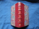
Première édition française .
Vers le Pôle
200 illustrations. 1/2 chagrin bleu-vert à coins, filets dorés mors et coins. Très bon Paris Flammarion s.d. 1 volume in-8°
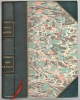
Fram over Polhavet. Den Norske Polarfærd 1893-96. Med et Tillæg af Otto Sverdrup. 2 vols. [PMM 384 - FARTHEST NORTH].
Kristiania, H. Aschehoug & Co.s Forlag 1897. Lex8vo. In two private half calf with richly gilt backs. (14), 526,(10),553 pp. With 53 plates and numerous text illustrations (all).
The original edition. Printing and the Mind of Man No. 384.
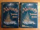
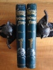
Fridtjof Nansen's Farthest north. Being The Record of a Voyage of Exploration of the Ship Fram 1893-96 and of a fifteen Month's Sleigh Journey By Dr.Nansen And Lieut.Johansen With an appendix By Otto Sverdrup Captain of The Fram about one hundred and twenty full page and numerous text illustrations and coloured palte in facsimile from Dr Nansen's own sketches portrait and maps.
1898 London. George Newnes, LTD. 1898. 2 volumes in 8 en reliure éditeur. toutes tranches dorées. dédicace appartenance sur pages de garde. T1: portrait + xv pp+ 480 pp + gde carte dépl. avec une ill. en couleurs h.t. + 59 ill. h.t. et 51 ill. in texte. T2: viii + 456 pp et 52 ill. h.t. + 39 ill. in texte.deuxième édition mais la première dans ce cartonnage. exemplaire d'une bibliothèque anglaise niçoise. Volume 2 en parfait état sans aucune rousseur. Volume 1 endommagé ( mouillures anciennes sur une partie de la reliure , en tête et fin de volume)
Gjennem Kaukasus til Volga.
Oslo, Dybwad, 1929. Orig. helshirtbd. Perm-og rygforgyldning. En smule slid ved øverste kapitæl. (4),162 pp., 3 kort og 10 plancher med illustrationer. Indvendig ren og frisk.
Originaludgaven.
Gjennem Sibirien.
Kristiania, Jacob Dybwad, 1914. Lex8vo. Samtidigt hldrbd. Rygforgyldning og forgyldt skindtitel. Ryg med lette brugsspor. (12),386 pp., plancher og 3 foldekort.
Originaludgaven.
In nacht en ijs - De noorsche Poolexpeditie 1893-1896, bijdrage van Kap. Sverdrup, bewerkt onder toezicht van Snellen (Dr. M.)
De Nederlandsche Boekhandel, 1896 "16 x 24, 2 vol., 997 pp., 211 figures, 8 planches, 5 cartes, cartonnage, toilé, ill. collée, Etat moyen - année estimée - reliure usagée et souillée; plusieurs tampons de l'ancien propriétaire"
Through Siberia the Land of the Future. Translated by Arthur G. Chater. Illustrated.
London, W. Heinemann, 1914. 4to. Orig. full cloth, rebacked preserving old spine. Covers gilt. Printed title from papercovers (?) pasted on back. XVI,477 pp., numerous plates and maps.
First English edition.
Vers le Pôle
Ernest Flammarion, in-8 rel. 1/2 chag. bleu (15,5 x 23), VII-424 p., 1ère édition française, non daté (c. 1897), mention de dix-huitième mille, traduit et abrégé par Charles Rabot, portrait de l'auteur en front., 200 illustrations in-t. et h.-t. d'après les photographies et les dessins de l'explorateur, reliure d'époque solide un peu frottée aux angles, dos à 5 faux-nerfs et fleurons avec quelques traces d'épidermure, intérieur très propre, couverture conservée, bon état.
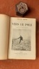
"Parti en 1893, l'explorateur norvégien Fridtjof Nansen (1861-1930) se fait volontairement prendre par les glaces dans la mer de Kara. Mais en seize mois il ne progressera que de 360 miles. Avec son compagnon Johansen, Nansen part alors en traîneau vers le nord et atteint la latitude de 86° 14' le 8 avril 1895 ; personne n'avait encore approché le pôle d'aussi près". Voir le sommaire sur photos jointes.
Vers le Pôle
Ernest Flammarion, Editeur, Paris, s.d. [v.1897]. In-8, broché sous couverture illustrée, 424 pp. Préface - Introduction - I. Le départ. Kabarova. La mer de Kara. Le cap Tchéliouskine. L'entrée dans la banquise - II. Le premier hivernage - III. Le printemps et l'été au milieu de la banquise - IV. Le second automne ...
Traduit et abrégé par Charles Rabot.Avec un frontispice et 200 illustrations d'après les photographies et les dessins de l'explorateur.Mention de quatorzième mille. --- Plus d'informations sur le site archivesdunord.com
Vers le Pôle. Traduite et abrégé par Charles Rabot.
P., Flammarion s.d. (ca 1897).in8 (23x16cm) œ toile orange époque, couverture illustrée conservée (Matot-Braine), VIII, 424pp., 200 illustrations d'après les photographies et les dessins de l'explorateur.
Rappelons que Nansen (1861-1930) fut l'un des plus célèbres explorateurs norvégiens."Sa marche vers le Pôle, sa retraite vers la terre François-Joseph et son hivernage sur cette terre seront rangés parmi les exploits les plus extraordinaires dont l'homme puisse se glorifier" (préface).Bel exemplaire.
Vers le Pôle traduit et abrégé par Charles RABOT
in 8 pleine toile verte à la bradel,titre et filets dorés. Faux-titre, portrait de l’auteur en frontispice,titre, VIII,424 pages non rogné,200 illustrations dans le texte et pleine page d’après les photographies et les dessins de l’explorateur Ernest Flammarion 1897
Vers le Pôle. Traduit et abrégé par Charles Rabot. 100 illustrations d'après les photographies et les dessins de l'explorateur.
1900 P., Flammarion, sans date (vers 1900), in 8° broché, VIII-466 pages ; couverture rempliée illustrée (défraichie, le dos manque entièrement) ; des rousseurs. Exemplaire de travail, débroché, à relier.
...................... Photos sur demande ...................


Phone number : 04 77 32 63 69
Vers Le Pôle. Traduit Et Abrégé Par Charles Rabot. 200 Illustrations D'Après Les Photographies Et Les Dessins De L'Explorateur.
1897 Paris, Ernest Flammarion, s. d., [1897],Gr. in-8, VIII-424 pp., un portrait, carte et illustrations comprises dans la pagination, demi-chagrin à coins, tête dorée, dos lisse orné,trés légèrement frotté,couvertures conservées,
Remise de 20% pour toutes commandes supérieures à 200 €
Norwegischer Polarforscher.
Berlin-Chalottenburg, Adolf Eckstein's Verlag, o.J. Heliogravure (Portrait). Bildgrösse: 26 x 18 cm. Blattgrösse: 46 x 29,7 cm.
[Librairie Hachette et Cie] - NANSEN, Fridtjof ; (RABOT, Charles)
Reference : 71554
(1893)
A travers le Grönland [A travers le Groenland ]
Ouvrage traduit du norvégien par Charles Rabot et contenant 170 gravures et 1 carte en couleurs, 1 vol. in-4 reliure demi-basane rouge, Librairie Hachette et Cie, Paris, 1893, IV395 pp. avec une grande carte dépliante
![A travers le Grönland [A travers le Groenland ]. NANSEN, Fridtjof ; (RABOT, Charles)](https://static.livre-rare-book.com/pictures/CDL/71554_thumb.jpg)
![A travers le Grönland [A travers le Groenland ]. NANSEN, Fridtjof ; (RABOT, Charles)](https://static.livre-rare-book.com/pictures/CDL/71554_2_thumb.jpg)
![A travers le Grönland [A travers le Groenland ]. NANSEN, Fridtjof ; (RABOT, Charles)](https://static.livre-rare-book.com/pictures/CDL/71554_3_thumb.jpg)
Important récit historique de la première traversée du Groenland d'est en ouest par le célèbre explorateur norvégien Fridtjof Nansen en 1888, accompagné de ses 5 compagnons sur des skis et des traîneaux. Etat très satisfaisant (dos frotté en tête avec petite épidermure, coupes lég. frottées, bon exemplaire par ailleurs)
La Robinson des glaces Fridtjof Nansen. Illustrations de Paul Dufresne.
P., Tolra, sans date (vers 1900), grand in 8°, cartonnage de livre de prix de l'éditeur, tête dorée, 218 pages ; traces de manipulation.
Illustrations in et hors-texte. PHOTOS SUR DEMANDE. ...................... Photos sur demande ...................
Phone number : 04 77 32 63 69
A la conquête du Pôle Nord. L'explorateur Norvégien Fridtjof Nansen.
P., Librairie Nationale d'Education et de Récréation, sans date (vers 1910), grand in 8° cartonnage "livre de prix" de l'éditeur, 238 pages.
Illustré de 17 gravures. PHOTOS SUR DEMANDE. ...................... Photos sur demande ...................
Phone number : 04 77 32 63 69
GOUACHE ORIGINALE : "PROJET DÉCORATIF POUR MONSIEUR FRUNEAU - GRAND ESCALIER D'UNE AGENCE DE VOYAGES TRANSPORTS " (1960)
nantes 1960 Une Gouache Originale en couleurs, Format : 65 centimètres de haut par 50 centimètres de large, sur papier noir, signé en bas à droite : G. BATY, sans date (1960), réalisé pour un "PROJET DÉCORATIF POUR MONSIEUR FRUNEAU - GRAND ESCALIER D'UNE AGENCE DE VOYAGES TRANSPORTS " (1960),
SUPERBE ........... UNIQUE ....... en bon état (good condition). trés bon état
Malta.
Boulogne, Editions Delroisse, sans date. In-4°, reliure de l’éditeur, jaquette illustrée.
[15733]
JOSEPH BONARPARTE en Amérique 1815-1832.
Paris, Flammarion, s.d. (vers 1898) ; in-12, 422 pp., br. Broché en bon état - qlq rousseurs.
Broché en bon état - qlq rousseurs.
Voyage de leurs majestés impériales dans le Sud-Est de la France en Corse et en Algérie.
Paris, L'Illustration, 1860. In-folio (28 x 38 cm) demi basane havane, dos lisse, titrage doré émoussé, plats de papier vert amande (un peu salis) illustrés de l'édition Reliure de l'époque (pages de garde un peu froissées).
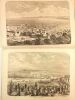
138 gravures d'un tiré à part édité par la revue L'Illustration. Album publié pour célèbrer le rattachement de Nice et de la Savoie à la France. L'impératrice Eugénie se rendant sur la Mer de Glace à dos d'âne orne le dos de la publication. Première édition, illustrée de nombreuses gravures sur bois. Tiré à part des articles parus dans l'Illustration. Bel exemplaire de cet album qui contient le récit illustré de l'excursion de Napoléon III et de l'Impératrice Eugénie.Document de propagande exceptionnel.
Description de l'Égypte ou Recueil des observations et des recherches qui ont été faites en Égypte pendant l'expédition de l'Armée française. Seconde édition, dédiée au roi, publiée par C. L. F. Panckoucke
TEXTE Paris, Panckoucke, 1820-1829. 24 tomes en 26 vol. de texte , in-8 Manquent : T 1-6-10-14-18 (3ème part) et 19 Un des monuments de l'Imprimerie Française et de l'archéologie mondiale, réalisé sous la direction de Vivant Denon et l'impulsion de Kléber après la Campagne d'Égypte. Broché. ATLAS Paris, Panckoucke, 1820-1829. 11 volumes IN PLANO, demi-basane havane ép., dos lisses ornés. Reliures usées, frottés. Qqs rousseurs par endroits. Ces 11 volumes d'atlas renferment au total 848 planches réparties : ANTIQUITÉS: 5 Volumes ,tome I, 91 planches; tome II, 85 planches ; tome III, 55 planches ; tome IV, 62 planches ; tome V, 82 planches + 16 planches pour la pierre de Rosette (2 par feuille) + 2 planches non numérotées. ÉTAT MODERNE : 2 volumes , 96 planches en numérotation continue + 31 planches + 11 planches (A-K) + 13 planches (AA-NN, pas de planche JJ) + 10 planches (a-k, pas de planche j). GÉOGRAPHIE : 1 volume : tableau d'assemblage, alphabet puis 47 planches (cartes sur double page) HISTOIRE NATURELLE : 3 volumes : tome I, 62 planches ,tome II, 105 planches ,tome II bis, tableau général des planches (volant en format plus petit) + 62 planches + 15 planches.
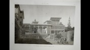
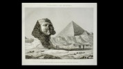
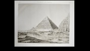
Seconde édition, dédiée à Charles X, qui avait donné l'autorisation le 23 juin 1820 au grand libraire et imprimeur parisien Charles-Louis-Fleury Panckoucke (1780-1844) de procéder à la réimpression de la Description de l Égypte. Il fit donc imprimer une seconde édition, elle aussi à mille exemplaires, en 26 volumes de texte en format plus petit (in-8°) que pour la première et 11 volumes de planches au format grand-atlas, imprimées à partir des cuivres originaux, retouchés pour certains à l'occasion de ce nouveau tirage. Cette seconde édition finança en partie la première édition impériale dont plus de la moitié du tirage était réservée aux exemplaires de présent. La Description de l'Égypte est le résultat de la collaboration des savants, artistes et techniciens qui suivirent Bonaparte en Égypte. C'est l'ouvrage le plus monumental jamais consacré à un peuple. Monge et Denon en furent les maîtres d' œuvre. La quantité et la précision des informations fournies surpassaient tous les travaux qui avaient pu être publiés avant l'expédition (récits et dessins de voyageurs, ouvrages). Les monuments étaient relevés et décrits avec un souci de précision remarquable. Même les inscriptions dont on n'avait pas encore percé le mystère furent reproduites avec une grande fidélité. La Description de l'Égypte constitue encore de nos jours une source documentaire de premier ordre: nombre d'édifices représentés sur ces planches furent entièrement détruits par la suite.
L'Afghanistan, ou description géographique du pays théâtre de la guerre, accompagnée de détails sur les tribus de ces contrées, leurs moeurs, leurs usages, etc., etc., par N. Perrin, ancien élève de l'Ecole royale des Langues orientales, collaborateur des Annales des voyages
Arthus Bertrand | Paris 1842 | 14 x 22.5 cm | broché
Rare édition originale de cette importante description géographique et ethnographique, destinée à faciliter la compréhension du conflit opposant les Afghâns aux Anglais, ces derniers souhaitant protéger leurs frontières indiennes de la menace représentée par l'empire russe (cf Bourquelot V, 637) Notre exemplaire est bien complet de sa carte dépliante en fin de volume : "Carte pour l'intelligence des voyages d'Alexandre Burnes". Dos bruni et comportant de petits manques, plats marginalement salis, manque de papier en angle inférieur gauche de la page de faux-titre, quelques rousseurs. L'auteur a pris pour guide l'ouvrage de Elphinstone, dont la seconde édition avait paru en 1838, et les relations de Burnes, Forster et Masson. - Photographies et détails sur www.Edition-Originale.com -