 Write to the booksellers
(Plan de Londres).
Vest Pocket Street Plan of Central London...
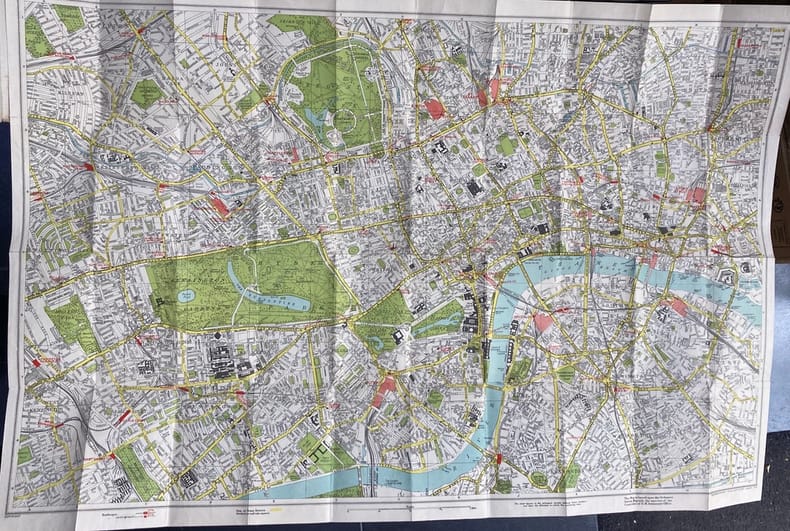
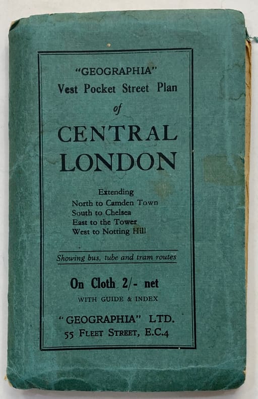
1900 [Londres]. « Geographia » LTD. (vers 1900). 1 carte dépliante (700 x 500 mm), sous couverture éditeur de papier bleu imprimé.
Reference : 41598
Carte de poche dépliante en anglais, du centre de Londres à l'échelle 1x14000, précisant le trajet des bus, métros et trams. La carte, colorée, est contrecollée sur toile. Précédée d'un fascicule touristique de 15 pp. ; [1] p., intitulé « Guide to Places of Interest ».Couverture usée. Notes à l'encre au 1er contre-plat. 1 petite croix a été tracée à l'encre rouge à l'angle de New Bond Street et de Conduit Street.
Bookseller's contact details
Librairie Pierre Prévost
M. Pierre Prévost
75, rue Michel-Ange
75016 Paris
France
01 40 56 97 98
Payment mode


Sale conditions
Conditions de vente conformes aux usages de la profession. Les prix sont nets, en Euros, port en sus. Emballage gratuit.