‎Serres Michel‎
‎Atlas‎

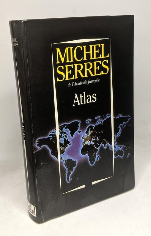
‎Le club 1994 in8. 1994. Broché.‎

Reference : 100121161


‎comme neuf‎

€5.00 (€5.00 )
Bookseller's contact details

Un Autre Monde
M. Emmanuel Arnaiz

contact@crealivres.com

07.69.73.87.31

Contact bookseller

Payment mode
Cheque
Transfer
Others
Sale conditions

Conformes aux usages de la librairie ancienne.

Contact bookseller about this book

Enter these characters to validate your form.
*
Send

5 book(s) with the same title

‎[ATLAS COMPOSITE/COMPOSITE ATLAS] FER (Nicolas de).‎

Reference : 4155

(1728)

‎Atlas itineraires de France dItalie et des Pays Bas.‎

‎Paris, de Beaurain Geographe du Roy, 1728. 1728 1 vol. in-4° (273 x 250 mm) de : 1 titre manuscrit avec lettres caligraphiées en rouge, bleu et or dans un encadrement de frises ; [188] ff. (dont 50 ff. de texte sur double page, 5 ff. de texte sur page simple, 133 cartes et planches sur double page dont 13 dépliantes). (Corps d'ouvrage très frais). Plein maroquin brun d'époque, dos à nerfs orné, triple encadrement de filets dorés sur les plats avec fleurons angulaires, roulette dorée sur les coupes, dentelles intérieures tranches dorées.‎


‎Bel atlas composite, très bien relié, composé dun titre manuscrit, de 35 cartes, 65 plans, 31 vues et 52 feuillets de texte gravés, la plupart sur double page, monté sur onglets (17 dépliants), dont 41 sont entièrement coloriés à la main, 40 et 33 partiellement. Nicolas de Fer fut un cartographe français très prolifique, actif du début des années 1690 jusqu'à sa mort en 1720. LAtlas est consacré à la France, à l'Italie et aux Pays-Bas. Il comporte 107 cartes ou vues de de Fer, 15 par Jean Baptiste Nolin (1657-1708) graveur et éditeur français ou son fils (1686-1762) du même nom. 1 vol. 4to (273 x 250 mm) of: 1 handwritten title with caligraphed letters in red, blue and gold in a frieze frame; [188] ff. (including 50 pages of text on double page, 5 pages of text on single page, 133 maps and plates on double page including 13 foldouts). (Very fresh body of work). Full period brown morocco, decorated ribbed spine, triple framing of gilt fillets on the boards with angular fleurons, gilt roulette on the cuts, interior lace on the gilt edges. Beautiful composite atlas, nicely bound, composed of a manuscript title, 35 maps, 65 plans, 31 views and 52 engraved sheets of text, mostly on double page, mounted (17 fold.), of which 41 are entirely colored by hand, 40 and 33 partially. Nicolas de Fer was a very prolific French cartographer, active from the early 1690s until his death in 1720. The Atlas is devoted to France, Italy and the Netherlands. It contains 107 maps or views of de Fer, 15 by Jean Baptiste Nolin (1657-1708) French engraver and publisher or his son (1686-1762) of the same name.‎

J-F Letenneur Livres Rares - Saint Briac sur Mer
Logo SLAM Logo ILAB

Phone number : 06 81 35 73 35

EUR9,500.00 (€9,500.00 )

‎Mateo Kries Jochen Eisenbrand Co-auteur: R egg, Arthur Pavitt, Jane Thau, Carsten M cel, Otakar Tegethoff, Wolf B scher, Henrike Ferrari, Fulvio de Roode, Ingeborg Sudjic, Deyan Et Al‎

Reference : 53182

‎Atlas of Furniture Design; The new encyclopedic publication on 200 years of furniture design‎

‎, Vitra Design Museum, 2018 Hardcover 1018 pages, 310 x 235 mm, Illustrated. ISBN 9783931936990.‎


‎the Vitra Design Museum publishes the Atlas of Furniture Design , a new comprehensive overview on the history of modern furniture design. With more than 1,000 pages, the Atlas is the most extensive book ever to be published on the topic. It documents 1,740 objects by over 540 designers, and features more than 2,800 illustrations, from object photographs to design sketches and interiors as well as patents, brochures, art, architecture, and portraits of the designers. The Vitra Design Museum collection, which counts among the world?s largest of its kind with upwards of 20,000 objects, including over 7,000 pieces of furniture, serves as the basis for Atlas of Furniture Design . The publication includes works by the most significant designers of the past 230 years and documents all important stages of design history. This includes 19th century furniture made out of bentwood and metal, Art Nouveau and Secession style designs, iconic designs by protagonists of modernism such as Le Corbusier, Gerrit Rietveld, Charlotte Perriand, Marcel Breuer, and Eileen Gray, but also post-war, post-modern, and contemporary furniture by designers such as Charles and Ray Eames, Eero Saarinen, Gae Aulenti, Finn Juhl, Ettore Sottsass, Philippe Starck, Hella Jongerius, Jasper Morrison, and Konstantin Grcic. The Atlas of Furniture Design is the product of over 20 years of research at the Vitra Design Museum and was compiled by a team of more than 70 authors. It contains comprehensive essays on the socio-cultural and design-historical contexts of furniture design, over 550 detailed texts on pioneering objects, and numerous information graphics that provide new visual insights into the history of furniture design. Furthermore, the book contains a complete appendix that includes designer biographies, bibliographies, a glossary of producers and materials, as well as a keyword index. These features make this publication an encyclopedic reference guide and indispensable resource for collectors, scholars, and experts, and without a doubt a book to be treasured by design lovers all over the world. The Atlas of Furniture Design is a treasure trove that offers not only definitive information about beloved staples of design history, but also new, fresh and often unexpected perspectives, all presented in a generous format that captures the breadth and depth of this important subject. Paola Antonelli, Senior Curator of Architecture and Design, The Museum of Modern Art Mateo Kries, director of the Vitra Design Museum and co-editor of the publication, explains: The Atlas paints a portrait of our entire collection while simultaneously providing an unprecedented overview of the history of modern furniture. The publication is set up to provide a new comprehensive outline for scholars of furniture design by considering the latest academic research, questioning extant knowledge, and giving top experts a platform to share their ideas. The book touches on a range of subjects spanning the beginnings of industrialization to digitalization, which is becoming increasingly influential in contemporary furniture design. Whether as a selection of iconic designs or as a history of styles, a chronicle of evolution or of revolution, a history of objects or of images, or a narrative of domestic habits or of individual designers, this book can be read in a vast range of ways. But the Atlas of Furniture Design can also be enjoyed by readers who prefer to dispense with complex theories and just want to concentrate on each single object. ‎

ERIK TONEN BOOKS - Antwerpen

Phone number : 0032495253566

EUR159.00 (€159.00 )

‎WYSS, J. Rud. (Johann Rudolph):‎

Reference : 141572aaf

‎Reise in das Berner Oberland. 2 Bde + 1 Bd. Hand Atlas für Reisende in das Berner Oberland. Zus. 3 Bde.‎

‎Bern, J.J. Burgdorfer, 1816 / 1817, in-8vo, XII + 404 S. + 1 Bl. (Verbesserungen) / 1 Bl. + VII + 1 S. Verbesserungen, S. 405-914 + 2 Bl. Anzeigen. mit 2 gest. Titelbl. mit je einer Vignette von Lory und 4 ganzseitig gestochenen Ansichten von Hegi nach Lory / Atlasband mit 84 S., 3 (2 mehrfach gefalteten) Panoramen, 5 Karten, 1 Tabelle und 1 gestochenen Tafel (Stellungen Oberländischer Schwinger), Exlibris-Stempel Dr. Hermann Fietz-Frey / Exlibris von Peter E. Obergfell. Band 1 und 2 sind neu und sauber in dezentem grünem Leinen gebunden wovon die ursprünglichen broschierter Einband Vorder- und Rückseite konserviert und auf den Leinen-Bänden montiert wurde. Der Hand Atlas ist in modernen grünen Halb-Leinen gebunden.‎


‎Erste Ausgabe. Sehr sauberes und frisches Exemplar. Die 4 Abbildungen zeigen die Beatushöhle / Schmadribach / Petronelle-Balm und oberster Fall des Reichenbach’s. Zus. mit dem sehr seltenen «Atlas», speziell verfasst als handlichem Reisewerk, mit Reiseplänen und Reiseregeln. Die meist von J.J. Scheurmann nach Stäheli gestochenen Bildtafeln im Atlas zeigen 5 (3 gefaltete) Karten, davon 2 zweifarbig (Gletscherkolorierung), 1 Tafel mit 6 Stellungen Oberländischer Schwinger, 1 Höhentafel und 3 (davon 2 gefaltete) Panoramen (Aussicht vom Hohbühl bey Interlachen" und "Aussicht vom Faulhorn ins höchste Gebirg des Berner-Oberlandes.).Fine complete copy of the first edition. With the rare ‘Atlas’ volume. All 3 volumes clean and fresh. Perret 4616 (connaît l'atlas seulement avec texte en français); Vgl. Goed. VI, 495, 12; Lonchamp 3324 und 3329; Mandach 104-110; BSL III/134.; Wäber 134; Perret - Regards sur les Alpes, page 123. Notice 37. Image disp.‎

Logo ILAB
(SLACES, NVVA)

Phone number : 41 (0)26 3223808

CHF1,200.00 (€1,286.24 )

‎THIERS, Adolphe (1797-1877):‎

Reference : 71051aaf

‎Histoire du Consulat et de l'Empire faisant suite à l'histoire de la Révolution française. 20 tomes + Atlas de l'histoire du Consulat et de l'Empire, dressé et dessiné sous la direction de M. Thiers par MM. Dufour et Duvotenay, gravé sur acier par Dyonnet. Ensemble 21 volumes. ‎

‎Paris, Paulin-Lheureux, 1845-62, atlas (1866), in-8vo, atlas in-folio, chaque volume env. 500 p., l'atlas comprend 66 cartes dont 7 sur double-page montées sur onglets (deux coloriées), non paginé, toutes les cartes en excellent état + 2 cartes ajoutées: une carte du Nord de l'Italie pour l'étude de la campagne de Napoléon III en1859 par le colonel Suisse F. Lecomte et une carte en fac-similé de la ville de Paris en 1576, reliures en pleine percaline verte, dos et plats estampés de filets à froid, quelques frottements et usures. Atlas in-folio relié en demi-chagrin, dos à nerfs orné de filets dorés, Généralement bel ensemble.‎


‎Tome 1. 494 pages. Constitution de l'An VIII, Administration intérieure, Ulm et Gènes, Marengo. Tome 2. 456 pages. Héliopolis, Armistice, Hohenlinden, Machine infernale, Les neutres. Tome 3. 570 pages. Evacuation de l'Egypte, Paix générale, Concordat, Tribunat, Consulat à vie. Tome 4. 620 pages. Les sécularisations, Rupture paix d'Amiens, Camp de Boulogne, Conspiration de Georges. Tome 5. 473 pages. L'Empire, Le sacre, troisième coalition. Tome 6. 573 pages. Ulm et Trafalgar, Austerlitz, Confédération du Rhin. Tome 7. 684 pages. Iéna, Eylau, Friedland et Tilsit. Tome 8. 687 pages. Fontainebleau, Aranjuez, Bayonne. Tome 9. 596 pages. Baylen, Erfurt, Somo-Sierra. Tome 10. 511 pages. Ratisbonne, Wagram. Tome 11. 476 pages. Talavera et Walcheren, le divorce. Tome 12. 709 pages. Avertissement de l'auteur, Blocus continental, Torrès-Védras, Fuentès d'Onoro. Tome 13. 583 pages. Le Concile, Tarragone, Passage du Niémen. Tome 14. 686 pages. Moscou, La Bérézina. Tome 15. 614 pages. Washington et Salamanque, Les cohortes, Lutzen et Bautzen. Tome 16. 693 pages. Dresde et Vittoria, Leipzig et Hanau. Tome 17. 911 pages. L'invasion, Brienne et Montmirail, Première abdication, Conclusion. Tome 18. 656 pages. Restauration des Bourbons, Gouvernement de Louis XVIII, Congrès de Vienne. Tome 19. 637 pages. L'Ile D'Elbe, L'Acte additionnel, Le Champ de Mai. Tome 20. 810 pages. Waterloo, Seconde abdication, Sainte-Hélène. Atlas de la Révolution, du Consulat et de l'Empire. Image disp.‎

Logo ILAB
(SLACES, NVVA)

Phone number : 41 (0)26 3223808

CHF550.00 (€589.53 )

‎Blaeu Atlas Schweiz; WAGNER, Robert- ‎

Reference : 134368aaf

‎Schweizer Städte- und Landschaftsbilder in illuminierten Kupferstichen des 17. Jahrhunderts. 35 Ansichten u. 8 Kartenblätter; mit einem wissenschaftlichen Kommentar von Robert Wagner. (= Atlas Blaeu-van der Hem des Prinzen Eugen von Savoyen-. Band 1). FAKSIMILE.‎

‎Graz, Akademische Druck- u. Verlagsanstalt, 1979, Gross-Folio, (ca. 60x40 cm), 67 S. (+1) + 48 Tafeln, davon 43 illuminierten Tafeln (nach Orig. kol. Kupferstiche mit Ansichten, Städten und Landkarten (8) der Schweiz), Weisser Ledereinband mit reicher Goldprägung. Einband identisch mit dem Original-Blaeu-Atlas des Prinzen Eugen v. Savoyen. (Wenige Kratzspuren u. Fleckchen). ‎


‎Eines von 1000 numm. Ex. N° 297 - Prachtvolle Faksimile-Reproduktionen im Originalformat der 43 die Schweiz betreffenden illuminierten Kupferstiche. Illuminiert von Dirck Jansz. van Santen. Kartenblätter u. Ansichten aus dem Atlas des Prinzen Eugen von Savoyen der Österreichischen Nationalbibliothek (Im Korpus sämtlicher Bände ist dies Band 13). Imposantes Faksimile der Blaeu Atlas - van der Hem. Band I: Helvetia quae est Europae liber XV. Mit Einleitung und Wiss.-Kommentar v. Robert Wagner (seiner Geschichte und mit bibliographischen Literaturangaben). bild‎

Logo ILAB
(SLACES, NVVA)

Phone number : 41 (0)26 3223808

CHF750.00 (€803.90 )
Get it on Google Play Get it on AppStore
The item was added to your cart
You have just added :

-

There are/is 0 item(s) in your cart.
Total : €0.00
(without shipping fees)
What can I do with a user account ?

What can I do with a user account ?

  • All your searches are memorised in your history which allows you to find and redo anterior searches.
  • You may manage a list of your favourite, regular searches.
  • Your preferences (language, search parameters, etc.) are memorised.
  • You may send your search results on your e-mail address without having to fill in each time you need it.
  • Get in touch with booksellers, order books and see previous orders.
  • Publish Events related to books.

And much more that you will discover browsing Livre Rare Book !