 Write to the booksellers
ARDAGH JOHN
ATLAS DE LA FRANCE
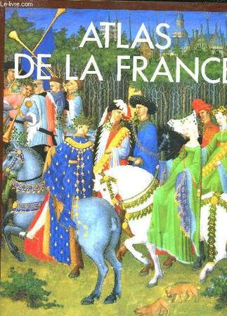
EDITIONS DU FANAL. 1992. In-4. Relié. Bon état, Couv. convenable, Dos satisfaisant, Intérieur frais. 240 pages. Nombreuses illustrations en noir et blanc et en couleurs dans le texte et hors texte.. Avec Jaquette. . . Classification Dewey : 912-Atlas, cartes et plans
Reference : RO30057075
ISBN : 2734406241
Avec la collaboration de Colin Jones. Traduit par Luc Boussard, Christiane Duval et Bernadette Saurel. Sommaire : le contexte géographique, Histoire de France, La France de nos jours, Portrait de la France régionale. Classification Dewey : 912-Atlas, cartes et plans
Bookseller's contact details
Le-livre.fr / Le Village du Livre
ZI de Laubardemont
33910 Sablons
France
05 57 411 411
Payment mode


Sale conditions
Les ouvrages sont expédiés à réception du règlement, les cartes bleues, chèques , virements bancaires et mandats cash sont acceptés. Les frais de port pour la France métropolitaine sont forfaitaire : 6 euros pour le premier livre , 2 euros par livre supplémentaire , à partir de 49.50 euros les frais d'envoi sont de 8€ pour le premier livre et 2€ par livre supplémentaire . Pour le reste du monde, un forfait, selon le nombre d'ouvrages commandés sera appliqué. Tous nos envois sont effectués en courrier ou Colissimo suivi quotidiennement.
5 book(s) with the same title
Atlas itineraires de France dItalie et des Pays Bas.
Paris, de Beaurain Geographe du Roy, 1728. 1728 1 vol. in-4° (273 x 250 mm) de : 1 titre manuscrit avec lettres caligraphiées en rouge, bleu et or dans un encadrement de frises ; [188] ff. (dont 50 ff. de texte sur double page, 5 ff. de texte sur page simple, 133 cartes et planches sur double page dont 13 dépliantes). (Corps d'ouvrage très frais). Plein maroquin brun d'époque, dos à nerfs orné, triple encadrement de filets dorés sur les plats avec fleurons angulaires, roulette dorée sur les coupes, dentelles intérieures tranches dorées.
Bel atlas composite, très bien relié, composé dun titre manuscrit, de 35 cartes, 65 plans, 31 vues et 52 feuillets de texte gravés, la plupart sur double page, monté sur onglets (17 dépliants), dont 41 sont entièrement coloriés à la main, 40 et 33 partiellement. Nicolas de Fer fut un cartographe français très prolifique, actif du début des années 1690 jusqu'à sa mort en 1720. LAtlas est consacré à la France, à l'Italie et aux Pays-Bas. Il comporte 107 cartes ou vues de de Fer, 15 par Jean Baptiste Nolin (1657-1708) graveur et éditeur français ou son fils (1686-1762) du même nom. 1 vol. 4to (273 x 250 mm) of: 1 handwritten title with caligraphed letters in red, blue and gold in a frieze frame; [188] ff. (including 50 pages of text on double page, 5 pages of text on single page, 133 maps and plates on double page including 13 foldouts). (Very fresh body of work). Full period brown morocco, decorated ribbed spine, triple framing of gilt fillets on the boards with angular fleurons, gilt roulette on the cuts, interior lace on the gilt edges. Beautiful composite atlas, nicely bound, composed of a manuscript title, 35 maps, 65 plans, 31 views and 52 engraved sheets of text, mostly on double page, mounted (17 fold.), of which 41 are entirely colored by hand, 40 and 33 partially. Nicolas de Fer was a very prolific French cartographer, active from the early 1690s until his death in 1720. The Atlas is devoted to France, Italy and the Netherlands. It contains 107 maps or views of de Fer, 15 by Jean Baptiste Nolin (1657-1708) French engraver and publisher or his son (1686-1762) of the same name.
Phone number : 06 81 35 73 35
Geographiae Blauianae volumen septimum, quo liber XIV,XV, Europae continentur. (France and Switzerland). - [BLAEU'S ATLAS MAJOR ON FRANCE AND SWITZERLAND]
Amsterdam, Labore & Sumptibus - Johannis Blaeu, 1662. Large folio (350 x 545 mm). In publisher’s full vellum binding with central gilt arabesque and armillary sphere. All edges gilt. Boards with stains and marks. Outer margin on back board with waterstain. Small stamp on front free end-paper, lower part of title-page and lower part of frontiespiece (The Royal Danish Geographical Society). Occassional light brownpostting throughout. Approximately 50 leaves with waterstain in outer margin, primarily affecting last part. (4), 256, (2), 78, (2) + 70 engraved maps. Complete, corresponds to Koemann Bl 56, 220.
First edition of volume seven, containing France and Switzerland, of Blaeu’s monumental Atlas Major, one of the most significant works of the 17th century widely considered to be one of the greatest atlases ever produced. It was the most expensive book that could be acquired in the mid-17th century. The Atlas Major was a significant achievement in the history of cartography and it represented a major step forward in the development of the modern atlas. Most of the present maps were issued in previous editions of Blaeu’s atlases from the 1630s onwards, and derive variously from Maurice Bouguereau’s Le Théatre Francoys (1594), Jean le Clerc’s Le Théatre géographique du Royaume de France (1619), as well as from other maps by Hondius and Janssonius. ""There are a small number of newer maps of France, some of which derived from the Geographer to the King of France, Pierre Du Val. The six maps of Switzerland in the atlas had been in print for several decades: four of them were copied from Mercator’s 1585 Galliae Tabulae geographicae."" (National Library of Scotland). The Atlas Major was notable for its high level of accuracy and detail. The maps were based on the latest geographical knowledge and featured state-of-the-art cartographic techniques, such as the use of latitudinal and longitudinal coordinates, and a sophisticated system of map projection. The maps were also notable for their beautiful engravings and illustrations, which were produced by some of the most talented artists of the time. The Atlas Maior was a major commercial success and it was widely used by scholars, navigators, and government officials. It was translated into several languages, and it became the standard reference work for cartography and geography during the 17th century. Atlas Major was subsequently published with French, Dutch, German, and Spanish texts. Koemann Bl 56, 220.
Precis elementaire et methodique de la nouvelle geographie de la France suivi d'une table alphabetique ...... pour servir de developpement a l'atlas national portatif de la France ... - et - Atlas national portatif de la France, destine a l'instruction publique , compose de 93 cartes et d'un precis methodique et elementaire de la nouvelle geographie du Royaume dedie et presente a l'assemblee nationale par les auteurs de l'atlas national de France
Paris au bureau de l'atlas national, rue de la Harpe 26, 1792. Les deux ouvrages sont relies dans la meme demi-reliure cuir vert. Format a l'italienne 19,50x26 cm, le papier du tome 2 est bleute, les cartes sont rehaussees a la main, de couleurs et in fine 3 sont depliantes. Les 3 cartes depliantes sont: "Partie de planisphere terrestre comprenant toutes les isles et colonies francoises", "Cartes particulieres des isles francoises en Amerique et aux Indes" et "Plan de la ville et environs de Pondichery".La reliure est dans un etat d'usage, l'interieur est frais. Quelques marques d'usage.Bon etat.
Chanlaire, Pierre Grégoire (1758-1817) et Dumez. Cartographes. Voir pour une edition precedente la Notice n° : FRBNF30375129"Titre illustré - Le "Précis" possède sa page de titre particulière, qui porte : "Précis élémentaire et méthodique de la nouvelle géographie de la France, suivi d'une table alphabétique des chefs-lieux de cantons, indicative des districts et départemens auxquels ils appartiennent; pour servir de développement à l'Atlas national portatif de la France...", avec même adresse et même date que le titre général". La fiche BN indique- 1ere edition 1791 et seconde 1793.
Atlas de la France rurale - Cahiers de la fondation nationale des sciences politiques - Atlas (a)
Presses de la fondation nationale des Sciences Politiques. 1968. In-Folio. Relié. Etat d'usage, Couv. légèrement passée, Dos abîmé, Intérieur frais. 176 pages - nombreuses cartes en noir et blanc hors texte. Plats tachés. Mors fendus.. . . A l'italienne. Classification Dewey : 912-Atlas, cartes et plans
Classification Dewey : 912-Atlas, cartes et plans
ATLAS DU 21e SIECLE. ATLAS NATHAN. LA FRANCE. L EUROPE. LE MONDE. 640 CARTES THEMATIQUES - PHYSIQUES - HISTORIQUES - POLITIQUES. DOSSIER SUR LE DEVELOPPEMENT DURABLE. EDITION 2006
NATHAN. 2005. In-4. Relié. Bon état, Couv. convenable, Dos satisfaisant, Intérieur frais. 207 pages augmentées de nombreuses photos et cartes en couleurs hors texte. Coins en haut très légèrement pliés.. . . . Classification Dewey : 912-Atlas, cartes et plans
Classification Dewey : 912-Atlas, cartes et plans