 Write to the booksellers
[HISTOIRE] - COLLECTIF
Carte routière pour Cyclistes et Automobiles du Nord-Est de la France. N° 2.
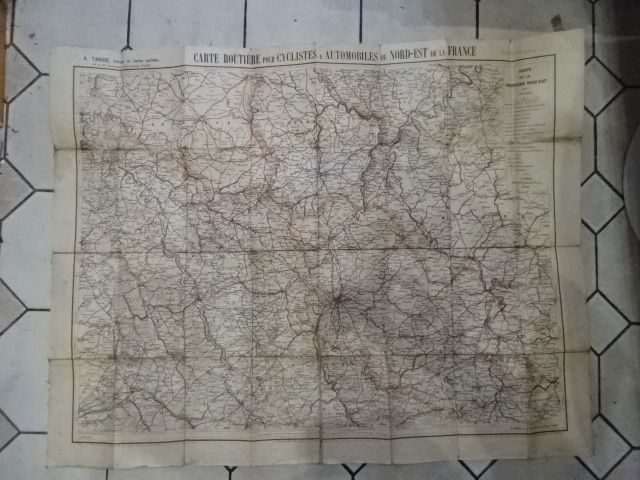
Paris, A. Taride, éditeur de Cartes cyclistes, s.d. (vers 1880) ; format plié: 117 x 118 mm, format déplié: 895 x 700 mm, carte pliée, montée sur toile (7 plis en largeur sur 3 plis en hauteur). Carte principalement du département de la Meurthe-et-Moselle, avec la zone annexée Lothringen du Reichsland. En frontière avec la Belgique, avec le Luxembourg (Gd. Duché), et la Principauté de Birkenfeld (Oldenbourg). Dressée avec le concours du personnel consulaire de l'Union Vélocipédique de France. Carte en couleurs (échelle au 1/250.000) gravée par P. Bineteau, delt.
Reference : _202100754
€20.00
Bookseller's contact details
Librairie Alphabets
M. Philippe Henry
06 87 32 55 92
Payment mode

Cheque
Transfer
Others
Sale conditions
Conforme à la vente par correspondance.