 Write to the booksellers
COMTE DE FERRARIS.
De Grote Atlas van Ferraris / Le Grand Atlas de Ferraris.
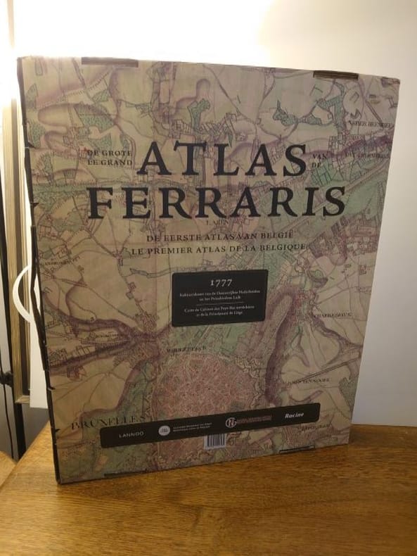
Lannoo, 2017. 66 x 53 cm, 608 pp. Un volume relié cartonnage d'éditeur sous jaquette illustrée. Ouvrage à l'état de neuf sous étui valise, encore sous blister sous son emballage d'origine. Le Comte de Ferraris fournit à l'empereur Joseph II 275 découpes de cartes dessinées et coloriées à la main. Ensemble, elles forment la Carte de Cabinet des Pays-Bas autrichiens et de la Principauté de Liège - autrement dit, la Belgique actuelle. Jamais encore un pays d'Europe de l'Ouest n'avait été mis sur carte à une échelle aussi détaillée et avec autant de finesse et de précision. ATTENTION PRÉVOIR DES FRAIS DE PORT SUPPLÉMENTAIRES.
Reference : 7309
Bookseller's contact details
Librairie L'Abac
M. Gilles Wolles
176-176A rue Blaes
1000 Bruxelles
Belgium
+3225025322
Payment mode
Sale conditions
Les oeuvres et ouvrages décrits sont complets et en bon état, sauf indication contraire. Nos conditions de vente sont conformes aux usages de la Chambre professionnelle belge de la Librairie Ancienne et Moderne (CLAM) et aux règlements de la Ligue Internationale de la Librairie Ancienne (LILA). Pour les expéditions, nous proposons un tarif écionomique par Mondial Relay pour les pays disponibles (France, Allemagne, Luxembourg, Pays-bas, Autriche, Espagne, Italie, Postugal); pour la Belgique par BPost sauf pour les livres au-dessus de 500,00€ (via DHL). De manière générale, les expéditions sont réalisées par DHL avec suivi aux risuqes de l'acquéreur, part à la charge de celui-ci. Prijzen zijn netto, in euro (€). Alle kunstvoorwerpen en boeken bevinden zich in goede staat, tenzij anders vermeld. Onze verkoopsvoorwaarden zijn in overeenstemming met de bepalingen van de Belgische Beroepskamer van Antiquaren (BBA) en de reglementen van de International League of Antiquarian Booksellers (ILAB). Voor verzending bieden wij een voordelig tarief van Mondial Relay voor beschikbare landen (Frankrijk, Duitsland, Luxemburg, Nederland, Oostenrijk, Spanje, Italië, Postugal); voor België via BPost behalve voor boeken boven € 500,00 (via DHL). Over het algemeen worden verzendingen uitgevoerd door DHL met tracking op risico van de koper, op kosten van de koper. Prices are net, in euro (€). All items or books are complete and in good condition, except opposite indication. Our terms of sale are in accordance with the practices of the Chambre professionnelle belge de la Librairie Ancienne et Moderne (CLAM) and with the rules of the International League of Antiquarian Booksellers (ILAB). For shipping, we offer an economical rate by Mondial Relay for available countries (France, Germany, Luxembourg, Netherlands, Austria, Spain, Italy, Postugal) ; for Belgium by BPost except for books above €500.00 (via DHL). Generally speaking, shipments are made by DHL with tracking at the buyer's risk, at the buyer's expense.
1 book(s) with the same title
De grote atlas van Ferraris. De eerste atlas van België. Kabinetskaart van de Oostenrijkse Nederlanden en het Prinsbisdom Luik 1777. Le grand atlas de Ferraris. Le premier atlas de la Belgique. Carte de Cabinet des Pays-Bas autrichiens et de la Principauté de Liège 1777 ( facsimile ) .
.: 10. Lannoo, Tielt ( in cooperation with the Royal Belgian Library ,the National Cartographical Institute, éditions Racine ), 2007, large in-folio ( 51 x 41 cm). Facsimile edition of the 275 maps, with a 16 pp bi-lingual commentary ( French-Dutch). Bound in an illustrated publisher's cased binding. Kept in an illustrated cardboard box with a handle. Box with minimal traces of use, upper inner joint on the point of splitting. Full size facsimile edition of the first detailed atlas of the Southern Netherlands ( the actual Belgium). The maps were made on the very large scale of 1/20.000. This scale would later be adopted by many cartographers for their ordnance survey maps. In 1777 it was a revolutionary concept. ISBN 9789020981384. (Due to larger/size weight of this book, additional shipping charges may apply depending on customer location.).