 Write to the booksellers
NIEBUHR, CARSTEN.
Reisebeschreibung nach Arabien und andern umliegenden Ländern. 2 vols. - [ON OF THE MOST IMPORTANT TRAVEL ACCOUNTS OF ARABIA]
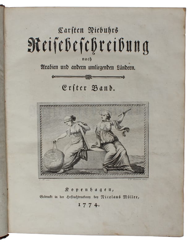
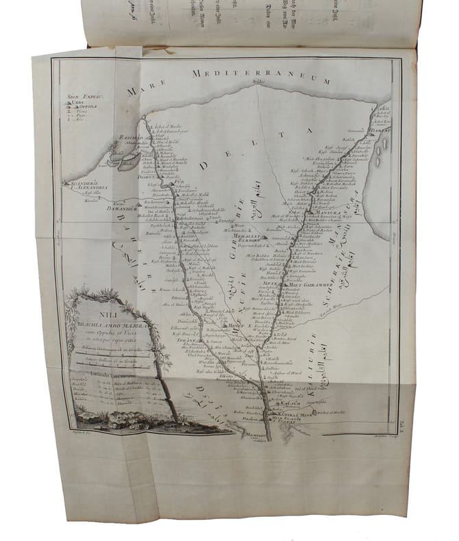
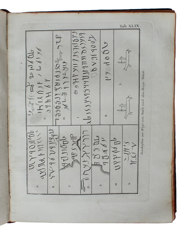
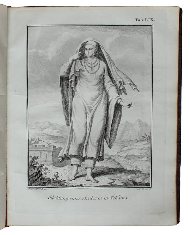
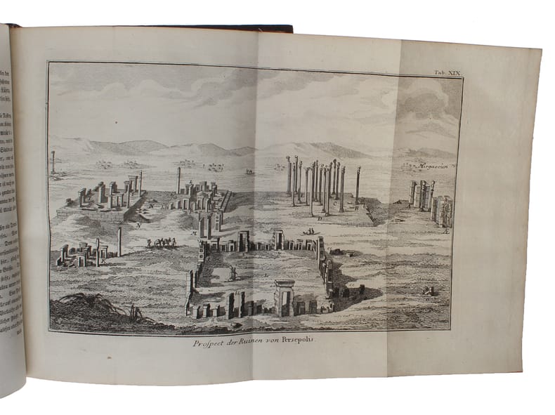
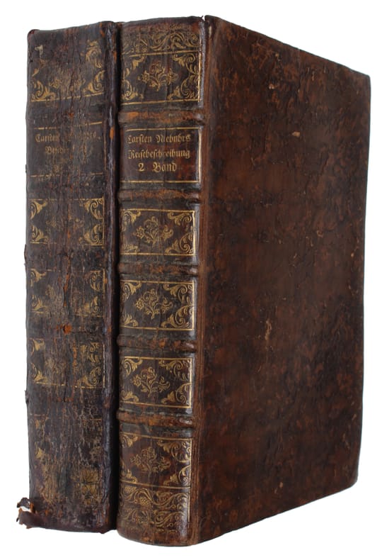

Kopenhagen, Nicolaus Möller, 1774-78. 4to. Bound in two contemporary full sprinkled calf bindings with five raised bands and richly gilt spines. Extremities with light wear. Spine on vol. 1 with wear with most of gilting worn off. Internally fine and clean. 2 engraved titlevignettes. Halftitles. XVI, (6), 505, (1)" (16), 479 pp. 1 large folded map, ""Tabula Iteneraria... Terrae Yemen... 1763."" and 124 engraved maps and plates (complete).
Reference : 60248
Scarce first edition of Niebuhr's great travel account of Arabia. Like his ""Beschribung von Arabien"", his ""Reisebeschreibung von Arabien"" ""provided a mass of new geographical, regional, and historical information... Among is many exact maps and plans, the map of the Red Sea and of Yemen served as the most reliable information for more than 50 years.""""Despite its tragic course, the expedition was a complete success with regard to its scientific and scholarly results. It was especially due to Niebuhr's efforts to preserve and continue his and his collegues' , that the Royal Danish Library was eventually equipped with a host of oriental manuscripts, maps, and drawings, as well as many botanical and zoological specimens... It was Niebuhr who edited and published Forskåll's Flora Aegyptiaco-Arabica (1775) and Descriptiones Animalium (1775), together with the drawings of Bauerfeind. In 1772 he had alredy published his systematic and geographically organized beschreibung von Arabien, which was followed between 1774 and 1778 by the first two volume of his three-volume chronologically arranged Reisebeschreibung nach Arabien. (the item offered, the third volume was published many years later, 1837). Both works, written in a clear and sober language and illustrated with numerous precise drawings, maps, and plans, provided a mass of new geographical, regional, and historical information... Among is many exact maps and plans, the map of the Red Sea and of Yemen served as the most reliable information for more than 50 years.""(Josef Wiesehöfer).
Bookseller's contact details
Herman H. J. Lynge & Son
William Schneider
Silkegade 11
1113 Copenhagen
Denmark
+45 33 155 335
Payment mode
Sale conditions
All items may be returned for a full refund for any reason within 14 days of receipt.
1 book(s) with the same title
Reisebeschreibung nach Arabien und andern umliegenden Ländern. 2 vols. - [ONE OF THE MOST IMPORTANT TRAVEL ACCOUNTS OF ARABIA]
Kopenhagen, Möller, 1774-78. 4to. Uniformly bound in two contemporary full sprinkled calf bindings with five raised bands and gilt lettering to spine. All edges coloured in red. Spine on volume 1 with wear and parts of gilting worn off, otherwise a nice, clean and widemargined copy. XVI, (6), 505" (16), 479 pp. + 124 engraved plates and 1 large folded map.
First edition of Niebuhr's great travel account of Arabia being a testament to one of the most significant and captivating exploratory journeys of the 18th century. Through meticulous mapping, cultural documentation, and scientific observations, Niebuhr's travelogue provided invaluable insights into Arabia, expanding geographic knowledge and influencing the field of Orientalism. Like his ""Beschribung von Arabien"", his ""Reisebeschreibung von Arabien"" ""provided a mass of new geographical, regional, and historical information... Among his many exact maps and plans, the map of the Red Sea and of Yemen served as the most reliable information for more than 50 years."" (Josef Wiesehöfer, Carsten Niebuhr (1733-1815)) Of the five scientists sent by the Danish government on the expedition, initiated by J. H. E. Bernstorff, Niebuhr was the sole survivor to return to Denmark"" the other four perished during the journey. The title vignettes were engraved by J. F. Clemens after drawings by Wiedewelt. Most of the engravings were based on drawings by Baurenfeind, who died during the expedition, while others were drawn by Niebuhr himself. The plates were engraved by Clemens, the Haas brothers, C. Defehrt, C. Martin, and others. ""Despite its tragic course, the expedition was a complete success with regard to its scientific and scholarly results. It was especially due to Niebuhr's efforts to preserve and continue his and his collegues' work, that the Royal Danish Library was eventually equipped with a host of oriental manuscripts, maps, and drawings, as well as many botanical and zoological specimens... It was Niebuhr who edited and published Forskåll's Flora Aegyptiaco-Arabica (1775) and Descriptiones Animalium (1775), together with the drawings of Bauerfeind. In 1772 he had alredy published his systematic and geographically organized Beschreibung von Arabien, which was followed between 1774 and 1778 by the first two volume of his three-volume chronologically arranged Reisebeschreibung nach Arabien (the item offered, the third volume was published many years later, 1837). Both works, written in a clear and sober language and illustrated with numerous precise drawings, maps, and plans, provided a mass of new geographical, regional, and historical information... Among his many exact maps and plans, the map of the Red Sea and of Yemen served as the most reliable information for more than 50 years."" (Josef Wiesehöfer, Carsten Niebuhr (1733-1815)). Birkelund 141.