 Write to the booksellers
"AMSTERDAM - KONING and BLANKEN.
Algemeene Kaart van het Groot Amsterdamsch Kanaal door Noord Holland, voor de Koopvaardijvaartr en s'Konings Marine ondernomen in 1819 en voltooid in 1825. Graveerd naar eene Kaart daar toe med goedvinden van Z.M. den Koning verstecht, door... J. Bla...

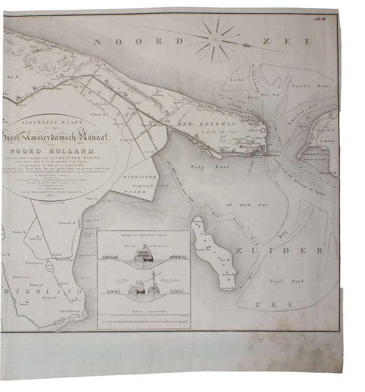
Amsterdam, Wed. Ger(ard) Hulst van Keulen, 1825. (50 x 100). Large engraved map over North Holland also with inset of ""Profils van het Groot Kanaal"". A small closed tear to lower margin, not affecting image. Lower right corner with a faint dampstain. With Compass-rose and scale.
Reference : 59188
€334.42
(€334.42
)
Bookseller's contact details
Herman H. J. Lynge & Son
William Schneider
Silkegade 11
1113 Copenhagen
Denmark
+45 33 155 335
Payment mode
Cheque
Transfer
Others
Sale conditions
All items may be returned for a full refund for any reason within 14 days of receipt.