 Write to the booksellers
EMORY, William Hemsley.
Notes of a Military Reconnoissance, from Fort Leavenworth, in Missouri, to San Diego, in California ; including parts of the Arkansas, Del Norte, and Gila Rivers.
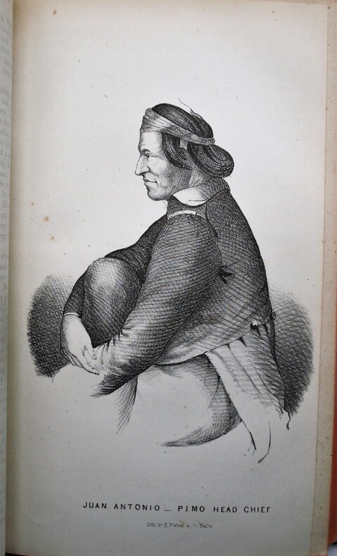
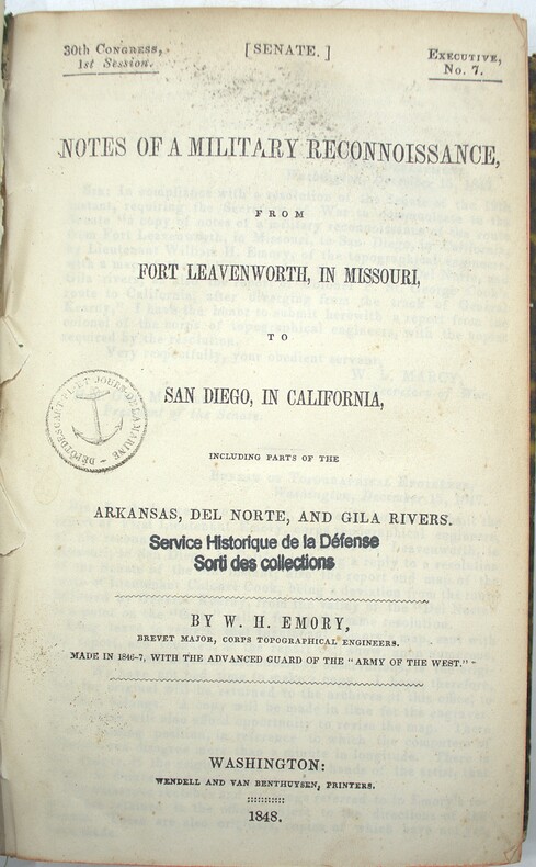
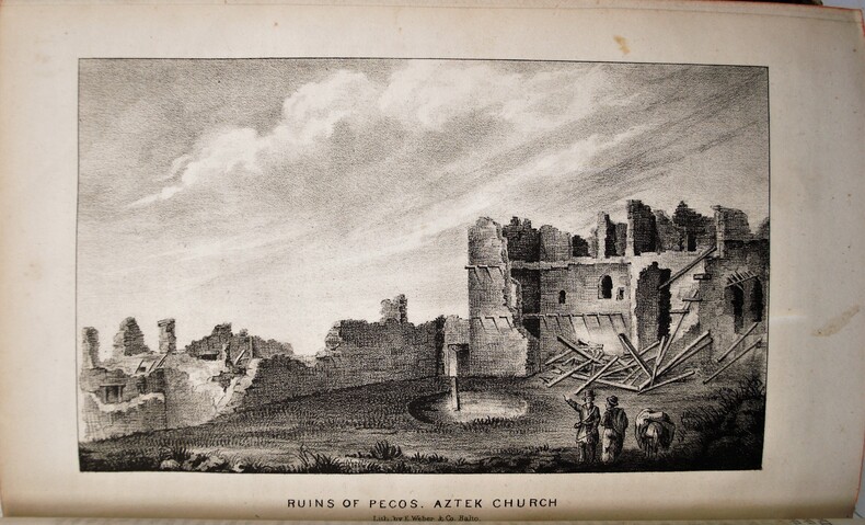
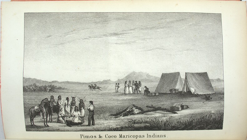
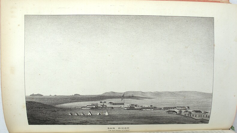
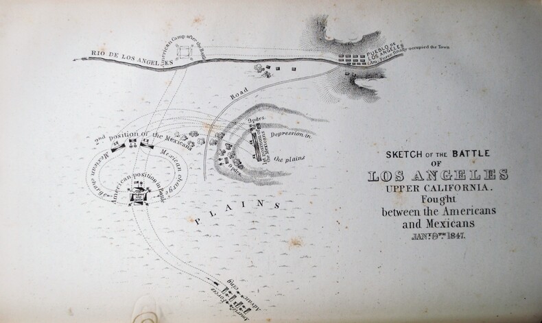
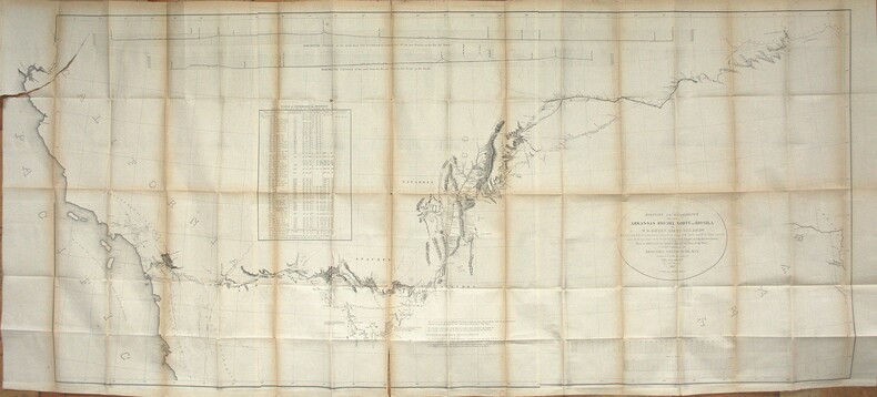
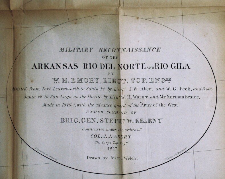
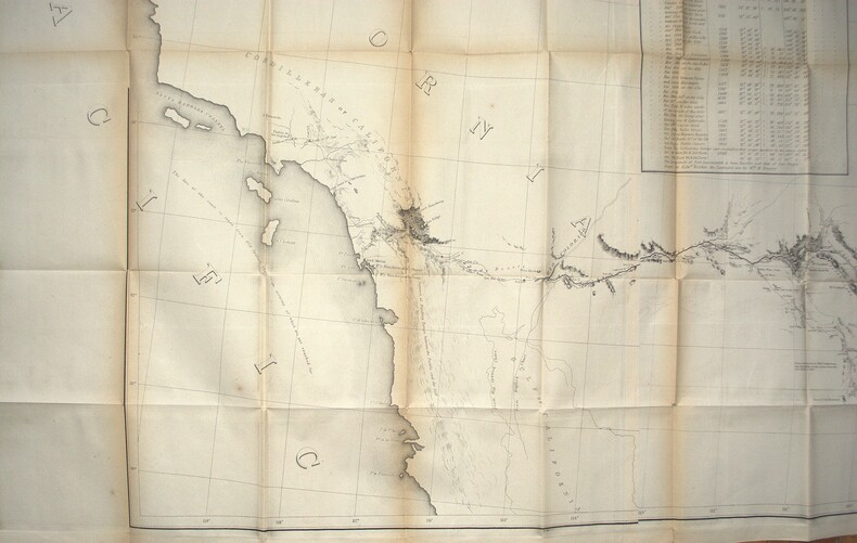
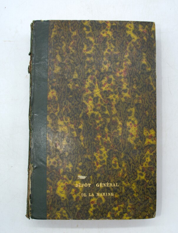
Washington, Wendell and Van Benthuysen, Printers, 1848. Octavo. xvi, 416 pages. Contemporary half calf, smooth spine gilt with author and title, red edges, stamp on title. Hinge cracked, small loose and label on spine. Large folding map detached and showing browning along the folds. First edition, Senate issue. 30th Congress, 1st Session, Senate, Executive No. 7. Illustrated with 43 plates, including three battle plans of the Mexican–American War (among them the Battle of Pueblo de Los Angeles), early views of California settlements (including San Diego), ethnographic portraits, and botanical plates, and accompanied by the large folding engraved map (33 × 75 inches, environ 84x190cm) The report documenting the military reconnaissance conducted in 1846–1847 during the Mexican–American War by Lieutenant-Colonel William H. Emory of the Corps of Topographical Engineers. The text is divided into two distinct parts : a narrative of the journey itself, combining geographical, logistical, and military observations, followed by extensive appendices presenting the scientific results of the expedition, including meteorological and astronomical observations, geological notes, and natural history data. A primary source for the history of the American Southwest. The plates provide early visual documentation of California, Native American populations, scientific observations, and contemporary military operations. The large folding engraved map, entitled Military Reconnoissance of Arkansas, Rio del Norte, and Rio Gila (dated 1847), is the cartographic centerpiece of the work. Compiled from original field observations, it provides the first comprehensive official mapping of the regions traversed by the expedition, integrating military routes, topography, settlements, barometric profiles, and tables of distances and elevations. The present example corresponds to the second and finalized state. Demi veau époque, dos lisse avec auteur et titre, tranches rouges, cachet au titre, charnière fendues, carte détachée et présentant des brunissures aux plis. Rapport officiel du Sénat sur la reconnaissance de 1846–1847, associant le récit de l’expédition et des annexes scientifiques. Illustré de planches et accompagné de la grande carte dépliante gravée, second état, document cartographique majeur de la guerre américano-mexicaine. Ch.3E
Reference : PHO-2174
Military reconnaissance, Mexican–American War, Western Americana, Southwest exploration, early California, cartography, Native American ethnography, botanical plates, battle plans, meteorological data, astronomical observations, topographical engineering, Arkansas to San Diego, Senate report, XIX, 19eme
Bookseller's contact details
Librairie Voyage et Exploration
M. Stéphan Feldman
09 86 72 59 94
Payment mode

Sale conditions
Les colis sont soignés, possibilité d'envoi partout dans le monde avec COLISSIMO international, frais à définir selon le poids de l'ouvrage et l'assurance choisie.