 Write to the booksellers
FERRARIS (Joseph de)
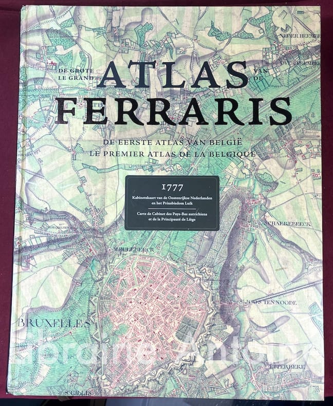
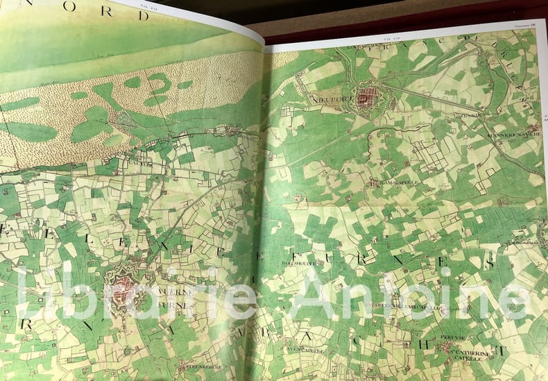
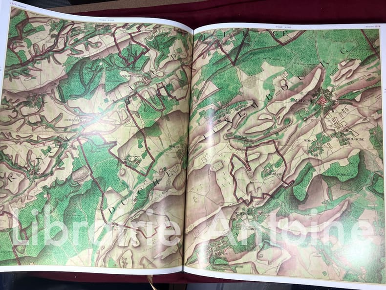
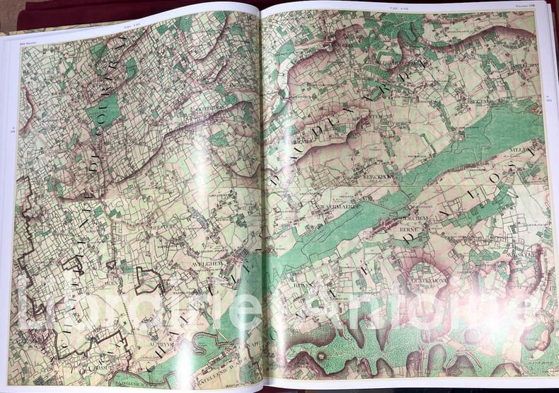
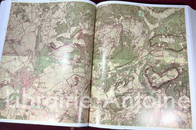
Le grand atlas de Ferraris. Le premier atlas de Belgique.

Lannoo - Racine - IGN - KBR 2011 In-folio (h. 42 cm.) 608 pp. couverture cartonnée illustrée.
Reference : 3979
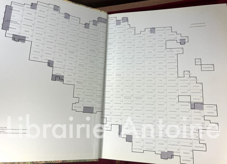
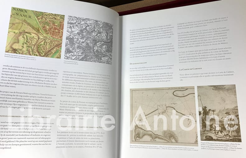
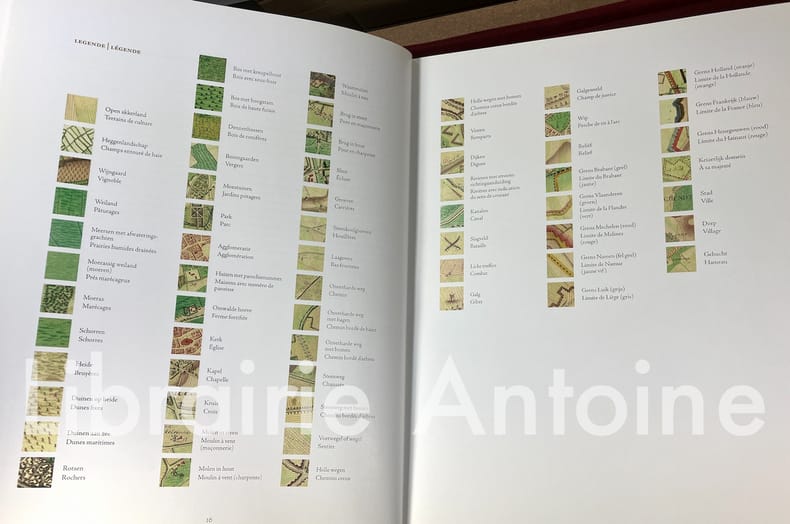
Superbe édition reproduisant en grand format un somptueux atlas colorié des Pays-Bas autrichiens, réalisé entre 1770 et 1778. "Entièrement réalisée et dessinée à la main par des élèves officiers, la carte de Ferraris avait une vocation exclusivement militaire : elle retraçait les éléments stratégiques les plus importants comme des rivières, des ponts ou des chemins creux permettant d'y cacher des troupes. Elle fut publiée à l'échelle originale du 1/11 520 et compte 275 planchettes." Wikipedia Qurelques marques au dos, sinon très bon état.Livre volumineux et lourd (6,5 kg hors emballage). Frais de port sur demande. Libraire membre du S.L.A.M. (Syndicat national de la Librairie Ancienne et Moderne) et de la L.I.L.A. (Ligue Internationale de la Librairie Ancienne). N'hésitez pas à prendre contact par mail pour des photographies et des détails supplémentaires, pour des recherches ou des estimations de livres anciens et rares.
Bookseller's contact details
LIBRAIRIE ANTOINE
M. ALEXIS-RAPHAËL ANTOINE
39 bis rue Molitor
75016 Paris
France
01 40 71 91 57
Payment mode
Sale conditions
conditions du Syndicat de la Librairie Ancienne et Moderne
1 book(s) with the same title
De grote atlas van Ferraris. De eerste atlas van België. Kabinetskaart van de Oostenrijkse Nederlanden en het Prinsbisdom Luik 1777. Le grand atlas de Ferraris. Le premier atlas de la Belgique. Carte de Cabinet des Pays-Bas autrichiens et de la Principauté de Liège 1777 ( facsimile ) .
10. Lannoo, Tielt ( in cooperation with the Royal Belgian Library ,the National Cartographical Institute, éditions Racine ), 2007, large in-folio ( 51 x 41 cm). Facsimile edition of the 275 maps, with a 16 pp bi-lingual commentary ( French-Dutch). Bound in an illustrated publisher's cased binding. Kept in an illustrated cardboard box with a handle. Box with minimal traces of use, upper inner joint on the point of splitting. Full size facsimile edition of the first detailed atlas of the Southern Netherlands ( the actual Belgium). The maps were made on the very large scale of 1/20.000. This scale would later be adopted by many cartographers for their ordnance survey maps. In 1777 it was a revolutionary concept. ISBN 9789020981384. (Due to larger/size weight of this book, additional shipping charges may apply depending on customer location.).