 Write to the booksellers
-
Type
Book (111)
Magazine (9)
Music sheets (11)
-
Latest
Last 3 days (1)
Last month (4)
-
Century
17th (1)
18th (2)
19th (7)
20th (77)
21st (6)
-
Countries
Belgium (8)
Denmark (3)
France (116)
Switzerland (4)
-
Syndicate
CLAM (3)
ILAB (50)
SLAM (43)
Stevens-Arce J. Sawyer R.J. Mares D. Santos D.
Reference : R100081385
(1998)
ISBN : 8440685661
Premio upc 1997 Novela corta de ciencia ficcion - Coleccion Nova n°112.
Ediciones B. 1998. In-8. Broché. Bon état, Couv. convenable, Dos satisfaisant, Papier jauni. 413 pages - couverture contrepliée - livre en espagnol.. . . . Classification Dewey : 460-Langues espagnole et portugaise
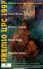
Coleccion Nova n°112 - Sommaire : Presentacion - Conferencia : Extraterrestres, ideas e irrelevancia : la importancia de la ciencia ficcion - El salvador de almas, James Stevens-Arce - Psicoespiacio, Robert J.Sawyer - La maquina de pymblikot, Daniel Mares - Bienvenidos al bicentenario del fin del mundo, Domingo Santos - apendice : los premios UPC de ciencia ficcion. Classification Dewey : 460-Langues espagnole et portugaise
BULLETIN AGRICOLE DE L'ALGERIE ET DE LA TUNISIE. Journal des informations agricoles pour les colons. Annales de la colonisation algérienne. 18 VOLUMES. 1896-1913
Alger-Mustapha, Imp. Typographique et lithographique Giralt, Imp. Agricole et commerciale Montegut, 1896-1913 , 18 volumes in-4 demi-basane, environ 500 pp par volume, quelques illustrations dont des figures dans le texte et des planches hors-texte. Continu 1896 à 1913. RARE ENSEMBLE de la 2e à la 19e année (1ere année manquante). POIDS: environ 15 kg. BON ETAT GÉNÉRAL.
"Windsurf Les premier livre sur la pratique de la ""planche à voile"""
Maritimes et d'outre-Mer. 1976. In-8. Broché. Bon état, Couv. convenable, Dos satisfaisant, Intérieur frais. 110 pages. Nombreuses illustrations hoers et dans le texte noir et blanc.. . . . Classification Dewey : 797-Sports nautiques
Classification Dewey : 797-Sports nautiques
"WHEWELL, WILLIAM - A PIONEER-WORK ON TIDES WITH THE FIRST COTIDAL WORLD-MAP.
Reference : 42692
(1833)
Essay towards a First Approximation to a Map of Cotidal Lines. Read May 2, 1833.
(London, Richard Taylor, 1833). 4to. No wrappers as extracted from ""Philosophical Transactions"" 1833 - Part I. Pp. 147-236, a few textillustr.,1 engraved plate and 2 large folded engraved maps (a general, representing the greater part of the world (42x93 cm) and Chart of the British Isles, drawn and engraved by J.& C. Walker.). A small tear to world map. Clean and fine.
First appearance of this classic, pioneering paper on the investigation of tidal phenomena. It is the first in a series of 16 papers Whewell made for the Royal Society. It contains the first printed cotidal world-map.""Whewell took over the subject of mapping cotidal lines from Lubbock with entusiasm....He exercised the pioneer's privilege of coining new words and phrases appropriate to his subject. Many failed to stick, some phrases of Whewell's origin still occasionally used are: 'age of the tides', 'luni-tidal interval', 'semi-menstrual inequality' etc, etc....Whewell's initial cotidal map for the world ocean was presented in his first paper of 1833 (the paper offered). By his own admission, it was entirely preliminary and tentative, what nowadays might be called a ""strawman"", to stimulate discussionm. He later (1836) suggested smll modifications, especially near the coast of North America"" these were incorporated in an 'improved' world map by G.B. Airy in his celebrated tratise on ""Tides and wave"", (Cartwright in ""Tides. A Scientific History"", pp.110-112.)
19 keer Brussel, 19 fois Bruxelles, 19 times Brussels [in: Brusselse thema's, Brussels Themes, Thèmes bruxellois, vol.7]
Brussel, VUBPress 2001 542pp., 24cm., gebroch., goede staat, [bevat 19 bijdragen, telkens in drie talen, over Brussel m.b.t. taalgebruik- en politiek, taalonderwijs, taalcultuur, taal en gezondheidszorg en taalsociologie]
LE GAMIN D'PARIS-PARTITION MUSICALE
4 PAGES-17,5 CM X 26,5 CM-PHOTOGRAPHIE YVES MONTAND SUR DESSINS DE PARIS (SIGNE ALAIN ?), MONOCHROME BISTRE-PAROLES DE MICK MICHEYL-MUSIQUE DE ADRIEN MARES-MANQUE 1 CM X 2 CM COIN INF DR DE P1
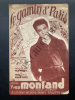
LES EDITIONS METROPOLITAINES-PARIS COUVERTURE SOUPLE ETAT BON