 Write to the booksellers
-
Type
Art print (1)
Book (48307)
Engraving (79)
Magazine (254)
Manuscript (2)
Maps (116)
Music sheets (3)
Old papers (2)
-
Latest
Last 24h (1)
Last 3 days (12)
Last month (128)
Last week (32)
-
Language
Danish (1)
Dutch (1)
English (22)
French (48699)
German (26)
Italian (4)
Latin (3)
Portuguese (2)
Spanish (6)
-
Century
15th (2)
16th (12)
17th (73)
18th (487)
19th (5419)
20th (25911)
21st (2423)
-
Countries
Belgium (1323)
Brazil (2)
Canada (1)
China (4)
Côte d'Ivoire (18)
Denmark (268)
France (43896)
Greece (4)
Italy (822)
Switzerland (2426)
-
Syndicate
ALAC (1)
CLAQ (1)
ILAB (36165)
NVVA (1339)
SLACES (1339)
SLAM (33082)
SNCAO (14)
HISTOIRE DE L'ETABLISSEMENT ET DE LA DIRECTION DE L'EGLISE CHRETIENNE PAR LES APOTRES, 2 TOMES
Abraham Cherbuliez et Cie, Paris. 1836. In-8. Broché. Bon état, Couv. légèrement passée, Dos satisfaisant, Non coupé. 266 pages pour le tome I et 301 pages pour le tome II. Etiquettes de code sur les dos. Tampons et annotations de bibliothèque sur les 1ers plats et en pages de titre. Quelques rousseurs.. . . . Classification Dewey : 270-Histoire et géographie de l'Eglise
Trad. de l'allemand du Dr Néander par Ferdiannd Fontanès, l'un des pasteurs de l'Eglise Réformée de Nismes. Classification Dewey : 270-Histoire et géographie de l'Eglise
LA POLITIQUE EN FRANCE XIXE-XX SIECLE
HACHETTE / DUPRAT Benjamin. 1991. In-8. Broché. Bon état, Couv. convenable, Dos satisfaisant, Intérieur frais. 222 pages illustrées de nombreuses illustrations en noir et blanc dans et hors texte.. . . . Classification Dewey : 372.89-Livre scolaire : histoire / géographie
REGIMES, INSTITUTIONS, ELECTIONS, COURANTS, PARTIS, GROUPE DE PRESSION, MEDIAS Classification Dewey : 372.89-Livre scolaire : histoire / géographie
Les français dans leur environnement.
Nathan. 1996. In-8. Broché. Bon état, Couv. convenable, Dos satisfaisant, Intérieur frais. 382 pages - annotations sur les tranches en pied et en tête - tampons sur la page de titre et sur les contre plats.. . . . Classification Dewey : 914-Géographie de l'Europe
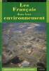
Classification Dewey : 914-Géographie de l'Europe
L'homme et l'érosion. L'érosion des sols dans la monde. 2e édition revue et mise à jour.
1991 Clermont-Ferrand, Faculté des Lettres et Sciences Humaines, 1991, grand in 8° broché, 269 pages ; illustrations et figures in et hors-texte.
...................... Photos sur demande ..........................
Phone number : 04 77 32 63 69
LE ONZIEME COMMANDEMENT, ETIOLOGIE D'UNE EGLISE INDEPENDANTE AU PIED DU MONT KENYA
Nouvelle Revue de Science Missionnaire, Immensee. 1978. In-8. Broché. Bon état, Couv. convenable, Dos satisfaisant, Intérieur frais. 634 pages. Etiquette de code sur le dos. Tampon et annotations de bibliothèque en page de titre. Quelques rares annotations dans le texte.. . . . Classification Dewey : 270-Histoire et géographie de l'Eglise

Neue Zeitschrift für Missionswissenschaft, Herausg. vom Verein zur Förderung der Missionswissenschaft Immensee, Supplementa, Vol. XXVII. Classification Dewey : 270-Histoire et géographie de l'Eglise
VOYAGE EN ECOSSE ET AUX ILES HEBRIDES, TOME PREMIER, TOME SECOND
J. J. Paschoud. 1821. In-8. Relié. Etat d'usage, Couv. légèrement passée, Dos frotté, Intérieur bon état. 415 pages pour le tome I, et 511 pages pour le tome II. 1er plat signé: Collège royal d'Angers (doré). Illustré de belles gravures en noir et blanc (7 planches) hors texte. Carte dépliable en couleur en fin du tome I. Pièce de tomaison avec tomaison et roulettes dorées sur le dos du tome I. Autres pièces de titre manquantes. Coiffe en pied du tome II manquante. Coins des plats frottés. Tampons de lycée (Angers) en pages de garde et de titre.. . . . Classification Dewey : 914-Géographie de l'Europe
L. A. Necker-de-Saussure, prof. honoraire de minéralogie et de géologie à l'Académie de Genève, Membre de la Société de physique et d'histoire naturelle de Genève, Membre honoraire de la Société géologique de Londres, etc. Gravures de L. A. Necker, de. d'après nature, et H. Deville sculpt. Tome I: Chap. I. Edimbourg, vieille ville, Holyrood, Château, Collège. Chap. II. Suite d'Edimbourg, nouvelle ville, société. IIe partie, Chap. I. Voyage à l'île d'Arran... Tome II: ...Chap. VI. Moeurs des Lowlanders ou habitants de Basse-Ecosse. IIIe partie, Chap. I. Voyage aux Hébrides. Chap. II. D'Oban à Staffa... Classification Dewey : 914-Géographie de l'Europe
La belle histoire de Pierre Nédellec.
1929 P., Editions de l'Oeuvre d'Auteuil (Collection "Les Défricheurs Africains"), 1929, in 8° broché, 168 pages ; illustrations hors-texte ; couverture fanée ; intérieur frais.
Mission de Guinée Française au pays de Coniagui. ...................... Photos sur demande ..........................
Phone number : 04 77 32 63 69
Die Bevölkerungsbewegung von Erlangen 1900 bis 1925. Diss. Univ. Giessen.
Erlangen, Höfer & Limmert, 1928, in-8°, VIII + 70 S., broschiert.
(SLACES, NVVA)
Phone number : 41 (0)26 3223808
LA NAISSANCE DE LA CIVILISATION INDUSTRIELLE ET LE MONDE CONTEMPORAIN.
ARMAND COLIN. 1954. In-4. Broché. Bon état, Couv. convenable, Dos satisfaisant, Intérieur frais. 249 pages - Frontispice e nnoir et blanc - Legeres salissures sur le 1er plat.. . . . Classification Dewey : 900-GEOGRAPHIE, HISTOIRE, SCIENCES AUXILIAIRES DE L'HISTOIRE
Classification Dewey : 900-GEOGRAPHIE, HISTOIRE, SCIENCES AUXILIAIRES DE L'HISTOIRE
La symphonie symbolique ou les merveilles de la Cathédrale de Chartres - Collection découvertes.
Editions du Charlot. 1989. In-8. Broché. Bon état, Couv. convenable, Dos satisfaisant, Intérieur frais. 142 pages - nombreuses illustrations en noir et blanc dans et hors texte.. . . . Classification Dewey : 270-Histoire et géographie de l'Eglise
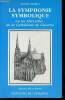
Collection découvertes. Classification Dewey : 270-Histoire et géographie de l'Eglise
Parcs naturels - Région Nord/Nord-Est
Presses de la cité. 1978. In-12. Broché. Etat d'usage, Couv. convenable, Dos satisfaisant, Intérieur frais. 126 pages augmentées de nombreuses photos,cartes et illustrations en couleurs et noir et blanc,dans et hors texte. Traces d'adhésifs sur la page de titre et dernière page - Couverture plastique protégeant l'ouvrage, en bon état.. . . . Classification Dewey : 910-Géographie générale. Voyages
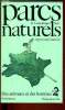
Classification Dewey : 910-Géographie générale. Voyages
Géographie de l'Algérie.-
Tome Premier: Géographie Physique, Agricole,Industrielle et Commerciale. Bone. Legendre et Cauvy. 1876. Tome Deuxième: Géographie politique et Itinéraire de l'Algérie accompagné de 3 cartes, une par province. Paris. Challamel. Algérie. Principaux Libraires. 1878. (mention de 2°édition sur la couverture). 2 volumes in-8 (120 x 185mm) brochés, couvertures vertes imprimées, 4ff.n.ch., 333 pages et 1f. d'errata et XVI, XV, 542 pages, bien complet des 3 grandes cartes dépliantes. Envoi de l'auteur à M. Boissin, curé d'Alais. Petits manques aux couvertures, infimes rousseurs mais exemplaires non coupés, bons à relier. Rares.
Inconnu à Tailliart qui signale 2 autres titres du même auteur.
Le Manuscrit du Saint-Sépulcre.
DU CERF. 1995. In-8. Broché. Bon état, Couv. fraîche, Dos satisfaisant, Intérieur frais. 321 pages.. . . . Classification Dewey : 270-Histoire et géographie de l'Eglise
Roman. Classification Dewey : 270-Histoire et géographie de l'Eglise
MAIS ENFIN QU EST CE QUE L OCCITANIE ?
PRIVAT .. 1978. In-8. Broché. Bon état, Couv. légèrement passée, Dos satisfaisant, Intérieur frais. 202 pages. Quelques illustrations en noir et blanc hors texte.. . . . Classification Dewey : 900-GEOGRAPHIE, HISTOIRE, SCIENCES AUXILIAIRES DE L'HISTOIRE
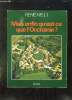
Classification Dewey : 900-GEOGRAPHIE, HISTOIRE, SCIENCES AUXILIAIRES DE L'HISTOIRE
MAIS ENFIN QU'EST-CE QUE L'OCCITANIE ?
PRIVAT. 1978. In-8. Broché. Bon état, Couv. convenable, Dos satisfaisant, Intérieur frais. 202 pages - nombreuses illustrations en noir et blanc dans et hors texte + 1 carte en noir et blanc.. . . . Classification Dewey : 900-GEOGRAPHIE, HISTOIRE, SCIENCES AUXILIAIRES DE L'HISTOIRE
Classification Dewey : 900-GEOGRAPHIE, HISTOIRE, SCIENCES AUXILIAIRES DE L'HISTOIRE
La vie quotidienne des cathares du languedos au XIIIe siècle.
Hachette. 1969. In-8. Relié. Bon état, Couv. convenable, Dos satisfaisant, Intérieur frais. 299 pages - jaquette conservée .. Avec Jaquette. . . Classification Dewey : 270-Histoire et géographie de l'Eglise
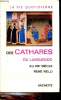
Classification Dewey : 270-Histoire et géographie de l'Eglise
[Rizzoli] - NELSON, Jimmy ; KARAN, Donna ; KEPANGA, Mundiya
Reference : 67187
(2018)
Homage to Humanity
1 vol. fort in-4 cartonnage éditeur sous emboîtage illustré, Rizzoli, 2018, 528 pp.
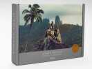
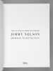
Bon exemplaire en très bon état, bien complet de son bel emboîtage illustré (emboîtage très lég. frotté). Very good copy, complete with its slipcase (slipcase very slightly rubbed).
Cahier d'activiés - Cycle 3- Niveau 1 - A monde ouvert - Géographie - CE2/CM1
Hachette. 1997. In-4. Relié. Etat d'usage, Coins frottés, Dos satisfaisant, Intérieur frais. 47 pages. Quelques illustrations en noir et blanc dans le texte.. . . . Classification Dewey : 372.89-Livre scolaire : histoire / géographie
"Collection ""A monde ouvert"". Classification Dewey : 372.89-Livre scolaire : histoire / géographie"
Histoire - Geographie - Education civique - CM2 -
Hachette. 2000. In-4. Relié. Bon état, Couv. convenable, Dos satisfaisant, Intérieur frais. 159 pages. Nombreuses illustrations et photographies en couleurs dans et hors texte. Couverture avec film plastique adhésif transparent et étiquettes de codes collées sur le 1er plat. Tampon sur la page de titre et le 2ème contre plat.. . . . Classification Dewey : 372.89-Livre scolaire : histoire / géographie
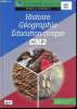
"Collection ""A monde ouvert"". Classification Dewey : 372.89-Livre scolaire : histoire / géographie"
Decouverte du monde cycle 2 - L'espace - Le temps - CP/CE1
Hachete. 2003. In-4. Relié. Etat d'usage, Coins frottés, Dos satisfaisant, Intérieur frais. 63 pages. Nombreuses illustrations/photographies en couleurs dans et hors texte.. . . . Classification Dewey : 372.89-Livre scolaire : histoire / géographie
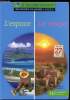
"collection ""A monde ouvert"". Classification Dewey : 372.89-Livre scolaire : histoire / géographie"
Nembrini Jean-Louis, Bordes J., Polivka P.
Reference : RO30339253
(1985)
ISBN : 2010111109
Histoire CM
Classiques Hachette. 1985. In-4. Cartonné. Etat passable, Coins frottés, Manque en coiffe de pied, Intérieur frais. 159 pages. Papier légèrement jauni. Nombreuses illustrations, cartes en couleurs et en noir et blanc, in et hors texte.. . . . Classification Dewey : 372.89-Livre scolaire : histoire / géographie
"Collection ""Pour connaître la France"". Classification Dewey : 372.89-Livre scolaire : histoire / géographie"
"Histoire - Géographie - Education civique. CM1, cycle 3, niveau 2 (Collection ""A monde ouvert"")"
Hachette. 2000. In-4. Relié. Bon état, Couv. convenable, Dos satisfaisant, Papier jauni. 159 pages. Nombreuses illustrations en couleur et noir et blanc, dans et hors texte. Deux cartes en couleur dépliantes collées sur les contreplats. Une étiquette collée sur le 1er plat.. . . . Classification Dewey : 372.89-Livre scolaire : histoire / géographie
Classification Dewey : 372.89-Livre scolaire : histoire / géographie
Nembrini jean louis, moretti anne sylvie,bordes j.
Reference : RO40039902
(1996)
ISBN : 2011159474
Histoire cm - cycle 3 / niveau 2 / collection a monde ouvert
HACHETTE. 1996. In-4. Relié. Etat d'usage, Couv. convenable, Coiffe en pied abîmée, Quelques rousseurs. 141 pages augmentées de nombreuses illustrations et autres figures en couleurs dans le texte. 2 planches dépliantes, illustrées de cartes en couleur, en début et fin d'ouvrage. Recouvet d'un film plastique. Adhésif entre 2 pages en fin et début d'ouvrage.. . . . Classification Dewey : 372.89-Livre scolaire : histoire / géographie
Classification Dewey : 372.89-Livre scolaire : histoire / géographie
NEMBRINI J.-L., BORDES J., POLIVKA P.
Reference : RO70075165
(1990)
ISBN : 2010127528
HISTOIRE, CE2
Hachette. 1990. In-4. Relié. Bon état, Couv. convenable, Dos satisfaisant, Intérieur frais. 79 pages. Couverture illustrée en couleur. Illustré de nombreuses photos en couleur. Avec un fichier Atlas historique collé au dos du 2e plat.. . . . Classification Dewey : 372.89-Livre scolaire : histoire / géographie
Coll. Pour connaître la France. Classification Dewey : 372.89-Livre scolaire : histoire / géographie
NEMBRINI J.-L., BORDES J., POLIVKA P.
Reference : RO70075166
(1985)
ISBN : 2010111109
HISTOIRE, CM
Hachette. 1985. In-4. Relié. Bon état, Couv. convenable, Dos satisfaisant, Intérieur frais. 159 pages. Couverture illustrée en couleur. Illustré de nombreuses photos en couleur. Spécimen.. . . . Classification Dewey : 372.89-Livre scolaire : histoire / géographie
Coll. Pour Connaître la France. Classification Dewey : 372.89-Livre scolaire : histoire / géographie