 Write to the booksellers
-
Type
Artists book (1)
Autograph (1)
Book (8591)
Engraving (3)
Magazine (5)
Maps (366)
-
Latest
Last 3 days (1)
Last month (23)
Last week (6)
-
Language
English (1)
French (8948)
German (10)
Greek (1)
Italian (1)
Polish (1)
Spanish (5)
-
Century
16th (9)
17th (21)
18th (196)
19th (1524)
20th (2947)
21st (383)
-
Countries
Belgium (148)
Canada (2)
China (28)
Denmark (44)
France (8492)
Greece (1)
Switzerland (252)
-
Syndicate
ALAC (2)
CLAQ (2)
CNE (1)
ILAB (7281)
NVVA (132)
SLACES (132)
SLAM (7081)
SNCAO (3)
THENS - ATTICA PIRAEUS - ATHINAL
EDITIONS C. GOUVOUSSIS. non daté. In-12. En feuillets. Bon état, Couv. convenable, Dos satisfaisant, Intérieur frais. 1 plan en couleurs de 69 x 51 cm.. . . . Classification Dewey : 912-Atlas, cartes et plans
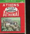
Classification Dewey : 912-Atlas, cartes et plans
The plan of Istanbul.
M.Münim Eser. non daté. In-Plano. En feuillets. Bon état, Couv. convenable, Dos satisfaisant, Intérieur frais. Un plan en couleur dépliant d'Istanbul - dimension du plan : 70 x 50 cm - plan en anglais.. . . . Classification Dewey : 912-Atlas, cartes et plans
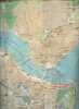
Classification Dewey : 912-Atlas, cartes et plans
The premier map London and suburbs complete with street index and main road house numbers paper 7/6.
"Phyllis Pearsall f.r.g.s. / Geographers' map co.ltd. otford road. non daté. In-Plano. En feuillets. Bon état, Couv. convenable, Dos satisfaisant, Intérieur frais. Une grande carte en couleur dépliante ""London and Suburbs"" - dimension de la carte : 114 x 88.5 cm - carte en anglais - avec un fascicule accroché à la carte de 63 pages agrafées ""index to street"".. . . . Classification Dewey : 912-Atlas, cartes et plans"
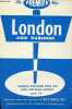
carte en anglais. Classification Dewey : 912-Atlas, cartes et plans
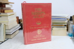
THE READER'S DIGEST COMPLETE ATLAS OF THE BRITISH ISLES
Reader's Digest. 1965. In-Folio. Relié. Etat d'usage, Couv. légèrement passée, Dos satisfaisant, Intérieur acceptable. 229 pages. Illustré de nombreuses cartes en couleur. Petite annotation en page de garde. Pages de garde et de titre salies. Tranche légèrement salie.. . . . Classification Dewey : 912-Atlas, cartes et plans
Including Great Britain, Northern Ireland, The Channel Islands, Isle of Man and the Rep. of Ireland. Classification Dewey : 912-Atlas, cartes et plans
THE READER'S DIGEST WORLD ATLAS
Reader's DIGEST. 1974. In-Folio. Relié. Bon état, Couv. légèrement passée, Dos satisfaisant, Intérieur bon état. 179 pages. Illustré de nombreuses cartes en couleur. Ex-Libris de Bill Barnes illustré en noir et blanc en page de garde.. . . . Classification Dewey : 912-Atlas, cartes et plans
The Face of the World. The Countries of the World... Classification Dewey : 912-Atlas, cartes et plans
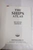
The Ships Atlas 7th Edition
1998 chez Shipping Guides LTD. In-4, relié, environ 150 pages. Nombreuses illustrations en couleurs. Exemplaire en bon état malgré de légères marques d’usage. Les pages sont fraîches et en parfait état - 1998 with Shipping Guides LTD. In-4, bound, about 150 pages. Many color illustrations. Copy in good condition despite slight signs of use. The pages are fresh and in perfect condition.
The Standard Map of China.
DAH CHUNG BOOK. 1986. In-Plano. En feuillets. Très bon état, Couv. légèrement passée, Dos satisfaisant, Intérieur frais. Carte dépliante en couleurs, de 106 x 76 cm. Légendes en chinois et an anglais. Echelle 1 / 6000000. . . . Classification Dewey : 912-Atlas, cartes et plans
Classification Dewey : 912-Atlas, cartes et plans
THE THEATRE OF WAR IN EASTERN EUROPE N° 11. CARTE ENTOILE EN COULEURS.
STANFORD S.. 1915. In-8. Broché. Bon état, Couv. convenable, Dos satisfaisant, Intérieur frais. Carte en couleurs entoilée dépliante de 84 cm + 115 cm.. . Sous Emboitage. . Classification Dewey : 912-Atlas, cartes et plans
Classification Dewey : 912-Atlas, cartes et plans
THE TIMES ATLAS OF THE WORLD
Times Books. 1997. In-Plano. Relié. Bon état, Couv. convenable, Dos satisfaisant, Intérieur frais. 123 + 218 pages. Illustré de nombreuses cartes en couleur. Jaquette légèrement passée.. Avec Jaquette. . . Classification Dewey : 912-Atlas, cartes et plans
9th Comprehensive Edition. Classification Dewey : 912-Atlas, cartes et plans
THE TIMES ATLAS OF THE WORLD. COMPREHENSIVE EDITION.
TIME BOOKS / JOHN BARTHOLOMEW & SON LTD.. 1975. In-Folio. Cartonné. Bon état, Couv. convenable, Dos satisfaisant, Intérieur frais. 223 pages. Jaquette illustrée en couleurs. Cartes en couleurs. Texte en anglais.. Avec Jaquette. . . Classification Dewey : 912-Atlas, cartes et plans
Classification Dewey : 912-Atlas, cartes et plans
THE TIMES ATLAS OF THE WORLD - VOLUME 1: WORLD, AUSTRALIA, EAST ASIA
The Times. 1958. In-Plano. Broché. Bon état, Couv. légèrement passée, Dos satisfaisant, Intérieur frais. 27 pages, 24 planches en couleurs et en noir et blanc, 34 pages d'index, carte couleur frontispice, une carte couleur volante; cartonnage éditeur plein toile; référence sur le dos.. . . . Classification Dewey : 912-Atlas, cartes et plans
Mid-century edition. Edited by John Bartholomew; containing maps showing various aspects of the world entire: also Australia, New Zealand, Antarctica, New Guinea, Japan, China, Korea, Mongolia, Indo-China, Thailand, Philippines, Burma, S.W. Pacific, Indonesia, Malaya etc. En anglais. Classification Dewey : 912-Atlas, cartes et plans
THE TIMES ATLAS OF THE WORLD VOLUME 3: NORTHERN EUROPE
The Times. 1955. In-Plano. Broché. Bon état, Couv. légèrement passée, Dos satisfaisant, Intérieur frais. 12 pages, planches numérotées de 49 à 72 en noir et blanc et en couleurs, 57 pages d'index; catonnage éditeur plein toile; référence sur dos, tampon bibliothèque sur page de soustitre, page de garde pliée.. . . . Classification Dewey : 912-Atlas, cartes et plans
Mid century edition. Edited by John Bartholomew; containing Ireland, Scandinavia, British Isles, Netherlands, Belgium, Poland, Czechoslovakia, Austria, Germany, Switzerland, France. Classification Dewey : 912-Atlas, cartes et plans
THE TIMES ATLAS OF THE WORLD VOLUME 4: SOUTHERN EUROPE AND AFRICA
The Times. 1956. In-Plano. Broché. Bon état, Couv. légèrement passée, Dos satisfaisant, Intérieur frais. 12 pages, planches numérotées de 73 à 96 en couleurs et en noir et blanc; 50 pages d'index; cartonnage éditeur plein toile; référence sur le dos.. . . . Classification Dewey : 912-Atlas, cartes et plans
Mid-century edition. Edited by John Bartholomew; containing Spain, Portugal, Italy, Danube Lands, Greece, Egypt, Mediterranean Islands, North, West, Central and East Africa, South Africa, the Atlantic Ocean. Classification Dewey : 912-Atlas, cartes et plans
THE TIMES ATLAS OF THE WORLD VOLUME 5: THE AMERICAS
The Times. 1957. In-Plano. Broché. Bon état, Couv. légèrement passée, Coiffe en pied abîmée, Intérieur frais. 12 pages, planches numérotées de 97 à 120 en couleurs et en noir et blanc; 57 pages d'index, plus frontispice couleur; cartonnage éditeur plein toile, un bord abîmé; étiquette consul anglais sur page de garde, référence bibliothèque sur dos; étiquette bibliothèque intérieur du 2e plat.. . . . Classification Dewey : 912-Atlas, cartes et plans
Mid century edition. edited by John Bartholomew; containing Arctic America, Canada, USA, Mexico, Central America, West Indies, Brazil, Venezuela, Colombia, Ecuador, Peru, Bolivia, Paraguay, Uruguay, Chile, Argentina, Pacific Ocean, etc. Classification Dewey : 912-Atlas, cartes et plans
The United States of America. Carte des Etats-Unis d'Amérique.
CHANNING, RWEN KAO. 1963. In-12. En feuillets. Bon état, Livré sans Couverture, Dos satisfaisant, Intérieur frais. Carte dépliante en couleurs de 62 x 94 cm. Légendes en anglais.. . . . Classification Dewey : 912-Atlas, cartes et plans
Classification Dewey : 912-Atlas, cartes et plans
THE VISITOR'S LONDON MAP
Bartholomew & Son Ltd. 1978. In-8. En feuillets. Bon état, Couv. convenable, Dos satisfaisant, Intérieur frais. Carte dépliable en couleur d'env. 100/75 cm. Index au dos.. . . . Classification Dewey : 912-Atlas, cartes et plans
Français, Deutsch, Italiano; Underground map in colour. Classification Dewey : 912-Atlas, cartes et plans
THE WORLD MAP - THE NATIONAL GEOGRAPHIC MAGAZINE.
THE NATIONAL GEOGRAPHIC SOCIETY. 1951. In-Plano. Broché. Bon état, Couv. convenable, Dos satisfaisant, Intérieur frais. Carte dépliante en couleurs de DIMENSION : 73 x 106 cm environ.. . . . Classification Dewey : 912-Atlas, cartes et plans
2 PHOTOS DISPONIBLES. Classification Dewey : 912-Atlas, cartes et plans
THEZ ORDNANCE SURVEY ATLAS OF GREAT BRITAIN
GUIL PUBLISHING. 1986. In-Folio. Cartonnage d'éditeurs. Etat d'usage, Couv. convenable, Dos satisfaisant, Intérieur frais. 256 pages. Jaquette illustrée en couleurs. Nombreuses cartes en couleurs. Nombreuses illustrations en couleurs dans le texte. Texte en anglais.. Avec Jaquette. . . Classification Dewey : 912-Atlas, cartes et plans
Classification Dewey : 912-Atlas, cartes et plans
TOKYO. FALK PLAN. RED SERIES.
TEIKOKU-SHOIN CO., LTD., TOKYO. 1989. In-8. Broché. Etat d'usage, Couv. légèrement passée, Dos satisfaisant, Intérieur frais. Photo en couleurs sur le premier plat. Plan dépliant illustré en couleurs de 100 x 56 cm . 35 pages de texte et lexique. Texte en français, anglais et allemand.. . . . Classification Dewey : 912-Atlas, cartes et plans
Classification Dewey : 912-Atlas, cartes et plans
TOPOGRAPHISCHER ATLAS DER SCHWEIZ, 1:100 000, ÜBERDRUCK, CENTRALSCHWEIZ EXKURSIONKARTE
Landestopographie, Schweiz. 1903. In-8. En feuillets. Etat d'usage, Couv. convenable, Dos satisfaisant, Mouillures. Grande carte entoilée en noir et bleu d'env. 77/57 cm. Quelques annotations au crayon sur le bord.. . . . Classification Dewey : 912-Atlas, cartes et plans
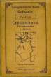
Classification Dewey : 912-Atlas, cartes et plans
TOPOGRAPHISCHER ATLAS DER SCHWEIZ, 1:50 000, SCHEIDEGG
Landestopographie, Schweiz. 1912. In-8. En feuillets. Etat d'usage, Couv. légèrement passée, Dos satisfaisant, Mouillures. Grande carte entoilée en couleur d'env. 77/65 cm. Tampon de librairie sur le 1er plat.. . . . Classification Dewey : 912-Atlas, cartes et plans
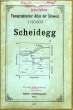
Classification Dewey : 912-Atlas, cartes et plans
Topographischer Atlas der Schweiz 1:50 000 - Theodulpass
Eidg. Landestopographie Bern. 1944. In-Plano. Broché. Bon état, Couv. convenable, Dos satisfaisant, Intérieur frais. Carte en couleurs de la Suisse.. . . . Classification Dewey : 912-Atlas, cartes et plans
Classification Dewey : 912-Atlas, cartes et plans
TOPOGRAPHISCHER ATLAS DER SCHWEIZ / BLATT Nr 487 - VISSOYE - Section XVII,16 - Feuille 487 / 1 carte depliante couleur de dimension 42 cm X 33.5 Cm environ / Echelle 1 : 50.000
SCHWEIZ - LANDESTOPOGRAPHIE - BERNE. 1906. In-Plano. En feuillets. Bon état, Couv. convenable, Dos satisfaisant, Intérieur frais. 1 CARTE DEPLIANTE EN COULEUR de dimension 42 Cm X 33,5 Cm environ avec une protection de 2 plats cartonnés semi cartonnées. 1 petite annotation sur le 1er plat (bleu) de presentation .. . . . Classification Dewey : 912-Atlas, cartes et plans
Plats en allemand. / ECHELLE : 1: 50.000 Classification Dewey : 912-Atlas, cartes et plans
TOPOGRAPHISCHER ATLAS DER SCHWEIZ / BRIG / BLATT Nr 497 / 1 CARTE DEPLIANTE EN COULEUR de dimension 42 Cm X 33,5 Cm environ / ECHELLE : 1 : 50.000
SCHWEIZ - LANDESTOPOGRAPHIE - BERNE. 1904. In-Plano. En feuillets. Bon état, Couv. convenable, Dos satisfaisant, Intérieur frais. 1 CARTE DEPLIANTE EN COULEUR de dimension 42 Cm X 33,5 Cm environ avec une protection de 2 plats cartonnés semi cartonnées. 1 petite annotation sur le 1er plat (bleu) de presentation .. . . . Classification Dewey : 912-Atlas, cartes et plans
Plats en allemand. / ECHELLE : 1: 50.000 Classification Dewey : 912-Atlas, cartes et plans
TOPOGRAPHISCHER ATLAS DER SCHWEIZ / MARTIGNY / BLATT Nr 526 / 1 CARTE DEPLIANTE EN COULEUR de dimension 42 Cm X 33,5 Cm environ / ECHELLE 1 : 50.000
SCHWEIZ - LANDESTOPOGRAPHIE - BERNE. 1900. In-Plano. En feuillets. Bon état, Couv. convenable, Dos satisfaisant, Intérieur frais. 1 CARTE DEPLIANTE EN COULEUR de dimension 42 Cm X 33,5 Cm environ avec une protection de 2 plats cartonnés semi cartonnées. 1 petite annotation sur le 1er plat (bleu) de presentation .. . . . Classification Dewey : 912-Atlas, cartes et plans
Plats en allemand. / ECHELLE : 1: 50.000 Classification Dewey : 912-Atlas, cartes et plans