-
Type
Book (1850)
Drawings (1)
Magazine (14)
Maps (62)
-
Latest
Last 3 days (2)
Last month (30)
Last week (2)
-
Language
French (1923)
German (3)
Portuguese (1)
-
Century
16th (4)
17th (17)
18th (50)
19th (148)
20th (373)
21st (37)
-
Countries
Belgium (251)
Canada (3)
China (1)
Côte d'Ivoire (5)
France (1387)
Italy (52)
Switzerland (228)
-
Syndicate
ALAC (3)
ILAB (410)
NVVA (130)
SLACES (130)
SLAM (160)
SNCAO (2)
Histoire de L'Ecole Cartographique Belge et Anversoise du XVIe siecle. Amsterdam, Meridian Publishing Co, 1964. 2 vols.
Amst., 1964, ,
2 vols. 402,470 pp. 15 plts. Soft cover.*Reprint of the 1895 edition, fine condition.
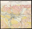
Geologische Karte von Winterthur und Umgebung.
Winterthur, 1924. Farbige Karte auf Leinen aufgezogen. 59 x 87 cm.
Herausgegeben von der Naturwissenschaftlichen Gesellschaft Winterthur und von der Geologischen Kommission der Schweizerischen Naturforschenden Gesellschaft unter Leitung von Alb(ert) Heim.
WEDEKIN BEATE, sous la direction D'ANGELIKA TASCHEN
Reference : 14410
(1997)
ISBN : 3822881023
Intérieurs New Yorkais.
1997 Taschen 1997, 299 pages, grand in 4 reliure cartonnée toilée bleue en très bon état avec jaquette en état d'usage (petite usures).
duche de Brabant en cartes et gravures anciennes.
, Duculot / Mappamundi,1983 Gembloux / Knokke, Belgique, 1983., Couverture reliee sous jaquette, 160 pages, 39 x31 cm, ** tres bon etat ( neuf !!! ). ISBN 9782801104767.
reproductions de cartes et gravures en couleurs et en noir et blanc, legendes en francais, anglais et allemand, captions in French, English and German, Beschriftung im Franzosisch, Englisch und Deutsch
duche de Brabant en cartes et gravures anciennes.
Gembloux / Knokke, Duculot / Mappamundi,1983, 1983 Hardcover, 160 pages, Texte en Francais, 385 x 305 mm, Tres belle exemplaire !!. ISBN 9782801104767.
reproductions de cartes et gravures en couleurs et en noir et blanc, legendes en francais, anglais et allemand, captions in French, English and German, Beschriftung im Franzosisch, Englisch und Deutsch
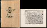
Die Schweiz auf alten Karten. Mit Geleitwort und einem kartographisch - technischen Anhang von Ed. Imhof.
Zürich, Verlag der Neue Zürcher Zeitung, 1945, in-4to, 227 S. + 4 n.numm. S., mit Textabb. u. 244 z.T. gefalt. Kartenabb., Widmung vom Vorbesitzer auf Vorsatz, Original H.-Leinenband, (erste Ausgabe).
Image disp.

(SLACES, NVVA)
Phone number : 41 (0)26 3223808
Die Schweiz auf alten Karten. Mit Geleitwort und einem kartographisch - technischen Anhang von Ed. Imhof.
Zürich, Verlag der Neue Zürcher Zeitung, 1945, in-4to, 227 S. + 4 n.numm. S., mit Textabb. u. 244 z.T. gefalt. Kartenabb., Original H.-Leinenband, Orig. ill. Umschlag. (Erste Ausgabe).
Image disp.

(SLACES, NVVA)
Phone number : 41 (0)26 3223808
Die Schweiz auf alten Karten. Mit Geleitwort und einem kartographisch-technischen Anhang von Prof. Ed. Imhof.
2. Auflage. Zürich, NZZ, 1969. 4°. 247 S. Mit zahlr. (dv. viele gef.) Karten u. Textillustr. nach alten Vorlagen. Orig.-Halblederband.
Philippe Vandermaelen (1795-1869).
Bruxelles, Bibliothèque Royale Albert 1er, 1969. 15 x 23, 63 pp., 4 planches en N/B, 6 figures, broché, très bon état.
Mapping the World. A History of exploration.
Folio Society, Londres, 2000. Un volume in-4 reliure de l'éditeur sous étui cartonné illustré, 263 pages, texte en anglais, riche iconographie en couleurs. Parfait état.
La librairie est ouverte du mardi au samedi de 9h30 à 12h30 et de 13h30 à 19h00. Commandes par courriel ou téléphone. Envoi rapide, emballage soigné. La librairie est ouverte du mardi au samedi de 9h30 à 12h30 et de 13h30 à 19h00. Commandes par courriel ou téléphone. Envoi rapide, emballage soigné.
Handful of History
, Alan Sutton, 1978 softcover, 201 pages, illustr. b/w. ISBN 0904387216.
A Handful of History is the result of his careful analysis of each card, and the result is a scholarly work on the subjects of each pack.
Das militärische Planzeichnen und die Militär-Kartographie. Ein Handbuch für Officiere. (ERSTAUSGABE).
Berlin, Ernst Siegfried Mittler, 1872, in-8vo, 2 Bl. + 86 S. + 2 lith. Figurentafeln, Bibl.-Stempel und hs. Bibl.-Nr. auf Titelbl., Leinenband, vergold. Titel und Bibl.-Nr. auf dem Rücken.
Jordan, Bibliographie zur Geschichte des Festungsbaues -.

(SLACES, NVVA)
Phone number : 41 (0)26 3223808
Speelkaarten Holland Casino
, Holland Casino, Ringband; COMPLEET; Inclusief kaartspel en losse bijlage met vertaling in Engels en Duits.
Speelkaarten. Dit boek bevat een exlusief kaartspel. en een los boekje
Karte des Kantons Zürich im Masstab von 1:25000 nach den in den Jahren 1843 bis 1851 gemachten Aufnahmen von 1825 bis 1865 auf Stein gravirt im topographischen Bureau in Zürich.
Zürich, Meliorations- und Vermessungsamt, 1990. 4°-quer. Titelblatt, Ueberischt und 30 faksimilierte, farbige Kartenblätter. 16 Seiten Dokumentation zur Faksimilierung. Orig. Pappschachtel mit Deckelschild.
Williams Brian Lye Keith (cartographie)
Reference : 75321
(1995)
ISBN : 9782724257434
Le petit Atlas des pays du monde
France Loisirs 1995 415 pages in8. 1995. cartonné. 415 pages.
french édition - Quelques marques plis de lecture et/ou de stockage mais du reste en bon état. Envoi rapide et soigné dans enveloppe à bulles depuis France
Williams Brian Lye Keith (cartographie)
Reference : 87879
(1995)
ISBN : 9782724257434
Le petit Atlas des pays du monde
France Loisirs 1995 415 pages in8. 1995. cartonné. 415 pages.
French édition - Livre présentant des marques de stockage et/ou de lecture sur la couverture et/ou les pourtours mais demeurant en très bon état d'ensemble. Expédition sous blister dans une enveloppe matelassée depuis la France
Williams Brian Lye Keith (cartographie)
Reference : 98687
(1995)
ISBN : 9782724257434
Le petit Atlas des pays du monde
France Loisirs 1995 415 pages in8. 1995. cartonné. 415 pages.
French édition :quelques marques de lecture et/ou de stockage sur couverture et coins mais du reste en bon état de lecture - Expédition sous blister dans une enveloppe matelassée depuis la France
Grote Atlas van Ferraris / Le Grand Atlas de Ferraris. 1:20 000 - grande edition ! groot formaat !
Tielt, Racine-Lannoo, 2018 Bound / Gebonden, Formaat : 405 x 510cm. Aantal pagina's : 600 pagina's . large Edition ! ISBN 9789401442589.
De eerste topografische atlas van Belgie in een nooit geziene uitgave - Eind 18de eeuw werd het grondgebied van het huidige Belgie voor het eerst volledig in kaart gebracht onder leiding van de Oostenrijkse graaf De Ferraris.- 275 met de hand getekende, topografische kaarten op een uiterst gedetailleerde schaal (1:11.520 verkleind naar 1:20 000)- Een uniek historisch document dat ons land toont voor de industriele revolutie, die het landschap grondig zou veranderen.- Een must voor landschapsdeskundigen, historici, geografen, heemkundigen en liefhebbers van geschiedenis- Tweetalige uitgave in samenwerking met de Koninklijke Bibliotheek van Belgie en het Nationaal Geografisch Instituut- Met een inleiding van Wouter Bracke, directeur Afdeling Kaarten en Plannen van de Koninklijke Bibliotheek.
Oeuvres choisies de Xavier de Maistre (Le lépreux de la cité d'Aoste, Les prisonniers du Caucase, La jeune sibérienne, Voyage autour de ma chambre, Le papillon).
Eugène Ardent & C.Thibaut, sans date, 192 pages, in 8 reliure percaline bleue, ouvrage orné du blason du collège de Soissons, bon état.
Carte routière de la division de CONSTANTINE
Imprimerie du Service Géographique de l'Armée, 1938. In-8 broché allongé. Carte dépliante en couleurs. Très bon état.
Les erreurs de la carte de France.
1906 Paris, Imprimerie du service géographique de l'armée, 1906. In-8, broché, couverture imprimée, 49 pp. 26 planches ht,Cartes et photographie.
manques au dos,texte bon
Carte du Département.-
De l'Atlas La France, Histoire Nationale des Départements. Lithographie Rigo et Cie. s.d. (milieu XIX°). Grande carte de 58x76cm, plusieurs fois repliée. Limites des arrondissements colorées, Armes et vue d'Auxerre en bordure. Rare.
Populäre Anleitung für die graphische Darstellung des Terrains in Plänen und Karten. Theoretisch-praktische Schule des Situationszeichnens. Zum Selbstunterricht und für Schulen. 3., auf Grund des neuen Zeichenschlüssels berichtigte und vermehrte Auflage.
Wien, Carl Gerold's Sohn, 1875, in-8°, 1 Bl. + 122 S. + 9 (1 farb.) Falttafeln, einige Bibliothekstempel u.a. auf Titelblatt und auf Rückseite der Tafeln, rezenter Pappband mit Leinen-Rücken, Original-Broschüre-Umschlagtitel auf dem Vorderdeckel aufgezogen.
Josef Zaffauk war k.k. Hauptmann im 35. Infanterie-Regiment, Professor an der technischen Militär-Akademie zu Wien.

(SLACES, NVVA)
Phone number : 41 (0)26 3223808
Atlas historique du golfe Persique (XVIe-XVIIIe siecles). Historical Atlas of the Persian Gulf (Sixteenth to Eighteenth Centuries), Historical Atlas of the Persian Gulf (Sixteenth to Eighteenth Centuries), Couto, Bacque-Grammont, Taleghani, Biedermann
, Brepols - Harvey Miller, 2006 Hardcover. 492 p., 75 b/w ill. 75 colour ill., 210 x 270 mm, Languages: French, English, Persian, Including an index. Fine copy. ISBN 9782503522845.
The Historical Atlas of the Persian Gulf is a joint initiative of the Ecole Pratique des Hautes Etudes in Paris, the University of Tehran, and the Documentation Centre of the Ministry of Foreign Affairs of Iran. The aim of this trilingual (French, English and Persian) publication is to trace the evolution of the cartographical representations of the Gulf between 1500 and 1750. About a hundred printed and manuscript maps from libraries and archives all over Europe, the United States and Iran have been gathered, some of them being published for the first time. The maps and charts are presented in five sections dedicated to Portuguese, Dutch, French, English and German cartography. Each item is published with enlarged detail reproductions showing the Gulf, and accompanied by brief commentaries as well as transcriptions of the place names and legends. The authors make numerous suggestions as to how the maps and charts developed in the context of international scientific exchange during the Early Modern age. Hence, the Atlas shows new perspectives on the genealogy of Gulf maps and provides an excellent working tool for future research on the cartography and the history of one of the World?s great strategic areas. Editors: Dejanirah Couto, Jean-Louis Bacque-Grammont, Mahmoud Taleghani Coordinator: Zoltan Biedermann Further contributors: Elio Brancaforte, Patrick Gautier Dalche L?Atlas historique du golfe Persique est une initiative conjointe de l?Ecole pratique des hautes etudes (Paris), de l?Universite de Teheran et du Centre de documentation du Ministere des affaires etrangeres d?Iran. L?objectif de cette publication trilingue (francais, anglais et persan) est de retracer l?evolution des representations du golfe entre 1500 et 1750. Une centaine de cartes imprimees et manuscrites provenant de bibliotheques et d?archives d?Europe, des Etats-Unis et d?Iran ont ete rassemblees, dont certaines publiees pour la premiere fois. Elles sont presentees en cinq sections consacrees aux cartographies portugaise, hollandaise, francaise, anglaise et allemande. Chacune d?elles est publiee avec une reproduction agrandie de la partie montrant le golfe et accompagnee d?un bref commentaire ainsi que de la transcription des toponymes et des legendes. Les contributions de plusieurs specialistes etudient en detail le developpement de la cartographie dans le contexte des echanges scientifiques de l?epoque moderne. Mettant ainsi en evidence de nouvelles perspectives sur la genealogie des cartes du golfe, l?Atlas constitue un outil de travail indispensable pour de futures recherches sur l?histoire de l?une des plus importantes zones strategiques du monde.
Topographia GALLIAE, sive descriptio famossimorum locorum in potentissimo Regno Galliae : partim ex usu & optimis Scriptoribus diversarum linguarum, partim ex Relationibus fide dignis per aliquot annos collectis, in ordinem redacta, & publico data per Martinum ZEILLERUM.
Barenreiter Bâle 1968-70 3 vol. 3 vols in-4, cartonnage de l'éditeur sous jaquette (défraichie).
Reproduction en fac-similé des planches de l'édition latine en 13 vol. de Francfort, C. Mérian, 1655-1661. Près de 300 planches et cartes dont certaines doubles ou repliées.
 Write to the booksellers