 Write to the booksellers
-
Type
Book (884)
Magazine (1)
-
Latest
Last 24h (1)
Last 3 days (2)
Last month (29)
Last week (1)
-
Language
English (1)
French (884)
-
Century
17th (6)
18th (22)
19th (61)
20th (447)
21st (43)
-
Countries
Belgium (10)
Canada (2)
Denmark (6)
France (772)
Switzerland (95)
-
Syndicate
ALAC (2)
ILAB (166)
NVVA (33)
SLACES (33)
SLAM (122)
In the land of the Bora or camp life and sport in Dalmatia and the Herzgovina 1894-5-6
Kegan Paul Trench Trübner & C° 1897 in8. 1897. Cartonné. iconographie en noir et blanc
couverture défraîchie frottement coins renfoncés tranche ternie fanée intérieur globalement propre rousseurs peu marqué
Belgique toujours grande et bel
Editions Complexe 1998 597 pages in8. 1998. Broché. 597 pages.
proche très bon état intérieur frais couverture défraîchie
Africa Trek II du Kilimandjaro au lac de Tibériade
Éditions France Loisirs 2006 582 pages 16x25x4cm. 2006. Broché. 582 pages.
proche très bon état ex libris tranche légèrement frottée
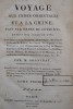
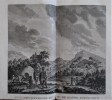
VOYAGE AUX INDES ORIENTALES ET A LA CHINE, FAIT PAR ORDRE DU ROI DEPUIS 1774 JUSQU'EN 1781. DANS LEQUEL ON TRAITE DES MOEURS DE LA RELIGION, DES SCIENCES & DES ARTS DES INDIENS, DES CHINOIS, DES PEGOUINS & DES MADEGASSES; SUIVI D'OBSERVATIONS SUR LE CAP DE BONNE-ESPERANCE, DES ISLES DE FRANCE & DE BOURBON, DES MALDIVES, CEYLAN, MALACCA, LES PHILIPPINES & LES MOLUQUES & DES RECHERCHES SUR L'HISTOIRE NATURELLE DE CES PAYS.
Paris, Dentu, 1806. 4 volumes in-8 (215x210mm), couverture d’attente, 372, 445, 413 et 489pp. Avec l’ATLAS in-4 (245x335mm) illustré de 120 planches sur 140. Exemplaire très frais, non rogné. Les planches de l’Atlas furent dessinées par l’auteur et gravées par Poisson, Milsan et Avril. De nombreuses planches sur l’Ornithologie, la zoologie, la botanique. A classic of natural history and discoveries in the far east including China, Ceylan, the Philippines, Burma, Maldives, Madagascar, the Island of Bourbon, etc. Drawings by Sonnerat, engraved by Poisson, Milsan and Avril. With the Atlas comprising 120 plates on 140. 4 volumes of text. Very clean.
Voyage au Cap de Bonne-Espérance et autour du monde avec le Capitaine Cook, et principalement dans le pays des Hottentots et des Caffres. Avec Cartes, Figures et Planches en taille douce. Traduit par M. Le Tourneur.
Paris, Buisson, 1787. 3 volumes in-8° (22x13cm) reliés plein veau époque, filets or sur les plats,dos lisse richement ornés avec titre et tomaison. Illustré de 15 planches dépliantes, 1 frontispice, une carte dépliante de la région du Cap. Coins usés, coiffes arasées. Édition in-8° paru la même année que celle in-4°. Il rejoignit Cook et s’occupa de recherches botaniques et d’histoire naturelle avec le Dr Forster.
Les sources du Nil.
Journal d’un voyage de découvertes par le capitaine SPEKE) Nouveau journal de voyages de CHARTON. Hachette éditeur. 1863. Volume IX livraisons 226-227-228-229-230-231-232-233-234 Pages 273 à 384/ traduction de ED FORGUES Gravures, cartes. Avec la couverture de livraison n°226 papier bleu imprimé. Complet en livraisons, non sorties de reliure. Edition pré-originale. Peu courant.
What led to the discovery of the source of the Nile.
Edinburgh and London, William Blackwood and Sons, 1864, lg. in-8vo, engraved frontispiece + X + 1 ll. (2 p.: half-title : Journal...Somali Land) + 372 p., + 1 double-page and 1 folding map, a very clean copy, engraved ex-libris ‘James Early Smith’ and a small legacy stamp on first fly ‘C.A.W. Guggisberg’, contemporary h.-leather, spine richly gilt.
First edition. An account of Speke’s first journey to Central Africa as part of Burton’s expedition, during which Speke claimed to have discovered the source of the Nile, a claim vigourously disputed by Burton, although time was to prove Speke correct. The book is in two parts, the first a journal of adventures in Somali-Land, the second a journal of a cruise on the Tanganyika Lake. Hilmy II, p 255. Image disp.
(SLACES, NVVA)
Phone number : 41 (0)26 3223808
SPITSBERGEN - THE FIRST OXFORD UNIVERSITY EXPEDITION TO SPITSBERGEN 1921.
Reference : 53796
(1925)
Spitsbergen Papers. Scientific Results of the First Oxford University Expedition to Spitsbergen (1921). 2 Vols.
London, Oxford University Press, 1925-29. Royal8vo. 2 orig. full cloth. Gilt lettering on spines. Containing 33 + 25 original offprints published in various periodicals in various sizes, published between 1921-29, some with plates and textillustrations, in the fields of geology, zoology, geography, hydrography, glaciology etc.
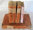
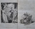
Comment j'ai retrouvé Livingstone. Voyages, aventures et découvertes dans le centre de l'Afrique. Ouvrage traduit de l'anglais avec l’autorisation de l’auteur par Mme H. Loreau, contenant 60 gravures et 6 cartes.
Paris, Librairie Hachette et Cie. 1874, 240x160mm, frontispice, 600pages, reliure demi-chagrin avec titre, auteur, filets et ornementations dorés au dos à faux-nerfs. Plats percaline. Toutes tranches dorées. Garde en soie. Bords des plats frottés et coins émoussés. Rousseurs éparses.
collation effectué: bien complets des 60 gravures in et hors-textes et des 6 cartes (déchirure sur une des carte déplinante sans atteinte du tracé),
AN AUTHENTIC ACCOUNT OF AN EMBASSY FROM THE KING OF GREAT BRITAIN. Together with a relation of the voyage undertaken on the occasion by His Majesty's ship the Lion, and the ship Hindostan, in the East India Company's service, to the Yellow Sea, and Gulf of Pekin; as well as of their return to Europe; with notices of the several places where they stopped in their way out and home. Taken chiefly from the papers of His Excellency the the Earl of Macartney.; Sir Erasmus Gower., and of other Gentlemen in the several departments of the Embassy.
Londres, Nicol, 1797. Première édition in-8°, complète en 3 volumes avec 3 grandes cartes dépliantes gravées par B. Baker. In-8° (220x140mm), reliés demi-basane, dos lisses décorés, petit manque à une coiffe. XVI-429pp. ; XV-383pp. ; XVII-490pp. ; tableau dépliant, illustré de 25 planches H.T., 3 grandes cartes dépliantes 42.5x62cm et 67.5x47 cm. Edition in-8° publiée la même année que l’originale, Staunton était secrétaire de Lord Macartney, envoyé pour établir des relations commerciales avec la Chine. La mission fut un désastre, la seule personne parlant le mandarin était le jeune fils de 11 ans qui sauva les apparences. Il visita Madère, Tenerife, Rio de Janeiro, Java, Sumatra, la Cochinchine etc. STAUNTON, Sir George. AN AUTHENTIC ACCOUNT OF AN EMBASSY FROM THE KING OF GREAT BRITAIN. Together with a relation of the voyage undertaken on the occasion by His Majesty's ship the Lion, and the ship Hindostan, in the East India Company's service, to the Yellow Sea, and Gulf of Pekin; as well as of their return to Europe; with notices of the several places where they stopped in their way out and home . Taken chiefly from the papers of His Excellency the the Earl of Macartney .; Sir Erasmus Gower ., and of other Gentlemen in the several departments of the Embassy. In Three Volumes. London: Printed for G. Nicol, 1797. First octavo edition, complete as issued in 3 volumes with 3 large fold-out maps engraved by B. Baker. Pp. xvi,429; xv,383; xvii,490 + [1] foldout leaf ('Appendix VII') inserted after p. 486. Worn contemporary bindings of diced calf with gilt lettering on spine. Folding frontispiece map in each volume: 1. 'A General Chart on Mercator's Projection, to show the train of the Lion and Hindostan from England to the Gulf of Pekin in Chiana, and of the their return to England.' 42.5 x 62.5 cm. 2. 'A Sketch of a Journey from ZHE-HOL in TARTARY by land to PEKIN and from thence by water to HANG-TCHOO-FOO in CHINA,' by J. Barrow. 67 X 47.5 cm. 3. 'Sketch of a Journey from HANG-TCHOO-FOO to QUANG-TCHOO-FOO of CANTON in CHINA,' by J. Barrow. 65 x 46.5 cm. (This edition, published in the same year and by the same publisher as the first two-volume quarto edition with the separate folio atlas of plates which was prepared at Government expense, is complete with only three maps as offered here.) Although Macartney's embassy to install a resident British minister and establish trade relations with China was not successful, it c.
The bear - ship of many lives
Washington square press 1964 in12. 1964. Broché.
bon état de conservation couverture un peu défraîchie intérieur propre
Les trésors de l'armada
Albin michel 1971 in8. 1971. Broché.
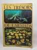
dos et bords frottés intérieur propre bonne tenue annotation en page de garde
L'or noir sous les flots bleus - la planète mer
Arts & voyages 1968 in8. 1968. Broché. photographie en noir et blanc
Bon état bords frottés intérieur propre
Voyage sentimental en france
A hiard 1833 in16. 1833. Cartonné.
Bon Etat taches et écornures d'usure normales
Lonely Planet Vietnam (French Edition)
Lonely Planet Publications - French editions 1998 560 pages 13x18x3cm. 1998. Broché. 560 pages.
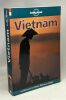
Bon état tranche un peu ternie intérieur propre bonnne tenue
La grande soif - voyage en Iran - traduit par Mathilde Camhi
Denoël 1959 in12. 1959. Broché.
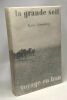
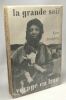
Bon état de conservation couverture défraîchie bords frottés sous papier de soie qques rousseurs dans les plats intérieurs intérieur propre
Voyage du conottière vers Venise
Émile-paul frères 1914 in12. 1914. Broché.
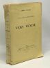
Mauvais état dos cassé abîmé (manque en haut) bords frottés intérieur propre par ailleurs
Kristian den Andres planer pa en arktisk expedition och deras förutsättningar. Ett bidrag till de geografiska upptäckternas ideologi
Lund, Gleerup 1960 220pp. + 2 plates out-of-text, 25cm., in the series "Lunds Universitets Arsskrift. N.F. Avd 1." Bd.54 Nr.5, softcover, stamp, G
SWEBACH (Jacques-François-Joseph), COUCHE Louis-François, dit COUCHE fils, BOVINET (Edme).
Reference : 230594
Bataille du Mont-Thâbor, livrée le 27 ventose An 7 (17 février 1799).
s.d. à vue : 28 x 39.5 cm - cadre : 39 x 50 cm, encadrée sous verre, cadre postérieur à baguettes dorées.
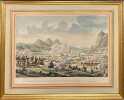
Gravure à l'eau-forte rehaussée de couleurs figurant la bataille du Mont-Thabor lors du siège de Saint Jean d'Acre durant la campagne d'Egypte. Dessin du modèle par Jacques François Joseph SWEBACH, (1769-1823).Eau-forte de Louis François COUCHE, (1782-1849).Gravure par Edme BOVINET (1767-1837?).
Phone number : 33 01 43 26 71 17
The scurrying bush
Chatto & windus 1966 in8. 1966. Cartonné.
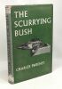
Bon état (BE) intérieur propre jaquette défraîchie (frottée)
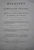
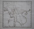
Relation de l’ambassade anglaise, envoyée en 1795 dans le royaume d’Ava, ou l’empire des Birmans.
Paris, Buisson, 1804. In-folio (37x28 cm) cartonnage orangé, non rogné (Reliure de l’époque). 2ff- 2 cartes dépliantes – 28 planches. Atlas seul, contenant deux cartes dépliantes et 28 planches de costumes, vues et histoire naturelle, gravées en taille-douce par Tardieu, Delignon, Niquet et Delvaux. Cartonnage un peu frotté, dos manquant, mais intérieur bien frais. Non rogné, sans les 3 volumes de texte. Atlas of the French translation “an account of an embassy to the kingdom of Ava”, 2 folding maps and 28 plates bound in contemp. board, binding worn, the plates are very clean, no foxing or water stain. Size folio (37x28 cm).
Cartères en feu
Arthaud 1952 in8. 1952. Broché.
rousseurs sur tranche supérieure mouillure sur la marge avec jaquette livre jauni
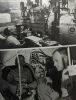
10 000 Miles à bord d'une Jonque.
S.l., Editions Arthaud (" Clefs de l'Aventure Clefs du Savoir, n° 41"), 1960. in-8°, 269 pages, photos n/b en hors texte, 1 carte h.t. depl., gloss., broche, couverture illustree plastifiee à rabats.
Bel exemplaire. [GE-1]
La nuit de Fès
Ernest flammarion 1932 in12. 1932. Broché.
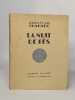
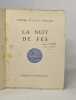
bon état de conservation dos légèrement frotté rousseurs sur tranches présence de rousseurs
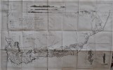
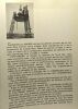
The Arctic Expedition 1910
Department of Marine and Fisheries Cloth Ottawa 1911
Fine Large octavo. 101 pages. Complete with the three folded maps. Interesting relation of the voyage of the "Arctic" in the north part of Canada. Numerous illustrations. Crisp copy.