 Write to the booksellers
-
Type
Autograph (3)
Book (23842)
Drawings (9)
Engraving (16)
Magazine (132)
Manuscript (5)
Maps (20)
Music sheets (41)
Old papers (3)
Photographs (8)
Postcards (3)
Posters (1)
Public sale (1)
-
Latest
Last 3 days (21)
Last month (129)
Last week (33)
-
Language
Czech (1)
Dutch (1)
English (24)
French (24050)
German (3)
Italian (1)
Latin (1)
Spanish (3)
-
Century
15th (1)
16th (8)
17th (82)
18th (546)
19th (4388)
20th (9906)
21st (1179)
-
Countries
Belgium (379)
Canada (44)
Côte d'Ivoire (15)
Denmark (760)
France (21364)
Germany (206)
Greece (4)
Italy (1)
Netherlands (4)
Switzerland (1307)
-
Syndicate
ALAC (44)
CLAM (8)
CLAQ (39)
CNE (13)
ILAB (14390)
NVVA (315)
SLACES (311)
SLAM (13148)
SNCAO (9)
Naturgeschichte. Uebersetzt und erläutert von Ph(ilipp) H. Külb.
37 Teile in 35 Bdn. in 4 Bdn. (ohne Register). Stuttgart, J. B. Metzler'sche Buchhandlung, 1840-56. 12°. 4380 S. Halbleinenbde. d. Zt. mit handschriftl. Rückenschildern (berieben). = "Römische Prosaiker", Bde. 155-215.
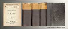
Kompletter Textteil ohne Register. Die oft fehlenden Bde. 36-39 (-1864) enthielten das "Geographische Register". - Mit Namenszügen auf den fl. Vorsätzen, mont. Inhaltsverzeichnis verso 1. Titelseite sowie zahlreichen Anstreichungen in Farbstift u. kl. Besitzereinträgen von alter Hand. Stärker gebräunt u. stockfleckig. - Einband-Rückenschilder gebräunt u. mit kl. Fehlstellen.
Fêtes et cérémonies siamoises. Le Siam pittoresque et religieux.
Firmin-Didot, 1935, pt in-8°, 124 pp, 50 photographies hors texte, broché, bon état. Edition originale, envoi a.s.
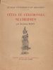
Raymond Plion était Consul de France à Bangkok. "Voici donc le résultat de promenades, d'observations, de traductions de textes plus ou moins sacrés, et de longs entretiens avec des érudits ou avec de vénérables et savants bonzes, dans l'ombre fraîche des pagodes, tout embaumées de la mince fumée des baguettes de santal se consumant devant les effigies de Bouddha."
REGARDS SUR L'EUROPE : LA HONGRIE
MARCUS. NON DATE. In-8. Broché. Bon état, Couv. convenable, Dos satisfaisant, Intérieur frais. 88 pages augmentées d'illustrations et de cartes en noir et blanc, dans le texte.. . . . Classification Dewey : 910.4-Voyages
Guide poche-voyage Classification Dewey : 910.4-Voyages
REGARDS SUR L'EUROPE : LA REPUBLIQUE TCHEQUE ET LA SLOVAQUIE
MARCUS. VERS 1994. In-8. Broché. Bon état, Couv. convenable, Dos satisfaisant, Intérieur frais. 91 pages augmentées d'illustrations et de cartes en noir et blanc, dans le texte.. . . . Classification Dewey : 910.4-Voyages
Guide poche-voyage Classification Dewey : 910.4-Voyages
Le Voyage mexicain. 1965-1966
Contrejour Cahier de Voyage 1990 In-8 Broché, couverture illustrée Signé par l'illustrateur
Avant-propos de Denis Roche. Textes de l'artiste in fine. 62 photographies en noir de Plossu, l'une reprise en couverture. 80 pp. > Très bel exemplaire signé par Plossu Très bon 0
Le Voyage mexicain. 1965-1966
Contrejour Contrejour 1979 In-8 Broché, couverture illustrée Signé par l'illustrateur
EDITION ORIGINALE. Avant-propos de Denis Roche. Textes de l'artiste in fine. 53 photographies en noir de Plossu, l'une reprise en couverture. In fine citation de Jack Kerouac, D.H. Lawrence, Malcolm Lowry & Antonin Artaud. 72 pp. > Très bel exemplaire signé par Plossu Très bon 0
Un an, ArrasPhotographies de Gildas Lepetit-Castel
Edité par l'auteur, Arras, 2007. In-8, reliure pleine toile éditeur sous jaquette illustrée, 70 pp. L'air de rien, préface par Bernard Plossu - L'image d'une ville, par Gildas Lepetit-Castel. - Planches
Avec 56 planches en noir et blanc en hors texte.Tiré à 1000 exemplaires chez l'auteur. --- Plus d'informations sur le site archivesdunord.com
Phone number : 01 42 73 13 41
La géographie vivante.
GRANDE MAISON D'EDITION DES PRIMAIRES.. 1923. In-8. Relié toilé. Bon état, Couv. défraîchie, Dos plié, Quelques rousseurs. 126 pages. Nombreuses gravures et illustrations en noir et blanc dans le texte. Nombreuses planches de cartes en noir et blanc, hors-texte. Dos toilé noir.. . . . Classification Dewey : 910-Géographie générale. Voyages
Cours élémentaire. Préface de Mortier. Exercices d'observations, préparation à la connaissance d'une carte, explication des termes géographiques, la Terre... Classification Dewey : 910-Géographie générale. Voyages
La Tentation de Bénarès
Magellan & Cie. 2007. In-8. Relié. Bon état, Couv. convenable, Dos satisfaisant, Intérieur frais. 60 pages. Nombreuses illustrations en couleurs dans et hors texte.. . . A l'italienne. Classification Dewey : 910.4-Voyages
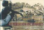
Classification Dewey : 910.4-Voyages
Concorde de la géographie des différents ages
Frères Estienne. 1772. In-12. Relié plein cuir. Bon état, Couv. convenable, Dos satisfaisant, Quelques rousseurs. 511pages. Relié cuir marron, tranches marbrées, titre sur pièce. Illustré de bandeau et cul-de-lampe, et frontispice de Antoine Pluche, 13 planches dépliantes de planisphères, sur papier à la forme. Coiffes légèrement frottées, page de garde tachée est déchirée en coin.. . . . Classification Dewey : 910-Géographie générale. Voyages
Ouvrage posthume de Pluche+ table alphabétiques des peuples, villes, rivières dont il est parlé dans cet ouvrage. Classification Dewey : 910-Géographie générale. Voyages
Concorde de la géographie des différens âges.
Paris Frères Estienne 1813 1 vol. relié in-12, veau fauve marbré, dos à nerfs, caissons ornés de fleurons et dentelle dorés, pièce de titre de maroquin rouge, tranches jaspées (bonne reliure de l'époque légèrement usée), LIX + 511 pp. Bon exemplaire bien complet du portrait-frontispice gravé par Cathelin d'après Blakey et d'une mappemonde et de 12 cartes dépliantes hors-texte.
Essai sur la Flore de la Guinée Française. Produits forestiers, agricoles et industriels - Côte occidentale d'Afrique
1906 Paris, Augustin Challamel, 1906, fort in-8 de 392 pp., reliure de l'époque de demi-percaline brique, 1er plat de la couverture imprimé en rouge et noir et illustré d'une photographie en noir et blanc conservé, bon exemplaire.
Ouvrage illustré de 80 planches de photographies hors-texte reproduites en phototypie.
Maroc
Marcus broché Bristol illustré Paris 1966 63 pages en format 11.5 - 19 cm - plans et dessins
Bon État
Grèce
Editions Marcus broché Bristol illustré Paris 1975 56 pages en format 11 - 19.5 cm - nombreuses illustrations
Bon État
Hongkong / MacAo - Taìwan ( Formose )
Marcus broché Bristol illustré Paris 1977 63 pages en format -12 - nombreuses illustrations
Très Bon État
Maroc
Editions Marcus broché Bristol illustré Paris 1966 64 pages en format 11 - 19.5 cm - nombreuses illustrations
Bon État
Maroc
Marcus broché Bristol Paris 1972 64 pages en format -12 - plans et illustrations
Très Bon État
Portugal
Marcus broché Bristol Paris 1972 64 pages en format -12 - nombreuses illustrations
Très Bon État
Tunisie
Marcus broché Bristol illustré Paris 1971 64 pages en format -12 - nomreux plans et illustrations
Très Bon État
Turquie
Editions Marcus broché Bristol illustré Paris 1978 64 pages en format 11 - 19.5 cm - nombreuses illustrations 2-7131-0013-5
Bon État
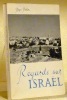
Regards sur Israël. Préface de Mgr François Charrière.
Fribourg, St-Paul 1959, 200x140mm, 186pages, illustré, broché.
Pour un paiement via PayPal, veuillez nous en faire la demande et nous vous enverrons une facture PayPal
VOYAGES DE RICHARD POCKOCKE, membre de la Société Royale, & de celle des Antiquités de Londres, &c. en Orient, dans l'Egypte, l'Arabie, la Palestine, la Syrie, la Grèce, la Thrace, &c. &c. &c.. Tome troisième seul
Neuchatel Aux dépens de la Société Typographique 1773 in 12 (16x9,5) 4 volumes reliures demi veau fauve de l'époque, dos lisses , pièces de titre et de tomaison de cuir vert, 556 pages (les pages 219 à 238 manquent, et sont remplacées par des feuillets blancs), 444 pages, 502 pages, 468 pages. Richard Pockocke (Pococke), 1704-1765. Traduit de l'Anglois, sur la seconde édition; par M. Eydous. Tel quel, les 4 premiers tomes seuls. Ensemble en bel état ( Photographies sur demande / We can send pictures of this book on simple request )
Bon Couverture rigide
VOYAGE DANS LE HAUTE ET BASSE EGYPTE
G.DUFOUR ET ED D'OCAGNE. 1827. In-18. Broché. Bon état, Couv. convenable, Dos satisfaisant, Intérieur frais. 222 pages avec gravure en frontispice. Court aperçu sur l'histoire de l'Egypte. Port d'Alexandrie. Ile du Phare. Monuments de l'antiquité. Catacombes près de la ville. Route par Aboukir et Rosette. Avec des additions tirées des voyages de Norden, Sonnini et autres.. . . . Classification Dewey : 910.4-Voyages
Bibliothèque géographique de la jeunesse ou recueil de voyages intéressant dans toutes les parties du monde, enrichis de carte géographiques coloriées et de vignettes. Traduit de l'allemand et de l'anglais et mis à la portée des jeunes gens par Mr M. BRETON. Classification Dewey : 910.4-Voyages
Voyage dans la Haute et Basse Egypte par R. Pococke. [suivi de] Voyage en Egypte et en Syrie par Browne, sepuis 1792 jusqu’en 1798. Tome 5 et 6, quatrième année, de la Bibliothèque géographique et instructive des jeunes gens ou Recueil de voyages intéressants, dans toutes les parties du monde, pour l’instruction et l’amusement de la jeunesse.
A Paris, Chez J. E. Gabriel Dufour, An XIV-1805. In-12 de 222, 214 pp. Plein veau raciné havane, dos lisse orné, pièce de titre bordeaux. Coiffes manquantes, dos et mors frottés.
![Voyage dans la Haute et Basse Egypte par R. Pococke. [suivi de] Voyage en Egypte et en Syrie par Browne, sepuis 1792 jusqu’en 1798. Tome 5 et 6, ...](https://static.livre-rare-book.com/pictures/KUA/2934_1_thumb.jpg)
![Voyage dans la Haute et Basse Egypte par R. Pococke. [suivi de] Voyage en Egypte et en Syrie par Browne, sepuis 1792 jusqu’en 1798. Tome 5 et 6, ...](https://static.livre-rare-book.com/pictures/KUA/2934_2_thumb.jpg)
![Voyage dans la Haute et Basse Egypte par R. Pococke. [suivi de] Voyage en Egypte et en Syrie par Browne, sepuis 1792 jusqu’en 1798. Tome 5 et 6, ...](https://static.livre-rare-book.com/pictures/KUA/2934_3_thumb.jpg)
Illustré de 2 gravures.