 Write to the booksellers
-
Type
Autograph (3)
Book (23610)
Drawings (9)
Engraving (16)
Magazine (132)
Manuscript (5)
Maps (19)
Music sheets (41)
Old papers (3)
Photographs (8)
Postcards (3)
Posters (1)
Public sale (1)
-
Latest
Last 24h (5)
Last 3 days (8)
Last month (401)
Last week (30)
-
Language
Czech (1)
Dutch (1)
English (24)
French (23818)
German (3)
Italian (1)
Latin (1)
Spanish (2)
-
Century
15th (1)
16th (8)
17th (79)
18th (541)
19th (4318)
20th (9653)
21st (1285)
-
Countries
Belgium (395)
Canada (40)
Côte d'Ivoire (15)
Denmark (756)
France (21106)
Germany (206)
Greece (4)
Italy (1)
Netherlands (4)
Switzerland (1324)
-
Syndicate
ALAC (40)
CLAM (5)
CLAQ (35)
CNE (15)
ILAB (14057)
NVVA (313)
SLACES (309)
SLAM (12825)
SNCAO (9)
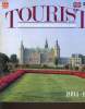
TOURIST IN COPENHAGEN AND NORTH ZELAND
EDITIONS ROCHER. 1994. In-8. Broché. Bon état, Couv. convenable, Dos satisfaisant, Intérieur frais. 122 pages. Nombreuses illustrations en couleur, dans le texte. Texte en anglais.. . . . Classification Dewey : 910-Géographie générale. Voyages
Classification Dewey : 910-Géographie générale. Voyages
Guides Diamant. Normandie. Contenant un appendice pour les îles Anglaises de Jersey et Guernsey.
1877 (4th ed.) xxiv, 366, 38, 112 p., 1 folded map, 4 folded city plans, publisher's blind stamped and gilded cloth
De Bordeaux à Toulouse, à Cette et à Perpignan.
HACHETTE L. et Cie. 2ème édition. 1862. In-12. Broché. Etat passable, Couv. défraîchie, Dos abîmé, Quelques rousseurs. 370 pages. Nombreuses illustrations en noir et blanc, hors-texte. Manques sur le dos cassé. Mouillures en fin d'ouvrage.. . . . Classification Dewey : 910.4-Voyages
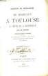
Itinéraire historique et descriptif contenant une carte des chemins de fer du Midi, un plan de Toulouse, et 32 vue dessinées d'après nature par Thérond. Classification Dewey : 910.4-Voyages
De Bordeaux à Toulouse, à Cette et à Perpignan
Editions de la Tour, 1989 - Réimpression de l'édition de 1873 - in-8 broché, couv. pelliculée, VIII+324 pages, 32 gravures, 2 cartes et plans - TBE
De Lyon à la Méditerranée. Deuxième édition contenant une carte, quatre plans et 126 vignettes dessinées par Hubert Clerget et Lancelot. Collection des Guides-Joanne.
Paris, Librairie de L. Hachette 1866, 180x115mm, VIII - 438pages, reliure demi-chagrin. Dos à faux-nerfs, titre doré. Bel exemplaire.
bien complet de la carte et des plans, Pour un paiement via PayPal, veuillez nous en faire la demande et nous vous enverrons une facture PayPal
De Paris à Bordeaux (2ème édition) / De Bordeaux à Toulouse, à Cette et à Perpignan. Itinéraire historique et descriptif (2ème édition)
Librairie L. Hachette et Cie, s.d./ 1862, in-12 rel. bas. beige (11 x 17,5), XII-380 p. / XII-374 p., 2 livres reliés en un volume, coll. des "Guides Joanne", nombreuses illustrations (vignettes, cartes, plans…), dos frotté, intérieur propre bien complet de ses cartes et illustrations, reliure d'époque solide, bon état.
Intéressante réunion de deux livres de voyage, dans leur 2ème édition (non datée pour "De Paris à Bordeaux")
De Paris à Lyon. Itinéraire contenant 3 cartes, 2 plans et 124 vignettes dessinées d'après nature par Hubert Clerget, Lancelot et Thérond. Quatrième édition
,Paris, Librairie Hachette et Cie 1873, 424+104 pp., 1 vol. in 12 relié pleine percaline bleu éditeur, dos lisse orné de caissons à froid avec titre doré, plats ornés d'encadrements à froid, titre doré sur le plat supérieur, 104 page de publicité sur papier bleu en fin d'ouvrage, quelques rousseurs.
Géographie du département de la Haute-Loire.. Quatrième édition.
Paris, Hachette et Cie, 1894; in-12, 64 pp., ill.in-t., carte dépliante en couleurs, bradel demi-percaline bleue (reliure de l'éditeur).
- - VENTE PAR CORRESPONDANCE UNIQUEMENT - LIEN DE PAIEMENT, NOUS CONSULTER.
Géographie du département de la Lozère.. Troisième édition
Paris, Hachette, 1892 in-12, 63 pp., gravures in-t., carte dépliante en couleurs, demi-percaline bleue (reliure de l'éditeur).
- - VENTE PAR CORRESPONDANCE UNIQUEMENT - LIEN DE PAIEMENT, NOUS CONSULTER.
Géographie du département de la Nièvre. Avec une carte coloriée et 15 gravures. Neuvième édition.
Paris, Librairie Hachette 1907 183x113mm, 65pages, cartonnage de l’éditeur. Bel exemplaire.
Pour un paiement via PayPal, veuillez nous en faire la demande et nous vous enverrons une facture PayPal
Géographie du département du Nord - 20 gravures et une carte
Librairie Hachette et Cie, Paris, 1873. In-12, cartonnage éditeur, dos toile bleue, 48 pp. Introduction - Département du Nord : I. Nom, formation, situation, limites... - II. Physiognomie générale. - III. Cours d'eau. - IV. Climat. - V. Histoire. - VI. Biographie. - VII. Population, langues, culte, instruction publique. - VIII. Divisions administratives. - ...
Avec une carte coloriée dépliante en fin de volume et 20 gravures.Ex-libris tamponné sur le plat supérieur. --- Plus d'informations sur le site archivesdunord.com
Phone number : 01 42 73 13 41
Géographie du département du Pas-de-Calais - 9 gravures et une carte
Librairie Hachette et Cie, Paris, 1913. In-12, cartonnage éditeur, dos toile bleue, 78 pp. Introduction - Département du Nord : I. Nom, formation, situation, limites... - II. Physiognomie générale. - III. Cours d'eau. - IV. Climat. - V. Curiosités naturelles. - VI. Histoire. - VII. Personnages célèbres. - VIII. Population, langues, culte, instruction publique. ...
Avec une carte coloriée dépliante en fin de volume et 9 gravures.Ex-libris tamponné sur le plat supérieur. --- Plus d'informations sur le site archivesdunord.com
Phone number : 01 42 73 13 41
Itinéraire des Bords du Rhin du Neckar et de la Moselle. Avec 15 Cartes et 12 Plans de villes.
Paris, L. Maison, 1854 ; fort in-12°,demi-chagrin bleu nuit à coins,dos à nerfs soulignés de filets à froid,auteur et titre doré, plats de toile granitée bleu nuit ,tranches peignées à l'identique du papier des gardes (J.Weber relieur) ; 8ff.chiffrés A à L, XXXVpp., 583pp.;fente à 1 mors ,mais reliure solide, piqûres à plusieurs cartes, tache rousse dans la marge supérieure des derniers feuillets (mouillure au borde des feuillets sans atteinte au texte).
Edition originale, bien complète de ses cartes et plans avec envoi autographe signé de l'auteur. (Reu-CH1)
Le Havre, Etretat, Fécamp, Saint-Valéry-en-Caux, Yport, Les Petites Dalles, Veules et Veulettes. 23 gravures, 4 cartes et 1 plan
,Paris, Librairie Hachette et Cie Collection Joanne, guides Diamant 1881, 64+XXVII-160+92 pp., 1 vol. in 16 relié pleine percaline verte éditeur orné de motifs à froid, titre doré au dos et sur le premier plat, publicités sur papier jaune en début et en fin d'ouvrage.
JOANNE, Adolphe (auteur du dictionnaire géographique et de l'itinéraire général de la France)
Reference : 110638
(1872)
Géographie, Histoire, Statistique et Archéologie des départements de la France. (10 tomes reliés en un seul) : Doubs - Haute Loire - Savoie et Loire - Loire - Ain - Savoie - Isère - Rhône - Haute Savoie - Jura
1872 A Paris, Librairie Hachette et Cie et à Besançon, Ch. Marion, Libraire - 1872 / 1883 / 1885 / - Fort In-12, plein chagrin souple, brun foncé, étiquette au dos - 99 + 63 + 64 + 62 + 60 + 64 + 70 + 53 + 64 + 69 pages - Ouvrage illustré (dans l'ordre des volumes) de 6 gravures et 1 carte - 1 carte coloriée et 11 gravures - 1 carte coloriée et 20 gravures - 1 carte coloriée et 16 gravures - 1 carte coloriée et 11 gravures - 1 carte coloriée et 14 gravures - 1 carte coloriée et 10 gravures - 1 carte coloriée et 19 gravures - 1 carte coloriée et 19 gravures -
Bon état, reliure comapcte malgré dos cassé - Cuir légèrement érosé - Etiquette partiellement manquante au dos - Un cahier de "L'Ain" relié à l'envers
Normandie. 2 cartes et 4 plans
,Paris, Librairie Hachette et Cie Collection 'Guides Diamant' des guides Joanne 1882, 64+XXIII-371+92 pp., 1 vol. in 16 relié pleine percaline verte éditeur orné de motifs à froid, titre doré au dos et sur le premier plat, tranches rouges, publicités sur papier jaune en début et en fin d'ouvrage.
Suisse
Hachette "Collection des Guides-Diamant" 1886, petit in-16 relié percaline verte de l'éditeur, XXXIV-480 p. suivies de 100 p. de publicité (très bon état) Guide touristique très complet, avec 12 cartes dépliantes.
Géographie du département du Cantal.. Cinquième édition
Paris, Hachette, 1895 in-12, 65 pp., ill. in-t. à pleine page, carte dépliante en couleurs, demi-percaline bleue, plats cartonnés (reliure de l'éditeur).
- - VENTE PAR CORRESPONDANCE UNIQUEMENT - LIEN DE PAIEMENT, NOUS CONSULTER.
Géographie du département du Cantal.. Huitième édition.
Paris, Hachette, 1909; in-12, 67 pp., ill. in-t. à pleine page, carte dépliante en couleurs, demi-percaline bleue, plats cartonnés (reliure de l'éditeur).
- - VENTE PAR CORRESPONDANCE UNIQUEMENT - LIEN DE PAIEMENT, NOUS CONSULTER.
Géographie du département du Puy-de-Dôme.. Septième édition
Paris, Hachette, 1890 in-12, 72 pp., ill. in-t. à pleine page, carte dépliante en couleurs, demi-percaline bleue, plats cartonnés (reliure de l'éditeur).
- - VENTE PAR CORRESPONDANCE UNIQUEMENT - LIEN DE PAIEMENT, NOUS CONSULTER.
Géographie du département du Puy-de-Dôme.. Treizième édition.
Paris, Hachette, 1911; in-12, 79 pp., ill. in-t. à pleine page, carte dépliante en couleurs, demi-percaline bleue, plats cartonnés (reliure de l'éditeur).
- - VENTE PAR CORRESPONDANCE UNIQUEMENT - LIEN DE PAIEMENT, NOUS CONSULTER.
Au Temps des Cochers. Histoire illustree du voyage en voiture attelee du XVe au XXe siecle.
Lausanne-Paris, Edita-Denoël, 1976. 205 X 305 mm. toile d"édit. sous jaquette. 211 pp. Très nombreuses illustrations en noir et en couleurs. Lexique des voitures attelées, bibliographie. Jaquette
Un Volume Gr. In-4°, de 212 pp. avec 300 illustrations, 15 cartes et 12 pages en quadrichomie. Rel. éditeur pleine toile marron sous jaquette illustré couleurs remplié. Remise de 20% pour toutes commandes supérieures à 200 €
Auvergne. Terre de volcans.
Cournon d'Auvergne, De Borée, 1993, pt. in-4, cartonnage souple photo coul. éd., 96 pp., papier glacé, nb. photos cartes et photos en coul., Bibliographie, Lexique des termes techniques, Sommaire, Un voyage au pays des volcans à travers de très belles photographies en couleurs. Très bon état
t kaid de Hiroshige
, Biblioth que de l'Image, 2002 Paperback, 95 pages, Texte en Francais, Tres belle exemplaire, 290 x 250 x 10 mm, illustrations en couleur. ISBN 9782914239691.
Hiroshige est surtout connu pour sa s rie de paysages au format horizontal The Fifty-three Stations of the T?kaid? et pour sa s rie de paysages au format vertical One Hundred Famous Views of Edo. Les sujets de son travail taient atypiques du genre ukiyo-e, dont l'accent tait g n ralement mis sur les belles femmes, les acteurs populaires et d'autres sc nes des quartiers de plaisir urbains de la p riode Edo au Japon (1603?1868). La s rie populaire Thirty-six Views of Mount Fuji de Hokusai a eu une forte influence sur le choix du sujet d'Hiroshige, bien que l'approche d'Hiroshige soit plus po tique et ambiante que les estampes plus audacieuses et plus formelles d'Hokusai. L'utilisation subtile de la couleur tait essentielle dans les estampes d'Hiroshige, souvent imprim es avec plusieurs impressions dans la m me zone et avec une utilisation intensive du bokashi (gradation des couleurs), qui taient toutes deux des techniques plut t laborieuses.