 Write to the booksellers
-
Type
Autograph (4)
Book (24614)
Drawings (9)
Engraving (16)
Magazine (104)
Manuscript (5)
Maps (15)
Music sheets (37)
Photographs (12)
Postcards (2)
Posters (1)
-
Latest
Last 24h (9)
Last 3 days (2)
Last month (144)
Last week (31)
-
Language
Czech (1)
Dutch (1)
English (24)
French (24786)
German (3)
Italian (1)
Latin (1)
Spanish (2)
-
Century
16th (8)
17th (87)
18th (544)
19th (4405)
20th (10490)
21st (1093)
-
Countries
Belgium (411)
Canada (42)
Côte d'Ivoire (14)
Denmark (755)
France (22050)
Germany (199)
Greece (5)
Italy (1)
Netherlands (4)
Switzerland (1338)
-
Syndicate
ALAC (42)
CLAM (6)
CLAQ (39)
CNE (14)
ILAB (14461)
NVVA (353)
SLACES (349)
SLAM (13167)
SNCAO (9)
Guillaume Pepin et Jeanne Meschin au début des Trois-Rivières
Association des Familles Pepin Inc Sherbrooke 2001 in-8 bien illustré, 161p. Couverture illustrée couleurs. :: Broché. Bon état.
Partition de la chanson : Prière du gitan (La)
Partitions sur les Gens du voyage Micro 1955

Bon état Petit format
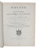
PÉRON, FRANCOIS & LOUIS FREYCINET, CHARLES ALEXANDRE LESUEUR & NICOLAS-MARTIN PETIT.
Reference : 53717
(1807)
Voyage de découvertes aux terres Australes. Exécuté par ordre de sa Majesté l'Empereur et Roi, Sur les Corvettes le Géographe, la Naturaliste, et la Goelette le Casuarina, Pendant les Anées 1800, 1801, 1802, 1803 et 1804. [Historique] Rédigé en parti... - [THE FIRST PUBLISHED COMPLETE AND FULLY DETAILED MAPPING OF AUSTRALIA]
Paris, 1807-1816 (Historique) & 1815 + 1812 (Navigation & Geographie). 4to & folio. Three text-volumes in 4to and three atlas, two in small folios, one (Navigation & Géographie) in elephant folio. All bound in nice contemporary brown half calfs with gilt spines. The first four (i.e. Historique-section) are uniform. The Navigation & Géographie-part with some brownspotting, the text-voume has been re-enforced at front hinge and corners and extremities are worn. There's a repaired tear to one of the maps. The Historique-section is generally very nice, clean, and fresh. Vil. I of the atlas has a torn lower back hinge, but no loss. A very nice set in strictly contemporaru bindings, with the tissue-guards, and FULLY COMPLETE WITH ALL 40 ETHNOLOGICAL AND ZOOLOGICAL PLATES, MOSTLY COLOURED, ALL 46 MAPS, BOTH TABLES, AND THE FRONTISPIECE PORTRAIT. Historique: Text: XXXI, (1), 471 pp. + engraved frontispiece-portrait + two folded tables (4), XV, (1), 496, (2, -errata), III (contents) pp. Atlas: (vol. I, plates:) (6) pp. + 40 plates (numbered 2-41 NB. plate I of the the map-volume constitutes also nr. I of the plate-volume - as always (see also Ferguson) )" (vol. II, maps:) 6 pp. + 14 maps, two of which are folded.Navigation & Géographie: Text: XVI, 576, (2, -errata) pp. Atlas: (2) ff. + 32 maps, 25 of which are double-page, 7 single.
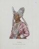
Rare fully complete copy, with both the History- and Navigation&Geography- parts of one the most important and famous descriptions of Australia ever published. One of the maps included constitutes the first published map to show the entire South Australian coastline.In April 1802, the British navigator Matthew Flinders and his French counterpart Nicolas Baudin met at Encounter Bay. Both men had been sent out by their respective governments to chart and explore the unknown southern coast of Australia. Between them, Flinders and Baudin explored, mapped and named most of the 3,700 kilometres from Ceduna on the west coast to Robe in the southeast, known in 1802 as ""the unknown coast"". Although Flinders in fact beat Baudin to ""the unknown coast"", the famous French account was published first and thus constitutes not only the first full description of the continent of Australia, but also contains the first published complete and fully detailed map of Australia. ""In October 1800, Nicolas Baudin commanded an expedition to the south seas to complete the French survey of the Australian coastline, and make scientific observations. The two ships, ""Le Geographe and Le Naturaliste"", arrived near Cape Leeuwin in May 1801. Following instructions issued in France, both ships sailed north along the western coast of the continent. After staying at Timor, the French then sailed south to survey Van Diemen's Land [Tasmania]. In following this itinerary, they missed the opportunity to be the first Europeans to survey the unknown southern coast. By early April 1802 Baudin in ""Le Geographe"" was in South Australian waters. He sailed westwards along the southern coastline, meeting Flinders at Encounter Bay, and continuing to Golfe de la Mauvaise [Gulf St Vincent] and Golfe de la Melomanie [Spencer Gulf], giving French names to many locations already named by Flinders. At Cape Adieu the survey was abandoned and Baudin sailed for Port Jackson where ""Le Naturaliste"" had already arrived. After wintering at Port Jackson, Baudin returned to the southern coast for a more detailed survey, and in January 1803 circumnavigated Ile Borda [Kangaroo Island]. While Baudin anchored at Nepean Bay, Freycinet and the geographer Boullanger explored the two gulfs in ""Casuarina"" - ""Le Naturaliste"" had been sent back to France with its scientific collections. By the end of February ""Le Geographe"" and ""Casuarina"" rendezvoused at King George Sound, and then explored the west and northwest coasts of 'New Holland', before heading home via Timor. Baudin died in 1803 on the homeward voyage, so publication of the account and charts of his voyage was undertaken by Francois Peron, the expedition's naturalist. The first volume of ""Voyage de decouvertes aux Terres Australes"" and Volume I of ""Atlas"", which included plates, was released in 1807. French place names were recorded for 'Terre Napoleon' west of Wilson's Promontory. As Peron died in 1810, cartographer Louis de Freycinet continued to edit the voyage's account, and in 1811 he published the second part of ""Atlas"", which featured the charts of the expedition, again recording French place names on 'Terre Napoleon.' The French expedition's charts were published in 1811 - three years before Flinders'. Freycinet's ""Carte General de la Nouvelle Hollande"" was therefore the first chart of Australia, bringing together the results of English and French surveys. The French charts are generally acknowledged as beautiful with their elaborate title cartouches with flora and fauna....In the end, claims of 'primacy' - or who was where first - were what mattered most to the authorities and to Flinders. With the French charts published first, with French names along the length of the South Australian coast, they laid a claim to that portion of the continent and called it ""Terre Napoleon"". When Flinders' charts were finally published in July 1814, he was scrupulous in honouring prior discoveries on the coast - hence 'Discovered by Nuyts 1627' and 'Discovered by Captn. Baudin 1802', which marked the western and eastern limits of his discoveries.It was not until the second edition of Voyage de decouvertes aux Terres Australes was published in 1824 that French place names were only recorded where the French had been the first to survey along the southern coast, mainly in the south-east and on the southern coast of Kangaroo Island, and Flinders' discoveries and place names were restored by the French authorities."" (State Library of South Australia). Apart from the seminal importance to the maps and geographical information of this celebrated voyage, it is also famous for its ethnological surveys and natural history specimens. In fact, the expedition brought back to France the most important collection of natural history specimens in the history of the French Museum.The voyage was commanded by Nicolas Thomas Baudin (1754-1803), who died at Batavia on the way home. The maps in both atlases are mainly by de Freycinet, and the fine illustrations are by Lesueur and Pétit. The plates consist of 5 coloured coastal views, natural history subjects (9 coloured), topographical views, native weapons, canoes, habitations, etc. (some coloured), and 10 portraits (4 coloured) of NAMED Aborigines by Nicolas-Martin Petit (1777-1804). One of the folding topographical views is a fine plate of Sydney by Charles Alexandre Lesueur (1778-1846). Louis de Freycinet: ""With his brother Henri, Louis de Freycinet joined the Baudin expedition as a junior lieutenant. Louis was born in August 1779 and joined the French navy in 1793. His duties on the expedition were as a cartographer-surveyor. While the French expedition was in Sydney from June-November 1802, Baudin bought a locally built schooner the ""Casuarina"", and placed Freycinet in command. It would be used for close inshore survey work, particularly on the southern Australian coast. While charting the South Australian gulfs, Freycinet missed his rendezvous with Baudin in ""Le Geographe"", but joined him in King George Sound. They then sailed along the Western Australian coast together, before going to Timor and then Mauritius. After the expedition's return to France, Freycinet worked on the charts and when the atlas was published in 1811 the entire unknown coast from Wilson's Promontory to the Head of the Bight was shown as Terre Napoleon, with French place names on all the prominent features. Following Péron's early death, Freycinet completed the official account of the expedition. From 1817 to 1820 Freycinet led a scientific expedition around the world, studying meteorology and magnetism. His wife Rose accompanied him. Despite shipwreck most of the expedition's records were saved. In 1824 a second edition of the account of the Baudin expedition was published, edited by Freycinet, and in the Atlas Matthew Flinders' place names were restored to the coast he had first discovered. Louis de Freycinet died in August 1842."" (State Library of South Australia). Ferguson: 449, 536 & 603.
La découverte des mers , n° 299 de cette collection
Presses Universitaires de France - P.U.F. , Que Sais-Je ? Malicorne sur Sarthe, 72, Pays de la Loire, France 1965 Book condition, Etat : Bon broché, sous couverture imprimée éditeur In-8 1 vol. - 128 pages
1ere édition Contents, Chapitres : Introduction - La mer Intérieure et comment en sortir - Epopée sans lendemain - Progrès technique, épices et propagation de la foi - Grandeur et décadence de la voile - La troisième dimension - L'homme sous la mer - Bibliographie sommaire quelques points rouges à l'encre dans les marges, papier legerement jauni, sinon bon etat - format de poche
La fille aux serpents. Souvenirs des Antilles.
Paris, Librairie des Bibliophiles, Jouaustm M. DCCC LXX VI, (1876), pt. in-8vo, frontispice eaux-forte d’Alfred Le Petit + 108 è., rousseurs, brochure originale.
(SLACES, NVVA)
Phone number : 41 (0)26 3223808
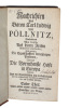
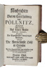
Nachrichten des Baron.... von Pöllnitz, enthaltend was derselbe auf seinen Reisen besonderes angemercket, nicht weniger die Eigenschaften dererjenigen Personen, woraus die wornehmste Hofe in Europa bestehen. Aus der Französischen neu=verbessert= und u...
Franckfurt am Mayn, 1735. Bound in one contemp. full calf. Light wear to top of spine. Titlelabel with gilt lettering. Spine slightly rubbed. (10),442(2),469(2),306(2),240 pp. Internally clean.
Reise i Chili og Peru og paa Amazonfloden i Aarene 1827-1832. Oversat af Frederik Schaldemose. 1.-2. Deel. (Kpl.).
Kiöbenhavn, C. Steen, 1842. Et samtidigt hldrbd. med rygforgldning. Ryg med lette brugsspor. 495,482,(2) pp.
First danish editon of ""Reise in Chile, Peru und auf dem Amazonenstrome während der Jahre 1827-1832. Leipzig, 1835."" - Sabin: 63630.
Moeurs et coutumes de la Malaisie.
Payot, 1939, in-8°, 205 pp, traduit du hollandais, une carte, broché, couv. illustrée, état correct
L'espèce humaine.
1901 (13th ed.) 368 p., publisher's embossed and gilt cloth. Bibliothèque Scientifique Internationale. Very good copy (binding and internally). Ex library Claude Gouffé.
Rapport sur les progrès de l'anthropologie,Recueil de Rapports sur les Progrès des Lettres et des Sciences en France
Paris, Imprimerie Impériale, 1867. In-4, demi-basane 570 p., EO, ,dos lisse frotté orné de filets dorés,coiffes lég. frottées. Édition originale de cet important rapport qui affirme que l'homme doit être étudié dans sa globalité, comme les autres animaux.
cachets bibliothéque,quelques rousseurs,bon état.
Un Parisien dans les Antilles. Saint-Thomas, Puerto-Rico, La Havane, La Vie de Province sous les Tropiques.
PLON E.. 1883. In-12. Relié demi-cuir. Etat d'usage, Couv. défraîchie, Dos satisfaisant, Rousseurs. 349 pages. Frontispice en noir et blanc, avec serpente. Quelques planches de gravures en noir et blanc, avec serpentes. Etiquette de code sur la coiffe en-tête et tampons de bibliothèque sur la page de titre et dans quelques marges. Coins et coupes des plats frottés.. . . . Classification Dewey : 910.4-Voyages
Classification Dewey : 910.4-Voyages
DIVISION ET REPARTITION DE LA POPULATION BERBERE AU MAROC .
Traduit de l'allemand par A.Simon . 1904 . Alger ,Adolphe Jourdan , In 8° relié 1/2 maroquin lierre .Dos lisse .Première couverture conservée (Reliure moderne) 222 pp.Une carte dépliante .(Passages soulignés au crayon aux 120 premières pages )
Dictionnaire amoureux de la Bretagne
Plon, coll. « Dictionnaire amoureux » 2013 In-8 broché 20,4 cm sur 13,1. 785 pages. Bon état d’occasion.
Bon état d’occasion
L'ANGLETERRE DANS VOTRE POCHE, HOW TO GET THERE, HOW TO LIVE THERE
Hatier. 1968. In-8. Broché. Bon état, Couv. légèrement passée, Dos satisfaisant, Intérieur bon état. 189 pages. Couverture illustrée en couleur. Illustré de dessins et de photos en noir et blanc.. . . . Classification Dewey : 910.4-Voyages
Préface de H. Evrard. Le voyage. Les monnaies. Hébergement... Classification Dewey : 910.4-Voyages
QUENELLE G., TOURNAIRE J., DELPORTE D., ENGLE D.
Reference : RO60032747
(1976)
ISBN : 2218035545
LES USA DANS VOTRE POCHE
Hatier. 1976. In-8. Broché. Bon état, Couv. convenable, Dos satisfaisant, Intérieur bon état. 191 pages. Couverture illustrée en couleur. Illustré de dessins et de cartes en noir et blanc.. . . . Classification Dewey : 910.4-Voyages
Le découpage régional. Adresses utiles. La langue... Classification Dewey : 910.4-Voyages
QUENELLE G., TOURNAIRE J., DELPORTE D., ENGLE D.
Reference : RO60032750
(1979)
ISBN : 2218035545
THE USA IN YOUR POCKET
Hatier. 1979. In-8. Broché. Bon état, Couv. convenable, Dos satisfaisant, Intérieur bon état. 191 pages. Couverture illustrée en couleur. Illustré de dessins et de cartes monochromes.. . . . Classification Dewey : 910.4-Voyages
Le découpage régional. Adresses utiles. La langue... Classification Dewey : 910.4-Voyages
LES POPULATIONS MALGACHES A TRAVERS LEUR HISTOIRE .
1953 . Publié par la section de documentation militaire de l'Union Française , Grand in 8° reprographié 160 pp. Cartes en couleurs .
Les chroniques du château de Compiègne
Jouve, éditeur, Paris, 1953. In-8, cartonnage éditeur sous jaquette illustrée, vii-230 pp. I. Les infortunes de Marie de Médicis - II. Au temps de la Fronde - III. Un camp du Roi-Soleil - IV. Napoléon et Marie-Louise - V. Le retour des Lys - VI. Un mariage royal sous Louis-Philippe - VI. ...
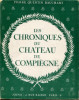
XVII planches en noir et blanc en hors-texte. --- Plus d'informations sur le site archivesdunord.com
Phone number : 01 42 73 13 41
Esame e difesa del decreto pubblicato in Pudisceri da Monsignor Carlo Tommaso di Tournon... Approvato e confermato dal Sommo Pontefice Benedetto XIII...
Venise : Antonio Mora, 1730 In-4, XXX-300 pages et 4 planches. Exemplaire non rogné, dans son cartonnage d'origine.
L’auteur, cardinal dominicain alors commissaire général du tribunal de l’Inquisition, prend ici la défense du décret promulgué par le cardinal de Tournon à Pondichéry en 1704, proscrivant les rites traditionnels locaux. La première édition parut en 1728. Ce plaidoyer s’inscrit dans le contexte de la Querelle des rites qui, depuis le XVIIe siècle, divise les missionnaires de la Chine et de l'Inde sur la désignation de Dieu dans les langues locales, l'adaptation des rites chrétiens, l'acceptation ou le refus des rites indigènes comme la vénération des ancêtres. Tandis que les Jésuites sont favorables à des « accommodations », d'autres missionnaires y voient des concessions à l'idolâtrie.Le cardinal Charles Thomas Maillard de Tournon (1668-1710), patriarche latin d'Antioche, fut nommé vicaire apostolique aux Indes et à la Chine en 1702 pour mettre fin aux rites malabars dont les Jésuites avaient autorisé la pratique aux nouveaux convertis. Malgré la confirmation de son décret par le pape Benoît XIII en 1727, la polémique fit rage jusqu'en 1744. Les planches décrivent les objets autorisés ou interdits, ainsi que le plan d'une mission.
Quer durchs Grönlandeis. Die Schweizerische Grönland-Expedition. 1912 / 13.
München, Ver. von Ernst Reinhardt, 1914. 1 vol. in-8 de VIII-196 pages, pleine toile écrue, dos lisse, 1er plat illuatré. Plats tachés.
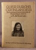
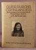
Illustré de 37 vignettes, 15 planches, dont certaines en couleurs et 1 en frontispice, et 1 carte.
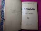
LE PANAMA ET LA RÉPUBLIQUE
LE PANAMA ET LA RÉPUBLIQUE Quesnay de Beaurepaire L’Affaire du Panama et les commissions politiques. Vol. in8, 180x130, relié, coins émoussés, bon état intérieur, 304pp Paris, Juven Editeur, ss date 1899
L'ALGERIE .
1885 . Paris ,Jouvet , In 12 relié pleine toile verte .VIII ,305 pp.Illustré de 100 gravures sur bois et d'une carte (Qq. Légères rousseurs)
Sous le ciel d'Orient. Impressions et souvenirs.
Desclée de Brouwer & cie. 1895 292p "1 volume grand IN8. Reliure d'époque en pleine percaline rouge. Plat orné d'un médaillon ""Institution Sainte Marie"". Dos lisse orné et titré. Tranches dorées.Ouvrage illustré de 27 gravures en noir in & h.t. Bon état."
PAYSAGES DU PORTUGAL
SECRETAIRE NATIONAL DE L'INFORMATION. non daté. In-12. Broché. Bon état, Couv. convenable, Dos satisfaisant, Intérieur frais. 88 pages + environ 20 planches illustrées en noir et blanc.. . . . Classification Dewey : 910.4-Voyages

Classification Dewey : 910.4-Voyages