 Write to the booksellers
-
Type
Any type (1)
Book (1809)
Engraving (3)
Magazine (6)
Maps (14)
-
Latest
Last month (3)
Last week (4)
-
Language
English (1)
French (1829)
German (2)
Portuguese (1)
-
Century
16th (3)
17th (17)
18th (124)
19th (433)
20th (260)
21st (8)
-
Countries
Belgium (59)
Denmark (622)
France (399)
Italy (14)
Switzerland (739)
-
Syndicate
ILAB (1279)
NVVA (563)
SLACES (563)
SLAM (80)
Historisk Qvartalsskrift. Red. af T.A. Becker. 1.-2. Bd.: 1.Hefter (alt som udkom).
K., 1843-44. 2 samt.hldrbd- Rygge slidte. 332, 160 pp.
Historisk-topografisk indhold. Indeholder bl.a.""Reise gjennem Jylland til Skagen og Lesø i Sommeren 1843"", 106 pp.
Das Hochgebirge der Schweiz. Prachtwerk mit 72 der interessantesten Ansichten aus dem Alpen-, Felsen- und Gletschergebiete. Originalzeichnungen in Stahl radirt von C. Huber. 3., erweiterte Auflage.
Basel, Chr. Krüsi, o.J. (ca. 1880), gr. in-4°, 4 Bl. + 410 Spalten (205 S.) + 73 Original-Stiche einschliesslich gestoch. Titel, vereinzelt stockfleckig, Original-Leinenband mit Gold- und Tiefprägung.
Komplettes Exemplar dieses Klassikers der alpinen Ansichten aus u.a. Graubünden, Berner-Oberland, Glarus, Wallis. Dieser Ausgabe des berühmten Werkes wurden nach d. 1. Ausgabe, noch zusätzlich 6 Stahlstichansichten beigefügt. Der Stahlstich: Panthenbrücke Klöntalsee wurde mit 1 Blatt: Ct. Glaris (Panorama-Ansicht und 3 Ansichten) ausgewechselt. Der Textteil wurde ebenfalls erweitert.Mit Ansichten von u.a. Davos, St. Moritz, Appenzell, Säntis-Panorama, Rhonegletscher, Leuk, Grindelwald, Aletsch-Gletscher, Falkenstein, Montblanc, Hospiz St. Bernhard, verschiedene Häuser-Typen. Perret 3253 (Ed. française); Lonchamp 2231; BSL III/93 (EA 1868, mit 48 Stahlstichen, und 2. Ausgabe 1875, mit 64 Stahlstichen). Image disp.
(SLACES, NVVA)
Phone number : 41 (0)26 3223808
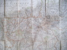
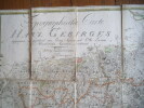
Carte topographique et routière de la Suisse et des contrées limitrophes. Dressée et dessinée par Jean Frédéric d’Osterwald. Gravée à Paris par Delsol.
Paris, sans date, vers 1850, 250x180mm, format de la carte 97x72cm., toilé, sous étui en percaline, feuille de titre collée sur le plat supérieur, frontières coloriées. Bel exemplaire.
Carte topographique et routière de la Suisse et des contrées limitrophes.
Paris, Imprimerie L. Martinet, sans date. Carte entoilée au format ouvert de 72 x 98 cm., en 16 parties, sous étui de carton bleu, avec large vignette de titre contrecollée au premier plat. Bords de l'étui frotté, avec manque, rousseurs à la vignette de titre, et à la toile de 2 des parties de la carte.
La carte, en couleurs, a été gravée par Delsol. "La gravure en a été confiée à l'un des plus habiles graveurs connus, et rien n'a été négligé pour mettre cette carte au premier rang", comme le signale un feuillet contrecollé au verso de la carte. Dernier travail d'Ostervald, publié après sa mort, et que l'on peut situer au début des années 1850.
![Carte topographique et routière de la Suisse et des contrées limitrophes.. OSTERWALD [OSTERVALD] Jean Frédéric d':](https://static.livre-rare-book.com/pictures/KUA/12499_1.jpg)
![Carte topographique et routière de la Suisse et des contrées limitrophes.. OSTERWALD [OSTERVALD] Jean Frédéric d':](https://static.livre-rare-book.com/pictures/KUA/12499_1_thumb.jpg)
![Carte topographique et routière de la Suisse et des contrées limitrophes.. OSTERWALD [OSTERVALD] Jean Frédéric d':](https://static.livre-rare-book.com/pictures/KUA/12499_2_thumb.jpg)
Oekonomisch-Statistische Beschreibung der Insel Fehmern.
Schleswig, 1796. Cont.hcalf. XVI,398 pp. a. 6 fold. Tables + Verzeichn.d.Subscribenten(8) pp. A wormhole in lower margin of Verz.d.Subscr.,otherwise fine.
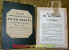
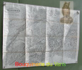
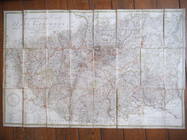
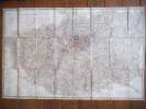
Topographische des Harz Gebirges.
OTTO LASIUS Georg Sigismund. Topographische des Harz Gebirges. Im Verlag WEIMAR des industrie- Comptoirs 1798. Caret topographique des montagnes du HAZRZ pris et dessinée par Georg Sigismund Otto Lasius. Belle carte en couleurs, entoilée, format 525 x810mm 180x105 pliée.
Description géographique et topographique du Département de la Dyle en forme de Dictionnaire (An VII-An VIII).- Avec un supplement sur la reunion des Cantons en Arrondissemens, et une Carte de Demarcation.
Bruxelles : Archives Generales du Royaume, 1996. (Algemeen Rijksarchief en Rijksarchief in de Provinciën . Reprints = Archives générales du Royaume et Archives de l'Etat dans les provinces . Reprints ; 38) grand in-8°, 200 + 8 pp., carte, broche, couv.
A l'etat de NEUF. [AGR*][CA28-1][AGR-4] Reproduction photomécanique de l'édition : Gaborria, An VII [i.e. 1798/99].
De Danske Vestindiske Öers Tilstand i Henseende til Population, Cultur og Finance-Forfatning, i anledning af nogle breve fra St. Croix, indrykkede i det Politiske og Physiske Magazin for Marts og April Maaneder 1797, hvortil er föiet Beskrivelse om Su...
Kiöbenhavn, Schultz, 1797. 8vo. Uncut, partly unopened, in contemporary (original?) marbled boards. Part of spine missing and wrappers very loose. Internally with very light occassional brownspotting. 84 pp. + four folded plates, each with the accompanying ""Plan""-leaf (complete).
First edition of Oxholm's early and important work on the state of the West Indies in which he describes the government loans to planters to buy slaves in the ten years from 1792 until abolition of the trade in 1802 and the effects of British imports on the price and quality of slaves. ""Denmark acquired St. Croix from France in 1733. Oxholm was a young Danish officer sent to the Danish West Indies in 1778 to map all the fortifications in the islands, suggest improvements, and estimate their cost. He was also to create topographic maps of the islands of St. Thomas and St. John. He mapped only St. John, but presented numerous drawings and maps at the Danish court where his work was approved and rewarded. Having married into a St. Croix family, he returned there and became a sugar planter. In 1794 he privately published a detailed map of St. Croix that he had created."" (John Russell Bartlett Collection)""Lieutenant Oxholm was a promising young man of 24 when he was sent to the Danish possessions in The West Indies. Oxholm’s task was to examine the ability of the colony to defend itself against attack and draw new maps of St. Thomas and St. John. But Oxholm was an enterprising man and he also examined a number of issues that he had not been tasked to deal with at all. The political situation of the colony, conditions for soldiers and enslaved laborers, health care and conditions for prisoners and lepers, organization of the sugar trade and the schools were all described. Oxholm became an advocate of slavery that he believed was necessary for the economy of the colony. But he was critical of the miserable living conditions of enslaved laborers, soldiers, and the sick.Oxholm’s maps were of high quality and impressively accurate. Some have been in use almost up until the present day. Today, his maps and drawings are considered by the Danish Ministry of Culture to be of “unique national importance”. Oxholm also left behind a number of reports and books about conditions in the Danish colony in the West Indies. The most important one is his book on the state of the West Indies, De danske vestindiske Øers Tilstand i Henseende til Population, Cultur og Finance-Forfatning (""The State of the Danish West Indian Islands with Respect to Population, Culture and Financial Condition"") from 1797, containing both descriptions and illustrations of plantation operations in the colony. Oxholm also wrote several debate pieces where, among other things, he defended the slave trade as late as 1806. Oxholm’s energy did not diminish, and right up until his death he continued making maps and drawings and suggesting improvements to conditions in the Danish colony in the West Indies."" (Danish State Archive, The Danish West-Indies - Sources of history).
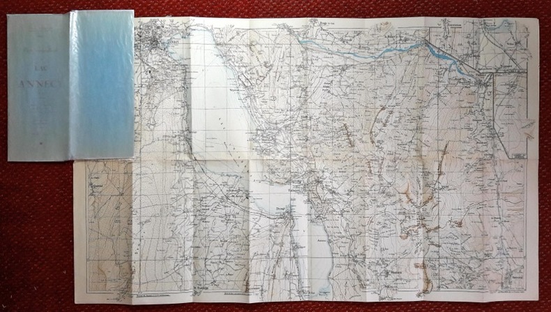
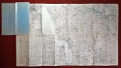
Carte topographique du Lac d'Annecy et de ses environs. Massifs de la Tourette, les Dents d'Ales, du Mont de Veyrier et du Semnoz. Vallées de Thones, Serraval et Montmin. Echelle 1/25.000.
Lyon, chez l'auteur, sans date. Carte dépliante couleurs au format oblong ouvert de 86 x 53 cm., sous couverture bleue.
Second plat détaché.
Beskrivelse over Kallundborg tilligemed Hans Jakob Paludans Levnetsbeskrivelse med Kobbere.
Kiøbenhavn, Sebastian Popp, 1788. Samtidigt hldrbd. Rygforgyldning. Kapitæler lidt slidte. Ryg med lettere brugsspor. Forgyldt skindtitel. (12),LXXXVIII,297 pp. Kobberstukket frontispiece samt stor kobberstukket foldet grundtegning. Trykt på blåt skrivepapir.
Originaludgaven af den første selvstændige beskrivelse af Kalundborg.
Dictionnaire des Rues de Paris avec tous les changements et additions jusqu'à ce jour, suivi de renseignements sur les Mairies, Commissariat , Justices de paix, Consulats, Musées, Lignes d'Omnibus et Tranways et principales curiosités de la capiatle.
1895 Paris, H.C. , sans date ( 1895) ; guide petit in-12° agrafé, couverture souple noire avec titre, date et armes de Paris dorés au 1er plat ; 88pp. 1 plan à double page situant les principaux monuments.
Rares piqûres. ( CO2)
PAULUS, Eduard / Königlich statistisch-topographisches Bureau (Hrsg.):
Reference : 127928aaf
Beschreibung des Oberamts Brackenheim. Beschreibung des Königreichs Württemberg nach Oberamtsbezirken. (Stuttgart, H. Lindemann, 1873). Neuausgabe.
Magstadt, Horst Bissinger KG. Verlag, 1976, gr. in-8vo, 450 S. + 6 Bl. + 4 lose Beilagen, Original-Pappband.
Aus dem Vorwort: Die unter der Redaktion des königl. Statistisch-topographischen Bureau als 55. Heft der angeordneten Beschreibung des Königreichs erscheinende Oberamtsbeschreibung von Brackenheim hat im allgemeinen das Bureaumitglied Finanzrath Paulus zum Verfasser, welcher die topographischen, archà ologischen und naturhistorischen Partieen an Ort und Stelle untersuchte und unter Benà tzung der gelieferten Beitrà ge bearbeitet wurden. Dabei hat das außerordentliche Mitglied unseres Bureauals Dr. Eduard Paulus mitwirkte und namendlich die Beschreibung der Bauwerke und anderer kunsthistorischer Gegenstà nde à bernommen. Die geschichtlichen Abschnitte wurden, sowohl zum allgemeinen Theil als auch zu den Ortsbeschreibungen, von dem Bureaumitglied Archivrath Dr. Stà hlin bearbeitet, welchem dazu insbesondere der auch fà r uns leider zu frà he verstorbene Direktor v. Stà lin, sowie der grà flich Neippergsche Rentamtmann HÃlder in Schwaigern reichhaltige Beitrà ge geliefert hat. Neben den bei den betreffenden Abschnitten der Beschreibung erwà hnten Herren, hat Oberamtmann Eisenbach in Brackenheim die Arbeit wesentlich gefÃrdert und das Bureau zu besonderem Dank verpflichtet. Stuttgart im August 1873 Rieke. Beschriebene Orte: Brackenheim Botenheim Cleebronn Dà rrenzimmern Eibensbach Frauenzimmern Gà glingen Haberschlacht Hà fnerhaslach Hausen Kleingartach Klingenberg Leonbronn Massenbach
(SLACES, NVVA)
Phone number : 41 (0)26 3223808
Topographie von Dännemark, einschliesslich Islands und der Färöer. Bearbeitet von F. Pauly.
Altona, 1828. Cont. hcalf. Back rubbed. First inner hinge loose. Internally fine. XII,758,(2) pp.
L'avventura del Partenone. Un monumento nella storia.
Firenze, Sasoni Editore 1983, 275x200mm, 395pagine, legatura del editore con sovracopperta. Timbro del proprietario. Ottimo stato.
195 fotografie b/n,
De danske Landbrug. Fremstillet paa Grundlag af Forarbejderne til Christian V.s Matrikel 1688. Udgivet efter hans Død.
København, Gyldendal, 1928. Lex8vo. Samt. hldrbd. 62,482 pp.
Originaltrykket.
Légende territoriale de la France pour servir a la lecture des cartes topographiques
Paris, Delagrave 1877 vii + 226pp., 2e édition entièrement refondue avec figures intercalées dans le texte et 18 planches tirées en lithographie et en chromolithographie (dans qqs.-unes dépliantes), dédicacé par l'auteur (1889), 22cm., br.orig. (dos restauré), bon état
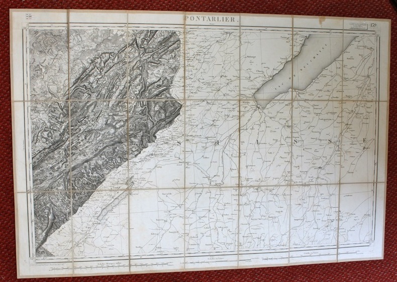
Pontarlier.
Paris, Lanée, succ. de Longuet, 1852. Carte entoilée au format ouvert de 59 x 89 cm., pièce de titre contrecollée au premier plat de la carte pliée, étui marbré avec pièce de titre sur une tranche.
Carte levée par les officiers du Corps d'Etat major et publiée par le Dépôt de la guerre. Quelques rousseurs, étui frotté et scotché en bords, avec petits manques, tache à la toile sous l'étiquette.
TRAITE DE TOPOGRAPHIE. Deuxième édition revue et considérablement Augmentée
1911 Béranger Couverture rigide 1911 Paris, Librairie polytechnique Ch Béranger , 1911. Grand in8 cartonnage toilé éditeur , III- 528 pp , 348 figures.
Traité de topographie
,Paris, Beranger 1911, 528 pp., 1 vol. in 8 relié pleine percaline avec coins en laiton (reliure éditeur), illustrations in et hors-texte, cach.
Cartes, Plans, Paysages et Jardins du Languedoc Méditerranéen XVIIème-XIXème siècles Tome 1
Collections de la Société Archéologique de Montpellier, Montpellier, 2003. Revue, in-4, 51pp.. ILO1 ETA5bis
Catalogue de l'exposition qui a eu lieu au Musée Languedocien, Hôtel des trésoriers de France, d'octobre 2003 à mars 2004. Catalogue illustré. Très bon état
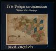
DE LA BRETAGNE AUX DEPARTEMENTS , HISTOIRE D'UN DECOUPAGE.
Revue trimestrielle, Editions Skol Vreizh, numéro 14, Décembre 1989, format oblong ( 22x20cm) , broché, 84 pages, nombreuses illustrations in et hors-texte, exemplaire en bon état.
LES NOMS TOPOGRAPHIQUES DEVANT LA PHILOLOGIE
Paris, Vieweg 1886. In Paris, Vieweg 1886. In-8 broché de 160 pages.
Dos cassé avec manque à celui ci, sinon bon état. Toutes les expéditions sont faites en suivi au-dessus de 25 euros. Expédition quotidienne pour les envois simples, suivis, recommandés ou Colissimo.
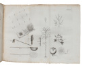
Cascade du Torrent, au dessous du Signal de Lausanne. (Avec 2 personnages dont un porte le sceau typique du laveur d’or).
1786 Image 21.7x35 cm, Gravure sur cuivre du 18è siècle, tirée de Zurlauuben Feuille 33.7x47.3 cm
Image disp.
(SLACES, NVVA)
Phone number : 41 (0)26 3223808
Grande vue de la Ville de Fribourg (en Suisse).
s.d., 1780-86, 21.5x34.7 l'image. tirée de l'ouvrage de: «Zurlauben, Tableaux topographiques de la Suisse, planche 139 1 feuille 33.3x50 cm.
Gravure sur cuivre originale. Prise au bas de la Sarine. Dessinée par Perignon, Ptre du Roy, gravée par Masquelier. Image disp.
(SLACES, NVVA)
Phone number : 41 (0)26 3223808