Write to the booksellers
- Home page
- Search by criteria
- title : a map of the north pole with all the territories that lye near it
1 books for « a map of the north pol... »Edit
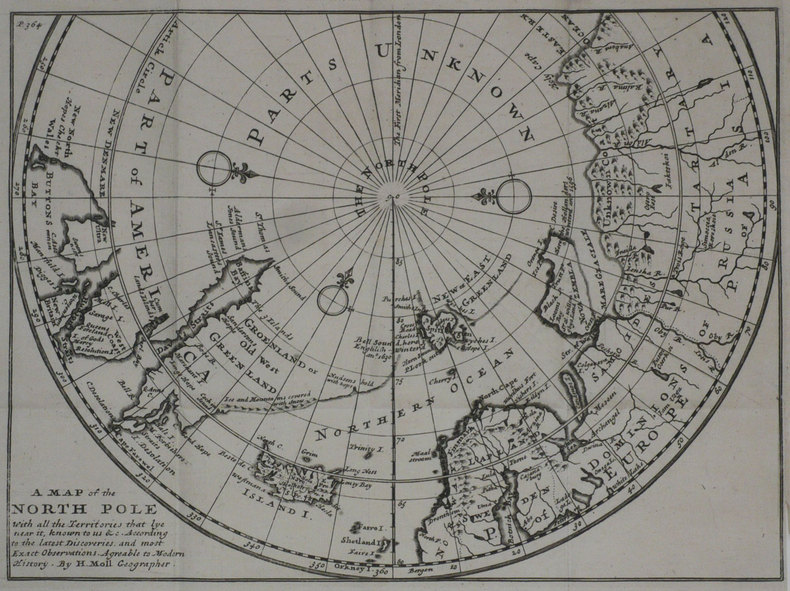
A Map of the North pole with all the territories that lye near it.
Londres 1739 201 x 271 mm.
Carte figurant le pôle Nord et les pays voisins, dressée par Herman Moll, issue de l'ouvrage Modern History de Thomas Salmon, publié à Londres en 1739. Cartographe, graveur et éditeur d'origine hollandaise, ami du célèbre flibustier William Dampier, Herman Moll s'installa à Londres vers 1678, et devint dès le début du XVIIIème siècle l'un des plus éminents éditeurs de cartes et atlas installés à Londres. Bel exemplaire, replié.