Write to the booksellers
10 books for « peron francois »Edit
-
Century
19th (2)
20th (3)
21st (3)
-
Topics
Australia (1)
Brittany (1)
First edition (2)
History (2)
Travel (1)
War (1)
-
Syndicate
ILAB (4)
SLAM (4)
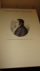
Éloge historique de François Péron, rédacteur du voyage de découvertes aux Terres australes, lu à la Société médicale d'émulation de Paris [...] dans la séance du 6 mars 1811.
Paris, Capelle et Renard, 1811 ; in-8, broché. 1 f.-LXXXII pp. Tel que paru, sans couverture.
![Éloge historique de François Péron, rédacteur du voyage de découvertes aux Terres australes, lu à la Société médicale d'émulation de Paris [...] dans ...](https://static.livre-rare-book.com/pictures/AIS/14690_1_thumb.jpg)
Edition originale. François Péron (Bourbonnais, originaire de Cérilly) fut un des rédacteurs su "Voyage de découvertes aux Terres Australes, pendant les années 1800, 1801, 1802, 1803 et 1804", et un des rares, parmi les 22 savants participants, a aller jusqu'au bout de cette expédition. Il est mort de tuberculose à Cérilly en décembre 1810.
Catalogue de vente aux enchères : 4.5.6. et 7 décembre 2010 - Ivoire - vente d'hiver : bijoux anciens et modernes, tableaux anciens, céramiques, argenterie, tableaux modernes & contemporains, école lyonnaise, ateliers barrie, Ferreri, Moyroud.
Ivoire. 2010. In-4. Broché. Bon état, Couv. convenable, Dos satisfaisant, Intérieur frais. 15 pages augmentées de nombreuses illustrations en couleurs, dans et/ou hors texte.. . . . Classification Dewey : 56-Catalogue
Commissaires-priseurs : Chenu Jean, Bérard Antoine, Péron François Classification Dewey : 56-Catalogue
Atlas du patrimoine maritime du Finistère
Le Télégramme (Editions) - Pêcheur d'images (Editions) 2010 140 pages 26x26x2cm. 2010. Broché. 140 pages.

French édition - LIVRE ISSU DE DESTOCKAGE - JAMAIS LU présentant des marques de manipulation sur la couverture et/ou les pourtours mais demeurant en bon état d'ensemble.Expédition sous blister dans une enveloppe matelassée depuis la France
Brest sous l'occupation.
Ouest France. 1981. In-8. Broché. Etat d'usage, Coins frottés, Dos plié, Papier jauni. 157 pages, nombreuses photos en noir et blanc dans et hors texte - coiffes abimées, pellicule transparente de la couverture partiellement décollée.. . . . Classification Dewey : 940.53-Seconde Guerre mondiale 1939-1945
Classification Dewey : 940.53-Seconde Guerre mondiale 1939-1945
Atlas du patrimoine maritime du Finistère
Le Télégramme (Editions) - Pêcheur d'images (Editions) 2010 140 pages 26x26x2cm. 2010. Broché. 140 pages.
French édition - Livre issu de déstockage JAMAIS LU présentant des marques de manipulation sur la couverture et/ou les pourtours mais demeurant en très bon état d'ensemble.Expédition sous blister dans une enveloppe matelassée depuis la France
La belle époque à Brest
RENNES, Ed. Ouest France - 1983 - In-8 - Cartonnage éditeur illustré - Gardes illustrées - Nombreuses illustrations NB dans le texte et HT - 153 pages - Très bon exemplaireAutre exemplaire avec envoi : 19
Cnformément à nos conditions générales de vente :Les frais de port sont affichés à titre indicatif. Il se peut que nous devions vous contacter pour vous informer du coût de laffranchissement supplémentaire en fonction du poids et du nombre de livres, surtout pour les envois internationaux Cependant vu l'augmentation des tarifs postaux à l'internationale, nous pouvons expédier les ouvrages en point relais MONDIAL RELAY pour les pays suivants : Allemagne, Autriche, Belgique, Espagne, Italie, Luxembourg, Pays-Bas, Pologne, et Portugal. Merci de nous indiquer en retour le point relais choisi ainsi que votre numéro de téléphone mobile & adresse Courriel pour assurer le suivi du colis.N'hésitez pas à nous interroger.In accordance with our general terms and conditions of sale:Shipping costs are displayed for informational purposes only. We may need to contact you to inform you of the additional postage costs depending on the weight and number of books, especially for international shipments.However, given the increase in international postal rates, we can ship books via Mondial Relay to the following countries: Germany, Austria, Belgium, Spain, Italy, Luxembourg, Netherlands, Poland, and Portugal. Please provide us with your chosen Mondial Relay point, as well as your mobile phone number and email address to ensure package tracking.Please feel free to contact us with any questions
VOYAGE DE DÉCOUVERTES AUX TERRES AUSTRALES
Éditions "Les Marmousets", tirage à 400 exemplaires numérotés, ici l'un des 50 reliés cuir sur Ivoire à grains de Rives (n°19), 1 volume relié cuir de format 38 x 28 cm, 156 pages, très bon état. Frais de port en supplément.
Envoi en colissimo : + 10,70 euros
Mémoires du Capitaine Péron, sur ses voyages.
Paris, Brissot-Thivars, 1824. 1824 2 vol. in-8° non rognés (230 x 145 mm) de : I. [2] ff. (faux titre, titre) ; V (avis) ; 328 pp (dont table) ; II. [2] (faux titre, titre) ; 359 pp. (dont table) ; 2 planches et 4 cartes dépliantes lithographiées par G. Engelmann. (rares rousseurs). Cartonnage bleu ciel, dos lisse avec pièce de titre et de tomaison en maroquin noir (reliure de l'éditeur), chemise et étui moderne.
Edition originale rare de ces récits daventures en mer dus au marin français Pierre-François Péron (1769-1846) et compilés par Louis Saturnin Brissot-Thivars, libraire, éditeur, journaliste et historien. Louvrage comporte les relations de naufrages et de tempêtes, l'abandon et le sauvetage de Péron et de quatre compagnons sur l'île déserte d'Amsterdam dans l'océan Indien, ainsi que le voyage de cinq mois de Péron à la côte nord-ouest des États-Unis sous le commandement du Capitaine Ebenezer Door. En mai 1796, le «Otter» atteint le détroit de Juan de Fuca. Le mois suivant, il entre dans la baie de Nootka, où l'équipage entretient de longues relations avec le célèbre chef Macuina, dont Peron décrit la trahison et la cruauté. En allant plus au nord, ils poussent jusqu'à la région de la baie de Bucareli, en Alaska, qu'ils explorent et cartographient. Avant de faire demi-tour, ils rencontrent et commercent avec les indigènes du littoral. Des descriptions importantes sont données de parties de la Colombie-Britannique, de l'île de Vancouver et des îles de la Reine-Charlotte, ainsi que de la Californie, où Péron a passé une semaine à Monterey pendant le voyage de retour. Streeter note que le «Otter» est peut-être le premier navire américain à visiter Monterey dont un record a été transmis, tandis que Howgego déclare qu'il est le premier navire américain à entrer dans la baie de San Francisco. Les visites en Tasmanie, en Nouvelle-Galles du Sud, à Hawaï et à Sumatra sont également relatées dans cet ouvrage. Les planches lithographiées montrent la chasse aux phoques et des pingouins. Les cartes représentent : l'île d'Amsterdam, la côte nord-ouest du détroit de Juan de Fuca jusqu'au sud de Nootka, le détroit divisant la reine Charlotte et le prince de Galles, les îles, et la baie de Bucareli. Exemplaire bien conservé de cette rare édition originale. 2 untrimmed vol. 8vo (230 x 145 mm) of : I. [2] ff. (false title, title) ; V (notice) ; 328 pp (including table) ; II. [2] (false title, title) ; 359 pp. (including table) ; 2 plates and 4 folding maps lithographed by G. Engelmann (rare foxing). Light blue boards, smooth spine with black morocco title page (publisher's binding), modern folder and slipcase. Rare first edition of these accounts of adventures at sea by French sailor Pierre-François Péron (1769-1846), compiled by Louis Saturnin Brissot-Thivars, bookseller, publisher, journalist and historian. The work includes accounts of shipwrecks and storms, the abandonment and rescue of Péron and four companions on the desert island of Amsterdam in the Indian Ocean, and Péron's five-month voyage to the northwest coast of the United States under the command of Captain Ebenezer Door. In May 1796, the "Otter" reached the Strait of Juan de Fuca. The following month, she entered Nootka Bay, where the crew had a long relationship with the notorious Macuina chief, whose treachery and cruelty Peron describes. Moving further north, they push on to the Bucareli Bay region of Alaska, which they explore and map. Before turning back, they met and traded with the coastal natives. Important descriptions are given of parts of British Columbia, Vancouver Island and the Queen Charlotte Islands, as well as California, where Péron spent a week in Monterey on the return voyage. Streeter notes that the "Otter" may be the first American ship to visit Monterey of which a record has been transmitted, while Howgego states that it is the first American ship to enter San Francisco Bay. Visits to Tasmania, New South Wales, Hawaii and Sumatra are also chronicled. Lithographed plates show seal and penguin hunting. The maps show Amsterdam Island, the northwest coast from the Strait of Juan de Fuca to south of Nootka, the strait dividing Queen Charlotte and the Prince of Wales, the islands and Bucareli Bay. A well-preserved copy of this rare first edition.
Phone number : 06 81 35 73 35
Mémoires du capitaine Péron, sur ses voyages aux côtes d'Afrique, en Arabie, à l'île d'Amsterdam, aux îles d'Anjouan et de Mayotte, aux côtes nord-ouest de l'Amérique, aux îles Sandwich, à la Chine, etc..
Brissot-Thivars Bossange frères | Paris 1824 | 13 x 21.3 cm | Relié
Très rare édition originale illustrée de 4 cartes et 2 planches hors texte : plan de l'île d'Amsterdam, carte d'une partie de la côte N.O. de l'Amérique, de l'embouchure septentrionale du canal de la Reine Charlotte, plan du port de Bokerelle côte N.O. de l'Amérique, loups et lion marins (cf Sabin 61001. Howes 7897. F. Monaghan 1174. Lada Mocarski 89. Gay 272. Ferguson 980. Hill 230. Borba de Moraes II, 663 : "A description of Bahia appears in Vol. I"). Rousseurs éparses. Petits manques et frottements sur les mors. Reliures en plein veau vert kaki, dos éclaircis à faux-nerfs ornés de guirlandes, pointillés et filets dorés, ainsi que de motifs typographiques estampés à froid, pièces de titre et de tomaison veau cerise, restaurations sur les mors, roulettes dorées sur les coiffes, encadrements de guirlandes dorées et à froid sur les plats, liserés dorés sur les coupes, tranches marbrées, reliures de l'époque. Officier de marine, Pirre-François Péron fut longtemps employé au commerce des peaux entre la côte nord-ouest de l'Amérique et la Chine. Il a notamment décrit des parties de la Californie (voyage à Monterey en 1796), la Tasmanie, la Nouvelle Galles du Sud, Hawaï et Sumatra. Il donne des informations très importantes sur la Colombie Britannique et les îles Vancouver et Reine Charlotte. D'après Henry R. Wagner, les prénoms de Péron (1769-1840) étaient Pierre François. Il ne faut évidemment pas le confondre avec son homonyme l'explorateur François-Auguste Péron (1775-1810). Agréable exemplaire établi dans charmante reliure romantique de l'époque signée Duplanil. - Photographies et détails sur www.Edition-Originale.com -
Phone number : 01 56 08 08 85