Write to the booksellers
5 books for « manesson mallet alain »Edit
-
Type
Book (4)
Maps (1)
-
Topics
Army (1)
Atlas (1)
Books from the xviith (1)
Cartography (1)
Cavalry (1)
Cities (1)
Infantry (1)
Navy (1)
Travel (1)
War (1)
-
Countries
Denmark (1)
France (4)
-
Syndicate
ILAB (2)
SLAM (1)
La géométrie pratique, divisée en quatre livres. Le premier enseigne les éléments de la géométrie pratique, & donne toutes les notions de chaque terme concernant cette science. Le second explique la trigonométrie, ou la mesure des distances par les instruments géométriques, comme font les piquets, les cordeaux, le demi-cercle, le quarré géométrique, le compas de proportion, l'astrolabe, la boussole, le baston de Jacob, la planchette, & aussi par les sinus & les logarithmes. Le troisième montre la planimétrie, ou la mesure des superficies (ce que le vulgaire appelle l'arpentage), avec les méthodes de transfigurer, d'augmenter, & de diviser toutes sortes de terres, bois, & c. Le quatrième regarde la stéréométrie, ou le toise de toutes sortes de corps de telle capacité & figure qu'ils puissent être.
Paris, Anisson, 1702.


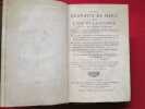
Edition originale. Elle est illustrée par deux portraits et 493 planches in-texte. (Le titre en annonce 500 mais l'ouvrage est bien complet ainsi). Ces leçons et démonstrations de géométrie ont été dessinées devant de splendides paysages du temps. Ces planches présentent ainsi de très nombreuses vues de Paris et de ses environs, de châteaux en France ou d'ailleurs, des paysages animés de paysans dans leurs occupations ... Certaines gravures de chateaux sont particulièrement précieuses, puisqu'ils ont été démolis depuis et ce sont les seules vues qui nous en restent. Plusieurs instruments scientifiques sont représentés. Il y a aussi une vue d'un terrain de jeu de paume. Alain (ou Allain) Manesson Mallet (1630-1706) mathématicien, cartographe, ingénieur militaire, dessinateur et architecte, était un des ingénieurs favoris de Vauban. Il avait été mousquetaire et Alexandre Dumas fait citer son nom par d'Artagnan dans le "Vicomte de Bragelonne", une des deux suites des "Trois mousquetaires". Quelques accrocs aux coiffes, fente le long d'un caisson sur le plat supérieur du tome 1. Bon exemplaire. /// 4 volumes in-8 de (26), 346, (2) / (12), 337 / (14), 359, (1) / (12), 281, (1) pp. Veau marbrés, dos à nerfs orné, tranches rouges. (Reliure de l'époque.) //// First edition. Illustrated with 2 portraits and 493 engraved full page plates. (The title claims 500, but the book is quite complete). These lessons and demonstrations of geometry were drawn in front of splendid landscapes of the time. The plates feature numerous views of Paris and its environs, castles in France and elsewhere, lively landscapes of peasants at work... Some engravings of chateaux are particularly precious, as they have since been demolished and are the only remaining views. Several scientific instruments are depicted. There is also a view of a jeu de paume court. Alain (or Allain) Manesson Mallet (1630-1706) mathematician, cartographer, military engineer, draughtsman and architect, was one of Vauban's favorite engineers. He had been a musketeer, and Alexandre Dumas had d'Artagnan quote his name in the Vicomte de Bragelonne, one of the two sequels to the Three Musketeers. Contemporary speckled calf. Head of spine chipped. A few tears in the headbands, crack along the lower compartment on upper board of volume 1. Fine copy. /// PLUS DE PHOTOS SUR WWW.LATUDE.NET


Les travaux de Mars, ou L'Art de la guerre. Divisé en trois parties. (Tome I seul)
Denys thierry 1685 A Paris, Chez Denys Thierry, 1685, 1 volume in-8 de 135 x 215 mm, (12) ff., 363 pages, (2) ff. (Table). Tome I seul sur 3, contient 2 frontispices et 155 planches. Pleine reliure d'époque, dos à 5 nerfs portant tires et tomaisons dorés, roulette dorée sur les coupes, gardes blanches. Coiffes, coins et un mors abimés, quelques manques de cuir, quelques rousseurs, de rares déchirures en marge (sans atteinte au texte), bon état général.
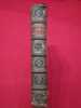
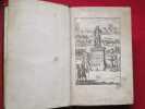
Merci de nous contacter à l'avance si vous souhaitez consulter une référence au sein de notre librairie.
Description de l'Univers contenant les différents systèmes du Monde, les Cartes générales & particulières de la Géographie Ancienne & Moderne: Les Plans & les Profils des principales Villes & autres lieux plus considérables
de la Terre; avec les Portraits des Souverains qui y commandent, leurs Blasons, Titres & Livrées: Et les Moeurs, Religions, Gouvernemens & divers habillemens de chaque Nation. Tome III. De l'Afrique Ancienne & Moderne.- Paris. Denys Thierry. 1683. In-8 (146 x 220mm) pleine basane brune, dos à 5 nerfs orné, gardes peignées, Titre-frontispice gravé, 3ff. (dont le titre général imprimé), 256 pages, contenant 100 gravures à pleine page (numérotées de I à CI (numérations fautives des gravyres LXXXIX et CI), 10 gravures additionnelles, 8ff. n.ch. (Table et Privilège). Exemplaire couvert d'annotations marginales manuscrites ainsi que 3 pages d'index en début d'ouvrage, de la main d'un ancien possesseur. Papier souvent bruni, reliure un peu frottée, mais plutôt bon état.
Beschreibung des gantzen Welt-Kreises. Vierter Theil: Welcher in sich enthalt Das Alte und Neue Europa. (Vol. 4 out of a total of 5).
Franckfurt am Mayn, Zunner, 1685. 4to. In contemporary half calf. Traces from old paper-label to spine. Binding with considerable wear. Back board broken but still attached. Inner hinges split. Frontispiece partly detached. Previous owner's name in contemporary hand to spine. With a few occassional brownspots and tears in margin, but internally generally nice and clean. (8), 210, (14) pp. + 128 engraved plates and 1 frontispiece. (plates are numbered consecutively from 1 - 130. Plate no. 90 and 92 are missing, but collation corresponds to the digitalized copy in Regensburg, Staatliche Bibliothek, OCLC Accession No: 930342403 and the Otto Leopold Schmidt-copy, sold at Bonham in 2020).
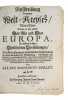
First German translation (vol. 4 only) of Mallet’s lavishly illustrated ambitious guide to Europe, offering geographical and cultural knowledge to a broader audience in part because of the numerous and detailed engravings. Mallet's maps and illustrations are not only geographically informative but also a fine example of the baroque style of the period. It has been suggested that his background as a teacher led to him being concerned with entertaining his readers. This concern manifested itself in these charming illustrations which include maps, cityscapes, and depictions of various cultural practices and costumes. The first edition appeared in Paris in 1683 as ""Description de l'univers,"" and soon after the hundreds of copper plates for the illustrations were transferred to Jan David Zunner in Frankfurt, who published the first edition of the German translation in 1684, with German text engraved in the plates. He then published the second French edition in 1685, with the German text still in the plates. Alain Manesson Mallet (1630–1706) was a French cartographer and engineer primarily known for his significant contributions to cartography, particularly through the present work. He began his career as a soldier in the army of Louis XIV, eventually rising to the rank of Sergeant-Major in the artillery and serving as an Inspector of Fortifications. Mallet also served under the King of Portugal before returning to France where he was appointed to the court of Louis XIV. His expertise in military engineering and mathematics earned him a position teaching mathematics at the royal court. (For the original in French see: Brunet III, 1343 and Sabin 44130 and Graesse IV, 354).
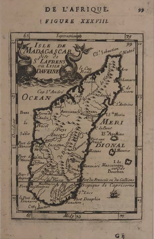
Isle de Madagascar dite de St.Laurent ou Lisle Daufine
Isle de Madagascar dite de St.Laurent ou Lisle Daufine par Alain Manesson Mallet (XVII)(140x95mm)carte de l'ile de Madagascar avec cartouche de titre orné de deux monstres marins. Elle est issue de la Description de l'Univers,texte français au verso. Bel exemplaire.