Write to the booksellers
1 books for « foster john wells w... »Edit
-
Topics
Cartography (1)
Iron (1)
Michigan (1)
Report on the Geology of the Lake Superior Land District. Part II. The Iron Region, together with the General Geology.
Washington, Printed by A. B. Hamilton, 1851. 2 volumes 8vo, xvi, 406 pp., with 36 plates ; accompanied by a separate volume containing 3 folding geological maps. Original publisher’s printed boards, slightly rubbed. The text volume bears the Arms of the United States on the covers, with the title and authors’ names on the spine and an eagle with “Senate U.S.” at the foot. The map volume bears the title on the upper cover and the blind-stamped Arms of the United States on the lower cover. One map torn, without loss, title brunished, some foxing.
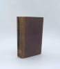
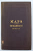
Second and final part of Foster and Whitney’s important geological survey of the Lake Superior Land District, devoted principally to the iron-bearing region of the Upper Peninsula of Michigan, with descriptions of its geological formations, iron and copper deposits and mineral resources. The separate map volume contains three large folding geological maps, measuring respectively 93 × 70 cm, 61 × 51 cm and 125 × 20 cm. An important early contribution to the geological mapping and mining history of the United States. John Wells Foster and Josiah Dwight Whitney were American geologists commissioned by the United States Government to explore and survey the Lake Superior region. Between 1847 and 1850, they travelled extensively through the Upper Peninsula of Michigan, studying its geology and rich deposits of copper and iron. Their surveys contributed to the first systematic geological exploration of this important mining region. Important rapport fondateur sur la géologie et les ressources minières de la région du lac Supérieur, particulièrement recherché pour ses trois grandes cartes géologiques originales. Ch-2B