 Write to the booksellers
84 books for « b b map »Edit
-
Type
Book (81)
Maps (3)
-
Language
English (1)
French (82)
Greek (1)
-
Century
16th (2)
18th (6)
19th (14)
20th (22)
21st (1)
-
Countries
Belgium (9)
China (7)
Denmark (21)
France (40)
Greece (1)
Netherlands (5)
Switzerland (1)
-
Syndicate
ILAB (26)
SLAM (4)
Topics
- Archaeology (2)
- Army (14)
- Asia - orient (1)
- Astronomy (1)
- Atlas (1)
- Australia (1)
- Brazil (1)
- Bulgaria (1)
- Canada (1)
- Cartography (2)
- China (5)
- China (5)
- England (2)
- Fortifications (1)
- Geographical maps (1)
- Geography (1)
- Golf (1)
- History (8)
- Hong kong (1)
- India (2)
- Indochina (1)
- Iran - persia (2)
- Ireland (1)
- La pérouse (1)
- Latin (2)
- Literature (2)
- Maps (11)
- North america (1)
- Ocean (1)
- Pacific (1)
- Pompeii (1)
- Religions (1)
- Road (1)
- State (1)
- Tales (1)
- Tea (5)
- Tides (1)
- Topography (1)
- Travel (1)
- War (1)
Helvetia Prima Rheni et V. Nova Tabula.
" Double-page wood-engraved map of Switserland , 320 x 400 mm, from Sebastian Munster's Geographia Universalis Vetus et Nova, published in Basel in 1542. On verso of this map is printed the textleaf ''33'' which starts as follows ; '' Helvetiae Nova Descriptio. Rhetiam & Helvetia tibi offert...''. On the map side the clover is pointing to the right. Map in good condition allthough some worm-galleries have been expertly repaired in the lower end of the fold, mainly outside the map image resulting for the image in a loss of approx. 1 cm² in the mountains east of Chur (the map is orientated with West up)."
"WHEWELL, WILLIAM - A PIONEER-WORK ON TIDES WITH THE FIRST COTIDAL WORLD-MAP.
Reference : 42692
(1833)
Essay towards a First Approximation to a Map of Cotidal Lines. Read May 2, 1833.
(London, Richard Taylor, 1833). 4to. No wrappers as extracted from ""Philosophical Transactions"" 1833 - Part I. Pp. 147-236, a few textillustr.,1 engraved plate and 2 large folded engraved maps (a general, representing the greater part of the world (42x93 cm) and Chart of the British Isles, drawn and engraved by J.& C. Walker.). A small tear to world map. Clean and fine.
First appearance of this classic, pioneering paper on the investigation of tidal phenomena. It is the first in a series of 16 papers Whewell made for the Royal Society. It contains the first printed cotidal world-map.""Whewell took over the subject of mapping cotidal lines from Lubbock with entusiasm....He exercised the pioneer's privilege of coining new words and phrases appropriate to his subject. Many failed to stick, some phrases of Whewell's origin still occasionally used are: 'age of the tides', 'luni-tidal interval', 'semi-menstrual inequality' etc, etc....Whewell's initial cotidal map for the world ocean was presented in his first paper of 1833 (the paper offered). By his own admission, it was entirely preliminary and tentative, what nowadays might be called a ""strawman"", to stimulate discussionm. He later (1836) suggested smll modifications, especially near the coast of North America"" these were incorporated in an 'improved' world map by G.B. Airy in his celebrated tratise on ""Tides and wave"", (Cartwright in ""Tides. A Scientific History"", pp.110-112.)
[CHINA] [INDOCHINA [CARTE EN RAYONNE] [VISCOSE ESCAPE AND EVASION MAP]
Reference : 12573
Carte en rayonne - Viscose Map - China (Part of) - French Indo-China (Part of)
no date, no printing location, [1944] 1 viscose map, 94 cm high, 63 cm wide, both printed sides, in very good condition, despite some small tears at folds. Sheet L and Sheet M.
This viscose map features Northern Indo-China on one side and Southern China on the other. The tightly woven fabric allows for clear prints, and two easily read sides. " This so called "silk" escape and evasion map was made in 1944 by the British Royal Air Force. "Silk" maps were originally developed during World War II to help British soldiers escape enemy territory or POW camps, and continued to be produced after the War ended in both Great Britain and the U.S."
Map of Bangkok and Thonburi - A Map for Tourists
Bangkok, Printed at Chatra Press, 1965. 1 folding map of Bangkok and Thonburi, 45*50 cm, compliment of World Travel Service, 1965. On one side, the full map of the City of Angels. On the other side, advertsiements for shops, hotels, massage parlours, etc
Traité de Géodésie, ou Exposition des Méthodes Astronomiques et Trigonométriques, appliquées soit à la mesure de la Terre, soit à la confection du canevas des Cartes et des Plans.
Paris, Courcier, 1805. 4to. Contemp. Full calf. Gilt spine. Titlelabel with gilt lettering. A paperlabel pasted on top of spine. Stamps on title-page.Corners a bit bumped. Spine slightly rubbed. XXIV,318,( 4 Errata) pp., 16 Tables and 10 large folded engraved plates (apparatus). Wide-margined and clean.
First edition. Pouissant is best remembered for his invention of a new map projection for a new map of France, and he was involved in the production of the map. The map was produced with considerable detail, the projection used spherical trigonometry, truncated power series and differential geometry as described here.
Galliae Regni Potentiss: Nova Descriptio Ioanne Ioliveto Auctore.
(Antwerpen, between 1584 a. 1612). 35x51 cm. Engraved map of France in fine contemporary handcolouring. Framed so that verso is shown. Latin text on verso ""Gallia"" with the initial Q handcoloured.
The map is from a Latin edition of Ortelius' ""Theatrum orbis Terrarum"" (4 editions between 1584 and 1612 with Latin texts). Ortelius and G. de Jode published the map after Jean Jolivet's General Map of France from 1560.
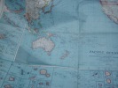
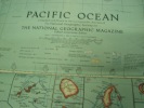
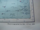
Map pacific ocean , National Geographic Map of the Pacific Ocean 1936 . BRITISH War Office 1943 ; 99 x 83 cm
1943 bon état,pliée
Remise de 20% pour toutes commandes supérieures à 200 €

Malaya - 1933 - Showing Hills
Malaya, Published under the direction of the Surveyor General. F.M.S. & S.S. 1 large folding map, sectionalised and laid onto linen, size 86*66 cm, scale: 12 miles to an inch, in very good condition.
The 1933 Map of British Malaya, issued by the Federated Malay States (FMS) Survey Department, offers a detailed topographical view of the peninsula, featuring comprehensive hill hachures, limestone hills, and mountain spot heights. This 12 miles-to-an-inch map highlights the main mountain ranges, roads, and railways. Please inquire first for more information.
Map of China, no date, around twenties.
London, George Philip & Son, Limited. A map in perfect condition under green cloth covers, used and damaged by insects. Folding map of China in near fine condition, size 65*55 cm, 2 inset maps- Peking and Environs, Hong Kong and Canton.
Sketch Map of South-Western Yunnan, Showing the Principal Trade Routes and Relative positions of the Principal Trade Marks
End of 19th century, beginning of 20th century 1 large map, 65*60 cm, scale 1/100.00, in good condition
Compiled principally from the Map of The Bureau Topographique des Troupes de l'Indo-Chine.
Tableau de la Grande-Bretagne, de l’Irlande, et des possessions Angloises dans les quatre parties du monde. Irlande. Instruction, Littérature, Antiquités, etc. [Map of Ireland].
1802 1 folded (37.5 x 44 cm) engraved map (‘’l’Irlande par J.D. Barbié du Bocage’’). A beautiful map of Ireland, with in the left upper corner ‘’Plan des Lacs de Killarney’’ and in the lower right corner ‘’Tour danoise’’ with some ruins.
Tableau de la Grande-Bretagne, de l’Irlande, et des possessions Angloises dans les quatre parties du monde. Irlande. Instruction, Littérature, Antiquités, etc. [Map of England].
1802 1 folded (45 x 48.5 cm) engraved map (‘’l’Angleterre par J.D. Barbié du Bocage’’). A beautiful map of England, with in the left upper corner ‘’Vue de Stone-Henge’’.
Tableau de la Grande-Bretagne, de l’Irlande, et des possessions Angloises dans les quatre parties du monde. Irlande. Instruction, Littérature, Antiquités, etc. [Map of Scotland].
1802 1 folded (38 x 50 cm) engraved map (‘’l’Écosse avec ses Isles par J.D. Barbié du Bocage’’). A beautiful map of Scotland, with in the left upper corner ‘’Craig-Phadrick’’ and ‘’Retranchement de Craig-Phadrick’’.
[CARTE ANCIENNE PERSE] [PERSIA, PERSIAN GULF BAHRAIN OLD MAP]
Reference : 4619
(1794)
A New Map of the Empire of Persia from Monsieur d'Anville First Geographer to the most Christian King ; with several Additions and Emendations
1794 London, Laurie & Whittle, 1794 Carte gravée sur cuivre (50,5 x 57 cm hors marges, 54 x 73 cm toutes marges comprises). Tirage de l'époque. Quelques traces d'une autre carte en surimpression. Map on copperplate (50,5 x 57 cm without the margins, 54 x 73 cm with the margins). Contemporary printing. Several light printed marks of another map.
ΠΑΡΓΑ ΑΝΤΙΠΑΞΟΙ PARGA
Original map 1931 of greek map 1/100.000, repro of Base Survey drawing Dec. 1943, coloured map 62 x 50 cm
Albert Pauphilet. La Queste du Saint Graal : Par Gautier Map, translatée des manuscrits du XIIIe siècle [Paperback] Map, Walter
Broché. Photo sur demande. Petit manque au dos.
Merci de nous contacter à l'avance si vous souhaitez consulter une référence dans notre boutique à Authon-du-Perche.
Map of Hong-Kong, quartier central
Paris, fin 19e, début 20e, imprimeur A. Baille. 1 map of Hong Kong, size 20*15 cm, under matboard, a good copy.
Map of Wuchow and Environs
Shanghai, early 20th century 1 map, 55*45 cm, depicting Wuchow and Environs showing limits, foreign properties and native city, a good copy.
Contes pour les gens de cour
, Brepols Publishers, 1993 paperback, 344 p., 130 x 190 mm. ISBN 9782503503066.
Que peut faire un clerc de l'administration royale, a la fin du XIIe siecle, s'il est dote d'un humour feroce, d'une langue agile, d'une culture vaste et eclectique, d'un gout irrepressible pour les bonnes histoires colorees et corsees, face a la montee en force des nouvelles modes litteraires de la litterature en francais et des romans courtois? Il prend une plume et redige de "bonnes histoires pour les gens de cour", pour montrer qu'on peut s'amuser en latin, de facon moins ridicule a ses yeux que ceux qui palissent d'amour aux pieds des dames. Gautier Map, clerc anglais richement prebende, grand conteur et amuseur des milieux de la cour de Henri II Plantagenet, est a la fois attire et agace par les themes fantastiques, merveilleux et amoureux qui font les delices de la cour anglaise lorsque la reine Alienor y sejourne. Il veut faire encore mieux: plus varie, plus subtil, plus savant, plus drole et moins naif. S'il meprise l'amour courtois, ce n'est pas par pudibonderie; s'il ecrit dans la langue savante de son temps, ce n'est pas par timidite. Son oeuvre, que par nonchalance sans doute il garda dans ses papiers personnels, est fantaisiste, insolente, ironique; c'est pour les ethnologues un reservoir de renseignements sur des coutumes et des traditions que personne avant lui n'avait notees, pour les historiens de la litterature un temoignage d'une epoque ou rien n'etait encore joue entre la langue vulgaire et le latin (qui pouvaient encore se donner la replique), pour tous un moment privilegie de l'emergence dans la litterature europeenne d'un art du recit qui aboutit de temps en temps, dans ce recueil jamais ennuyeux ni banal, a d'eblouissantes reussites.
"OUTHIER, ABBÉ R. ET (PIERRE-CHARLES) LE MONNIER. - MAP OF THE PLEIADES.
Reference : 45938
(1755)
Carte des Pléyades, dont la position de trente-cinq principales étoiles est déterminée par les observations de M. le Monnier, faites en 1744, 1745, 1746 & 1748. Les autres étoiles qui suivent, ont été placées par estime des distances & par des alignem...
(Paris, Imprimerie Royale, 1755). 4to. Extract from ""Mémoires fe Mathematique et de Physique, Présentés à l'Academie des Sciences par divers Savans"", Tome II. Pp. 607-608 and 1 folded engraved map ""Carte dee Etoiles des Pleiades ajoutées a celles qui ont etes observées par Mr. le Monnier, suivant divers Alignements &c. par Mr. l'abbé Outhier"" (ca. 25x19 cm.).
First printing of Le Monnier's famous star map of the Pleiades.
Geological Map of the Arctic. Prepared by the First International Symposium on Arctic Geology sponsored by the Alberta Society of Petroleum Geologists.
Calgarry - Alberta Canada, Symposium Committee, 1960. (102 x 115 cm.). Large colourprinted circular map of the Arctic Regions. Folded. Well-preserved.
Grund Tegning af Fästningen og Castellet i Leystad.
No place and date (probably Denmark, late 18th century). Hand painted map in ink and water colour. 26,5 x 41 cm. Silver frame. Overall slightly foxed.
Neustadt (Géog.) German town in the Duchy of Brunswick-Lüneburg, four miles N. O. of Hanover, on the river Leyne. The map depicts the the fortifications and the river.
HOMANN - HASE (carthographers) - map of CHINA - Regni Sinae vel Sinae Propriae.
Reference : 16861
Hase Johann Matthias Hase (Homani Heredum). Regni Sinae vel Sinae Propriae, Mappa et Descriptio Geographica, ex mappis particularibus, quas Sinarum Rex Canghi opera patrum Missionariorum é S.J. in provincias...Publicoque primum communicata in opera magnificentissimo R.P. du Halde et ab Anvillaeo Gall. Reg. Geographo...
(Nuremberg, between 1735-1742), Ioh. Matth. Hasii. Math. P.P. Imprensis Homani anorum Heredum, copper engraved map, 59,5 x 52 cm, contemporary colouring, with two cartouches (title and scale) (a few small marginal tears not affecting the plate, a hardly noticeable old waterstain at the back, a good copy). Early German reprint of the first accurate map of China made around 1735 by the French cartographer D'Anville and based on information by the French Jesuit missionaries in China. (R.P. Du Halde).
Publ. by the Ordnance Survey. Sec. ed. (scale: 16 miles to 1 inch.)
Southampton, 1931.
16 p.; fold. map, 86 x 64 cm, coated & coloured. Wrs.
MAP.- FUNDKARTE ZU G. SCHELL, DIE RÖMISCHE BESIEDLUNG VON RHEINGAU UND WETTERAU.
Reference : 103361