 Write to the booksellers
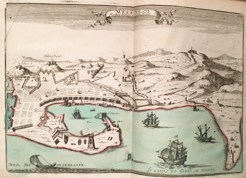
[ATLAS COMPOSITE] FER (Nicolas de).
Atlas itineraires de France dItalie et des Pays Bas.
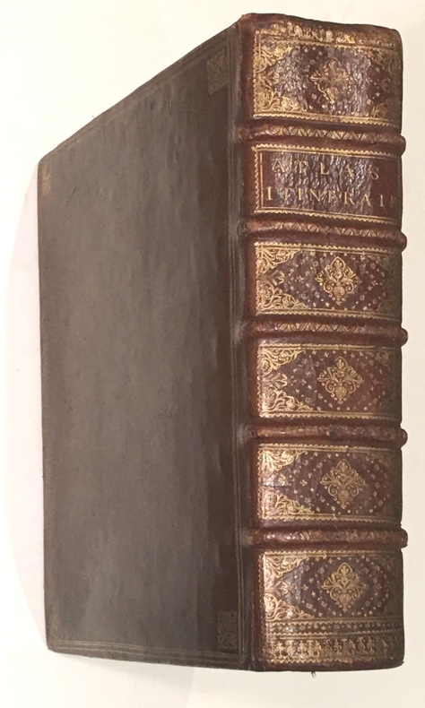
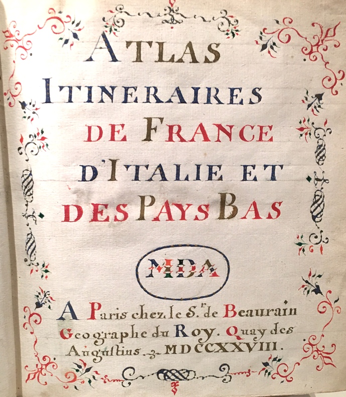
Paris, de Beaurain Geographe du Roy, 1728. 1728 1 vol. in-4° (273 x 250 mm) de : 1 titre manuscrit avec lettres caligraphiées en rouge, bleu et or dans un encadrement de frises ; [188] ff. (dont 50 ff. de texte sur double page, 5 ff. de texte sur page simple, 133 cartes et planches sur double page dont 13 dépliantes). (Corps d'ouvrage très frais). Plein maroquin brun d'époque, dos à nerfs orné, triple encadrement de filets dorés sur les plats avec fleurons angulaires, roulette dorée sur les coupes, dentelles intérieures tranches dorées.
Reference : 4155
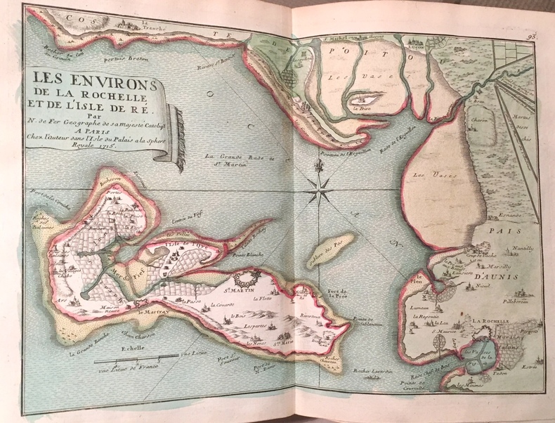
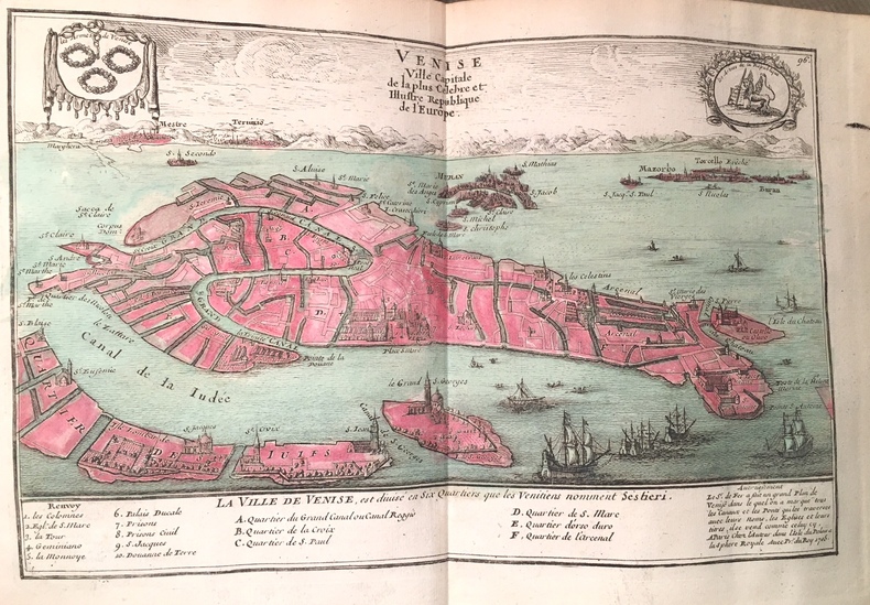
Bel atlas composite, très bien relié, composé dun titre manuscrit, de 35 cartes, 65 plans, 31 vues et 52 feuillets de texte gravés, la plupart sur double page, monté sur onglets (17 dépliants), dont 41 sont entièrement coloriés à la main, 40 et 33 partiellement. Nicolas de Fer fut un cartographe français très prolifique, actif du début des années 1690 jusqu'à sa mort en 1720. LAtlas est consacré à la France, à l'Italie et aux Pays-Bas. Il comporte 107 cartes ou vues de de Fer, 15 par Jean Baptiste Nolin (1657-1708) graveur et éditeur français ou son fils (1686-1762) du même nom. 1 vol. 4to (273 x 250 mm) of: 1 handwritten title with caligraphed letters in red, blue and gold in a frieze frame; [188] ff. (including 50 pages of text on double page, 5 pages of text on single page, 133 maps and plates on double page including 13 foldouts). (Very fresh body of work). Full period brown morocco, decorated ribbed spine, triple framing of gilt fillets on the boards with angular fleurons, gilt roulette on the cuts, interior lace on the gilt edges. Beautiful composite atlas, nicely bound, composed of a manuscript title, 35 maps, 65 plans, 31 views and 52 engraved sheets of text, mostly on double page, mounted (17 fold.), of which 41 are entirely colored by hand, 40 and 33 partially. Nicolas de Fer was a very prolific French cartographer, active from the early 1690s until his death in 1720. The Atlas is devoted to France, Italy and the Netherlands. It contains 107 maps or views of de Fer, 15 by Jean Baptiste Nolin (1657-1708) French engraver and publisher or his son (1686-1762) of the same name.
Bookseller's contact details
J-F Letenneur Livres Rares
M. Jean-François Letenneur
11 bd du tertre Gondan
35800 Saint Briac sur Mer
France
librairie@jfletenneurlivresrares.fr
06 81 35 73 35