‎BELLIN (Jacques-Nicolas);‎
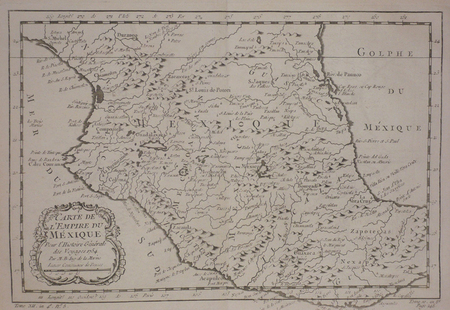
‎ [MEXIQUE] Carte de l'empire du Mexique.‎

‎ 1754 197 x 293 mm.‎

Reference : LBW02485


‎ Carte gravée du Mexique s'étendant de Durango à Oaxaca (Zapotecas), publiée dans l'Histoire générale des voyages par Nicolas Bellin. Ingénieur hydrographe français à la tête du Dépôt des cartes et plans de la Marine, ce dernier fut chargé de dresser les cartes de toutes les côtes des mers connues. Bel exemplaire.‎

€50.00 (€50.00 )
Bookseller's contact details

Librairie Le Bail
Didier Le Bail
13 rue Frédéric Sauton
75005 Paris
France

librairie.lebail@orange.fr

33 01 43 29 72 59

Contact bookseller

Payment mode
Others
Cheque
Others cards

Contact bookseller about this book

Enter these characters to validate your form.
*
Send
Get it on Google Play Get it on AppStore
The item was added to your cart
You have just added :

-

There are/is 0 item(s) in your cart.
Total : €0.00
(without shipping fees)
What can I do with a user account ?

What can I do with a user account ?

  • All your searches are memorised in your history which allows you to find and redo anterior searches.
  • You may manage a list of your favourite, regular searches.
  • Your preferences (language, search parameters, etc.) are memorised.
  • You may send your search results on your e-mail address without having to fill in each time you need it.
  • Get in touch with booksellers, order books and see previous orders.
  • Publish Events related to books.

And much more that you will discover browsing Livre Rare Book !