‎BONNE (Rigobert).‎
‎[PORTO-RICO/SAINT-DOMINGUE] Carte des isles de St. Domingue et de Porto-Rico.‎
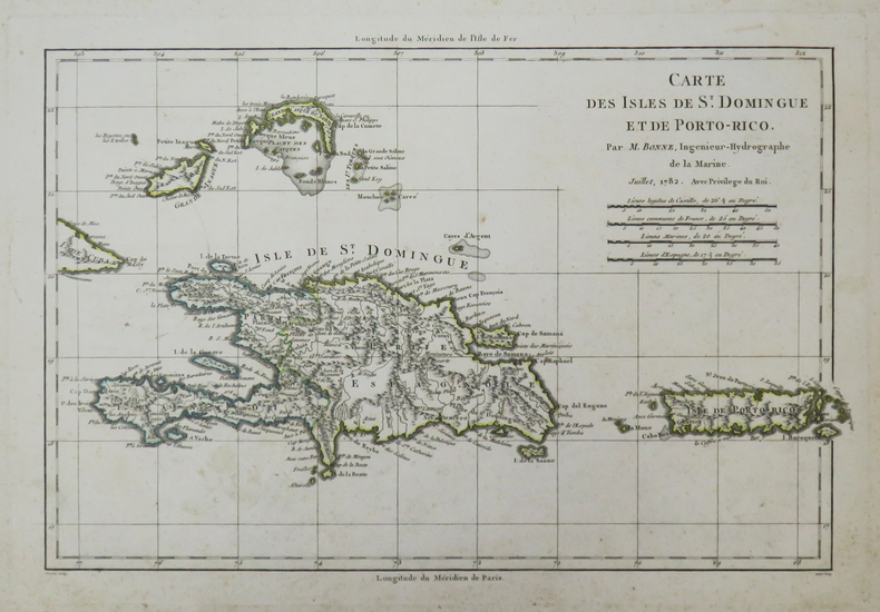
‎1782. 225 x 332 mm.‎

Reference : LBW-3728


‎Belle carte des îles de Saint-Domingue et de Porto-Rico, avec la pointe est de Cuba, les îles Inagua et les Turks et Caïques, dressée par Rigobert Bonne, ingénieur-géographe et cartographe, et successeur de Jacques-Nicolas Bellin comme hydrographe du Dépôt de la Marine en 1773. Contours aquarellés à l'époque. Légères rousseurs.‎

€200.00 (€200.00 )
Bookseller's contact details

Librairie Le Bail
Didier Le Bail
13 rue Frédéric Sauton
75005 Paris
France

librairie.lebail@orange.fr

33 01 43 29 72 59

Contact bookseller

Payment mode
Others
Cheque
Others cards

Contact bookseller about this book

Enter these characters to validate your form.
*
Send
Get it on Google Play Get it on AppStore
The item was added to your cart
You have just added :

-

There are/is 0 item(s) in your cart.
Total : €0.00
(without shipping fees)
What can I do with a user account ?

What can I do with a user account ?

  • All your searches are memorised in your history which allows you to find and redo anterior searches.
  • You may manage a list of your favourite, regular searches.
  • Your preferences (language, search parameters, etc.) are memorised.
  • You may send your search results on your e-mail address without having to fill in each time you need it.
  • Get in touch with booksellers, order books and see previous orders.
  • Publish Events related to books.

And much more that you will discover browsing Livre Rare Book !