 Write to the booksellers
MOLL (Herman).
[CAROLINE du SUD] A Plan of Port Royal harbour in Carolina with the proposed forts, depth of water &c.
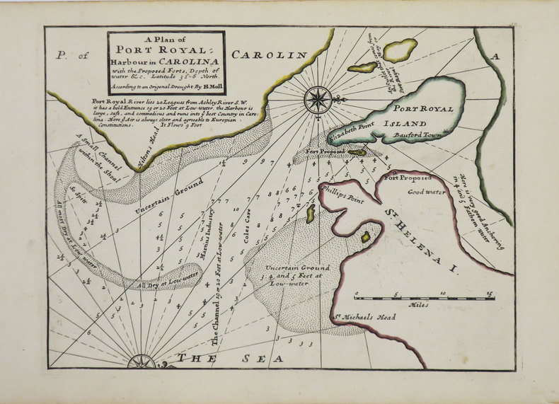
Londres, Thomas and John Bowles, [circa 1736]. 200 x 270 mm.
Reference : LBW-3563
Belle carte détaillée de la baie de Port Royal Island et St Helena Island, dans le comté de Beaufort en Caroline du Sud, issue de l'Atlas minor de Herman Moll, publié vers 1736. Y figurent la ville de Beaufort et Elizabeth Point, ainsi que les profondeurs marines. Le nord est placé à droite de la carte. Cartographe, graveur et éditeur d'origine hollandaise, ami du célèbre flibustier William Dampier, Herman Moll s'installa à Londres vers 1678, et devint dès le début du XVIIIe siècle l'un des plus éminents éditeurs de cartes et atlas installés à Londres. Bel exemplaire, contours aquarellés à l'époque.
Bookseller's contact details
Librairie Le Bail
Didier Le Bail
13 rue Frédéric Sauton
75005 Paris
France
33 01 43 29 72 59
Payment mode


