 Write to the booksellers
MOLL (Herman).
A Map of Chili, Patagonia, La Plata and ye south part of Brasil.
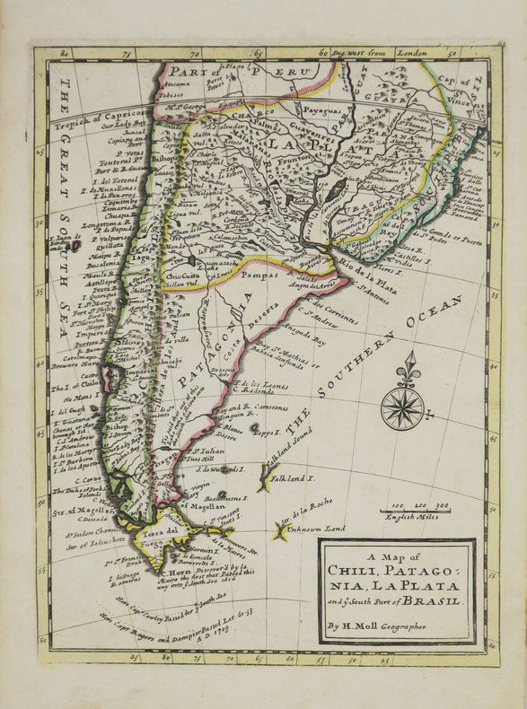
[Londres], Thomas and John Bowles, [circa 1736]. 276 x 206 mm.
Reference : LBW-3519
Carte figurant la moitié sud de l'Amérique Latine, depuis Potosi en Bolivie jusqu'à la Terre de Feu. Elle est issue de l'Atlas minor de Herman Moll, publié vers 1736, et ornée d'une rose des vents. Cartographe, graveur et éditeur d'origine hollandaise, ami du célèbre flibustier William Dampier, Herman Moll s'installa à Londres vers 1678, et devint dès le début du XVIIIe siècle l'un des plus éminents éditeurs de cartes et atlas londoniens. Bel exemplaire aux contours aquarellés à l'époque.
€250.00
(€250.00
)
Bookseller's contact details
Librairie Le Bail
Didier Le Bail
13 rue Frédéric Sauton
75005 Paris
France
33 01 43 29 72 59
Payment mode
Others
Cheque
Others cards


