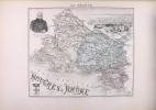
VUILLEMIN, THUILIER, LACOSTE & ROSSIGNOL MARTINEAU & STEIN - (FILLATREAU)
Nouvel atlas illustré - La France et ses colonies - cent huit cartes
Direction et administration, Paris, 1899. In folio (41 x 31 cm), reliure éditeur plein chagrin noir, filets et titres dorés sur le plat, 108 cartes en couleurs dont une de grande dimension rempliée in-fine. Bords du plat supérieur avec des défauts.
Reference : 24635
Division administrative, politique, judiciaire, religieuse, militaire, etc.
Bookseller's contact details
Librairie ancienne Philippe Lucas
M. Philippe Lucas
9 Quai de la Pêcherie
69001 Lyon
France
04 78 30 94 84
Payment mode


Sale conditions
Pour nous commander un livre : Notez le numéro de référence. Pour 1kg 5€ en fréquenceo. RIB : Sur demande.
2 book(s) with the same title
Nouvel Atlas illustré : La France et ses Colonies Cent-huit cartes. Cent huit cartes dressées d'après les cartes du dépôt de la Guerre, des Ponts et Chaussées, de la Marine, des Travaux Publics, de l'Intérieur et des Eaux et Forêts par VUILLEMIN, THUILIER, Ch. LACOSTE, LORSIGNOL, géographes, membres de la société de géographie de Paris illustrées par M. FILLATREAU, gravées par MM. LECOCQ, LEBEL, BIZET, FONTAINE, WALTNER, F; DELANNOY, BARBIER, etc.
Paris Direction et Administration 1897 Un bel exemplaire de cet atlas avec des cartes colorées à la main tout au long de l'ouvrage. Reliure en bougran rouge, avec titres et décorations estampés sur le premier plat. Le dos est en cuir rouge assorti, avec des titres et des décorations dorés. La reliure est en très bon état. Quelques frottements et rayures sur le cuir, et de légères bosses sur les plats. Léger froissement au papier de fin et à la page de titre. Le reste de l'atlas est en excellent état. La carte des chemins de fer de France présente un léger froissement et une petite déchirure fermée (réparée avec du ruban adhésif d'archivage). 108 cartes en couleurs des départements français et des colonies (y compris le planisphère des colonies françaises). Deux cartes de Paris, et une double page des environs de Paris. Chaque département est accompagné d'une ou deux pages de texte décrivant les caractéristiques du département et d'une carte de celui-ci. Complet de deux grandes cartes dépliantes in-fine des chemins de fer de France et d'Europe, et de la carte des chemins de fer de France. Cet atlas pèse près de 5 kg emballé - des frais de port supplémentaires seront donc demandés en dehors de l'UE. Voir les 20 photos sur notre site web pour une impression réelle. 410 x 300 mm
A lovely copy of this atlas with hand coloured maps throughout. Red buckram binding, with titles and decoration embossed to the front board. Matching red leather spine, with gilt titles and decorations. Binding in very good, fresh condition. A little rubbing and scratching to the leather, and slight bumping to the boards only. Slight creasing to the end paper and title page. The rest of the atlas is in excellent, clean condition. The map of the Railways of France has a little creasing and small closed tear (now repaired with archival tape). 108 colour maps of French departments and colonies (including the planisphere of the French colonies). Two maps of Paris, and a double page environs of Paris. Each of the departments has one or two pages of text outlining the features of the department, and a map of it. Complete with two large in-fine folding maps of the railways of France and Europe, and the railway map of France. This atlas weighs almost 5kg packed - so additional shipping will be requested outside of the EU. See the 20 photographs on our website for true impression. 410 by 300mm (16Πby 11٠inches). .
Nouvel Atlas illustré : La France et ses Colonies Cent-huit cartes.
Paris, Direction et Administration, 1897. In-folio, demi-chagrin noir, dos à nerfs orné avec titre doré. 108 cartes en couleurs des départements français et des colonies (y compris le planisphère des colonies françaises). Bien complet des deux grandes cartes dépliantes in-fine des chemins de fer de France et d'Europe. Coupes et coins usagés avec petits manques.
 Write to the booksellers


